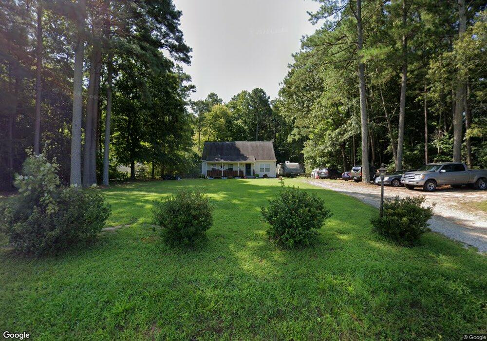
10961 Harcum Rd Gloucester, VA 23061
Ware Neck NeighborhoodEstimated Value: $350,122 - $414,000
3
Beds
2
Baths
1,764
Sq Ft
$211/Sq Ft
Est. Value
About This Home
This home is located at 10961 Harcum Rd, Gloucester, VA 23061 and is currently estimated at $371,781, approximately $210 per square foot. 10961 Harcum Rd is a home located in Gloucester County with nearby schools including Botetourt Elementary School, Peasley Middle School, and Gloucester High School.
Ownership History
Date
Name
Owned For
Owner Type
Purchase Details
Closed on
Jul 10, 2008
Sold by
Mash Christopher A and Mash Stacey L
Bought by
Ackley William A and Atene Shannon M
Current Estimated Value
Home Financials for this Owner
Home Financials are based on the most recent Mortgage that was taken out on this home.
Original Mortgage
$184,300
Outstanding Balance
$128,857
Interest Rate
7.89%
Mortgage Type
New Conventional
Estimated Equity
$242,924
Create a Home Valuation Report for This Property
The Home Valuation Report is an in-depth analysis detailing your home's value as well as a comparison with similar homes in the area
Home Values in the Area
Average Home Value in this Area
Purchase History
| Date | Buyer | Sale Price | Title Company |
|---|---|---|---|
| Ackley William A | $190,000 | Eastern Title Company |
Source: Public Records
Mortgage History
| Date | Status | Borrower | Loan Amount |
|---|---|---|---|
| Open | Ackley William A | $184,300 |
Source: Public Records
Tax History
| Year | Tax Paid | Tax Assessment Tax Assessment Total Assessment is a certain percentage of the fair market value that is determined by local assessors to be the total taxable value of land and additions on the property. | Land | Improvement |
|---|---|---|---|---|
| 2025 | $1,663 | $270,890 | $65,630 | $205,260 |
| 2024 | $1,663 | $270,890 | $65,630 | $205,260 |
| 2023 | $1,579 | $270,890 | $65,630 | $205,260 |
| 2022 | $1,418 | $195,570 | $38,940 | $156,630 |
| 2021 | $1,359 | $195,570 | $38,940 | $156,630 |
| 2020 | $1,248 | $195,570 | $38,940 | $156,630 |
| 2019 | $1,336 | $192,280 | $39,100 | $153,180 |
| 2017 | $1,336 | $192,280 | $39,100 | $153,180 |
| 2016 | $1,291 | $185,760 | $39,100 | $146,660 |
| 2015 | $1,263 | $198,800 | $43,000 | $155,800 |
| 2014 | $1,292 | $198,800 | $43,000 | $155,800 |
Source: Public Records
Map
Nearby Homes
- 10785 Hornets Nest Rd
- 10410 Robins Nest Ln
- 00 New Upton Farms Ln
- 10183 Bumpy Rd
- 1A Carter Hill St
- 10.88 AC Beech Creek Rd
- LOT 2 Riverwatch Dr
- 10114 New Hope Ct
- 10829 Graceland Farms Ln
- 27 E West Pkwy
- 686 Shore Dr
- 0 Buchanan Ln
- 25+AC Buchanan Ln
- 9851 Autumn Woods Ln
- 9789 Honey Tree Ct
- 262 Columbine Dr
- Lot 1 Poplar Dr
- 89 Poplar Dr
- 939 Coachpoint Rd
- 722 Point Anne Dr
- 10977 Harcum Rd
- 10947 Harcum Rd
- 10991 Harcum Rd
- 10931 Harcum Rd
- 000 Harpers Farm Way
- 11011 Harcum Rd
- 10917 Harcum Rd
- 11021 Harcum Rd
- 10903 Harcum Rd
- 11031 Harcum Rd
- 10972 Harcum Rd
- 10696 Harpers Farm Way
- 11045 Harcum Rd
- 10639 Harpers Farm Way
- 10692 Harpers Farm Way
- 11071 Harcum Rd
- 10607 Harpers Farm Way
- 10833 Harcum Rd
- 11085 Harcum Rd
- 11099 Harcum Rd
Your Personal Tour Guide
Ask me questions while you tour the home.