Estimated Value: $334,000 - $355,000
4
Beds
3
Baths
1,702
Sq Ft
$205/Sq Ft
Est. Value
About This Home
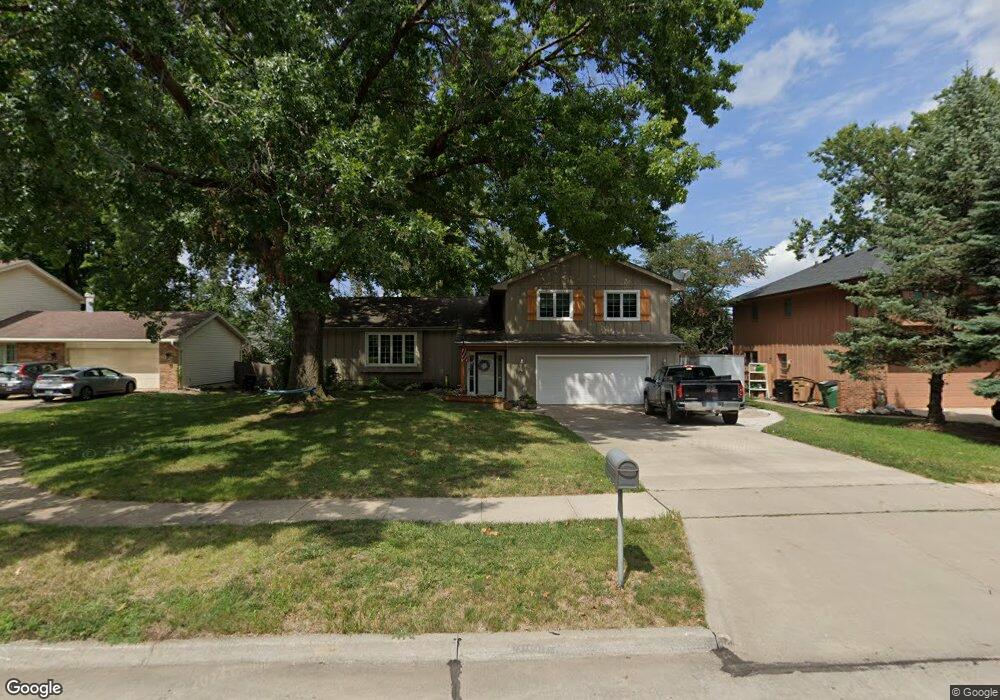
This home is located at 10961 Hawthorn Dr, Clive, IA 50325 and is currently estimated at $348,193, approximately $204 per square foot. 10961 Hawthorn Dr is a home located in Polk County with nearby schools including Crossroads Park Elementary School, Indian Hills Junior High School, and Valley Southwoods Freshman High School.
Ownership History
Date
Name
Owned For
Owner Type
Purchase Details
Closed on
Sep 13, 2013
Sold by
Adams Ronald R and Adams Janice S
Bought by
Gilbert Patricia Elaine Peril
Current Estimated Value
Home Financials for this Owner
Home Financials are based on the most recent Mortgage that was taken out on this home.
Original Mortgage
$152,000
Outstanding Balance
$114,141
Interest Rate
4.56%
Mortgage Type
New Conventional
Estimated Equity
$234,052
Purchase Details
Closed on
Jun 3, 2004
Sold by
Vogelsang Jennifer Jane and Vogelsang Glenn David
Bought by
Adams Ron and Adams Janice S
Purchase Details
Closed on
Jun 21, 1997
Sold by
Farrell Marilyn K
Bought by
Olney Jennifer and Andreen Jennifer
Home Financials for this Owner
Home Financials are based on the most recent Mortgage that was taken out on this home.
Original Mortgage
$118,400
Interest Rate
8%
Create a Home Valuation Report for This Property
The Home Valuation Report is an in-depth analysis detailing your home's value as well as a comparison with similar homes in the area
Home Values in the Area
Average Home Value in this Area
Purchase History
| Date | Buyer | Sale Price | Title Company |
|---|---|---|---|
| Gilbert Patricia Elaine Peril | $190,000 | None Available | |
| Adams Ron | $175,500 | -- | |
| Olney Jennifer | $147,500 | -- |
Source: Public Records
Mortgage History
| Date | Status | Borrower | Loan Amount |
|---|---|---|---|
| Open | Gilbert Patricia Elaine Peril | $152,000 | |
| Previous Owner | Olney Jennifer | $118,400 |
Source: Public Records
Tax History Compared to Growth
Tax History
| Year | Tax Paid | Tax Assessment Tax Assessment Total Assessment is a certain percentage of the fair market value that is determined by local assessors to be the total taxable value of land and additions on the property. | Land | Improvement |
|---|---|---|---|---|
| 2024 | $4,512 | $306,100 | $59,000 | $247,100 |
| 2023 | $4,558 | $306,100 | $59,000 | $247,100 |
| 2022 | $4,502 | $252,100 | $50,300 | $201,800 |
| 2021 | $4,330 | $252,100 | $50,300 | $201,800 |
| 2020 | $4,264 | $230,800 | $46,500 | $184,300 |
| 2019 | $3,996 | $230,800 | $46,500 | $184,300 |
| 2018 | $3,914 | $209,100 | $41,300 | $167,800 |
| 2017 | $3,656 | $209,100 | $41,300 | $167,800 |
| 2016 | $3,572 | $191,300 | $37,400 | $153,900 |
| 2015 | $3,572 | $191,300 | $37,400 | $153,900 |
| 2014 | $3,314 | $176,800 | $34,000 | $142,800 |
Source: Public Records
Map
Nearby Homes
- 10580 Greenbelt Dr
- 1538 NW 106th St
- 10475 Sunset Terrace
- 1495 Rio Valley Dr
- 10490 Elmcrest Dr
- 10546 Forest Ave
- 1752 NW 101st St
- Fairfield Plan at Fox Valley
- Brighton Plan at Fox Valley
- Danbury Plan at Fox Valley
- Carson Plan at Fox Valley
- Aurora Plan at Fox Valley
- Gilmore Plan at Fox Valley
- 3997 NW 179th Ct
- 1563 NW 99th Ct
- 9906 Lincoln Ave
- 1311 NW 120th St
- 1679 NW 99th St
- 1525 NW 122nd St
- 12373 Hazelwood Ct
- 10935 Hawthorn Dr
- 10979 Hawthorn Dr
- 10972 Lincoln Ave
- 10956 Hawthorn Dr
- 10989 Hawthorn Dr
- 10915 Hawthorn Dr
- 10986 Lincoln Ave
- 10966 Lincoln Ave
- 1782 NW 109th Ct
- 10978 Hawthorn Dr
- 10986 Hawthorn Dr
- 1776 NW 109th Ct
- 1690 NW 109th St
- 10993 Lincoln Ave
- 1682 NW 109th St
- 10960 Lincoln Ave
- 10901 Hawthorn Dr
- 10975 Rosewood Dr
- 10922 Lincoln Ave
- 10985 Lincoln Ave