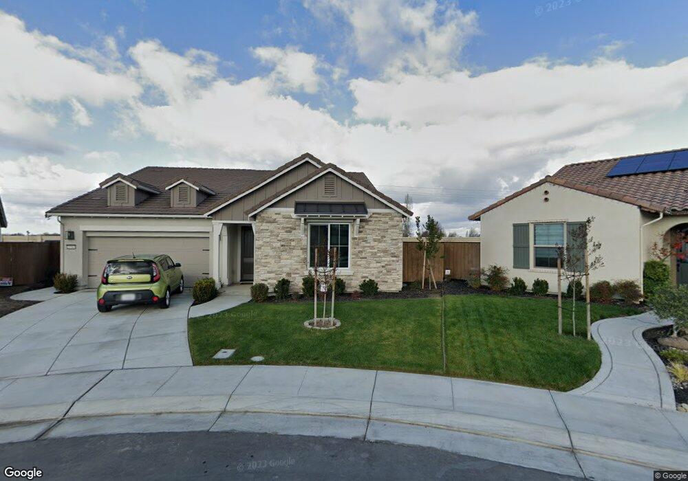
10969 Cherry Port Dr Stockton, CA 95219
Estimated Value: $545,000 - $602,000
3
Beds
2
Baths
1,893
Sq Ft
$302/Sq Ft
Est. Value
About This Home
This home is located at 10969 Cherry Port Dr, Stockton, CA 95219 and is currently estimated at $571,600, approximately $301 per square foot. 10969 Cherry Port Dr is a home with nearby schools including Manlio Silva Elementary School, Christa McAuliffe Middle School, and Bear Creek High School.
Ownership History
Date
Name
Owned For
Owner Type
Purchase Details
Closed on
Jun 30, 2020
Sold by
Regatta Building Partners Llc
Bought by
Shapiro Robert J and Martinez Shapiro Theresa
Current Estimated Value
Home Financials for this Owner
Home Financials are based on the most recent Mortgage that was taken out on this home.
Original Mortgage
$408,453
Outstanding Balance
$362,861
Interest Rate
3.2%
Mortgage Type
New Conventional
Estimated Equity
$208,739
Purchase Details
Closed on
Dec 10, 2019
Sold by
Eight Mile Development Inc
Bought by
Regatta Building Partners Llc
Create a Home Valuation Report for This Property
The Home Valuation Report is an in-depth analysis detailing your home's value as well as a comparison with similar homes in the area
Home Values in the Area
Average Home Value in this Area
Purchase History
| Date | Buyer | Sale Price | Title Company |
|---|---|---|---|
| Shapiro Robert J | $430,000 | Old Republic Title Company | |
| Regatta Building Partners Llc | $365,000 | Old Republic Title Company | |
| Eight Mile Development Inc | $365,000 | Old Republic Title Co San |
Source: Public Records
Mortgage History
| Date | Status | Borrower | Loan Amount |
|---|---|---|---|
| Open | Shapiro Robert J | $408,453 |
Source: Public Records
Tax History Compared to Growth
Tax History
| Year | Tax Paid | Tax Assessment Tax Assessment Total Assessment is a certain percentage of the fair market value that is determined by local assessors to be the total taxable value of land and additions on the property. | Land | Improvement |
|---|---|---|---|---|
| 2025 | $7,602 | $465,444 | $32,472 | $432,972 |
| 2024 | $7,416 | $456,319 | $31,836 | $424,483 |
| 2023 | $7,297 | $447,372 | $31,212 | $416,160 |
| 2022 | $7,117 | $438,600 | $30,600 | $408,000 |
| 2021 | $7,325 | $430,000 | $30,000 | $400,000 |
| 2020 | $3,386 | $100,000 | $100,000 | $0 |
| 2019 | $0 | $0 | $0 | $0 |
Source: Public Records
Map
Nearby Homes
- 6502 Crestview Cir Unit 21
- 6902 Tailwind Ln
- 6290 Crestview Cir
- 6808 Don Conti Ln
- 6707 Oakum Way
- 10866 Coral Reef Ln
- Residence 1765 Plan at Breakers Cove at Westlake
- Residence 2966 Plan at Breakers Cove at Westlake
- Residence 2403 Plan at Breakers Cove at Westlake
- Residence 1944 Plan at Breakers Cove at Westlake
- Residence 3308 Plan at Breezes at Westlake
- Residence 3175 Plan at Breezes at Westlake
- Residence 2872 Plan at Breezes at Westlake
- Residence 2138 Plan at Breezes at Westlake
- 10426 Cobble Creek Way
- 10414 Cobble Creek Way
- 10420 Cobble Creek Way
- 5969 Silveroak Cir Unit 19
- 6807 Oyster Point Ln
- 10866 Merritt Dr Unit 19
- 10965 Cherry Port Dr
- 10966 Cherry Port Dr
- 10961 Cherry Port Dr
- 10962 Cherry Port Dr
- 10960 Mikas Pond Way
- 10957 Cherry Port Dr
- 10958 Cherry Port Dr
- 10956 Mikas Pond Way
- 10954 Cherry Port Dr
- 6815 Sparks St
- 10953 Cherry Port Dr
- 10952 Mikas Pond Way
- 6725 Shorewood Ln
- 10949 Cherry Port Dr
- 6721 Shorewood Ln
- 10948 Mikas Pond Way
- 6819 Sparks St
- 6717 Shorewood Ln
- 10945 Cherry Port Dr
- 10953 Mikas Pond Way