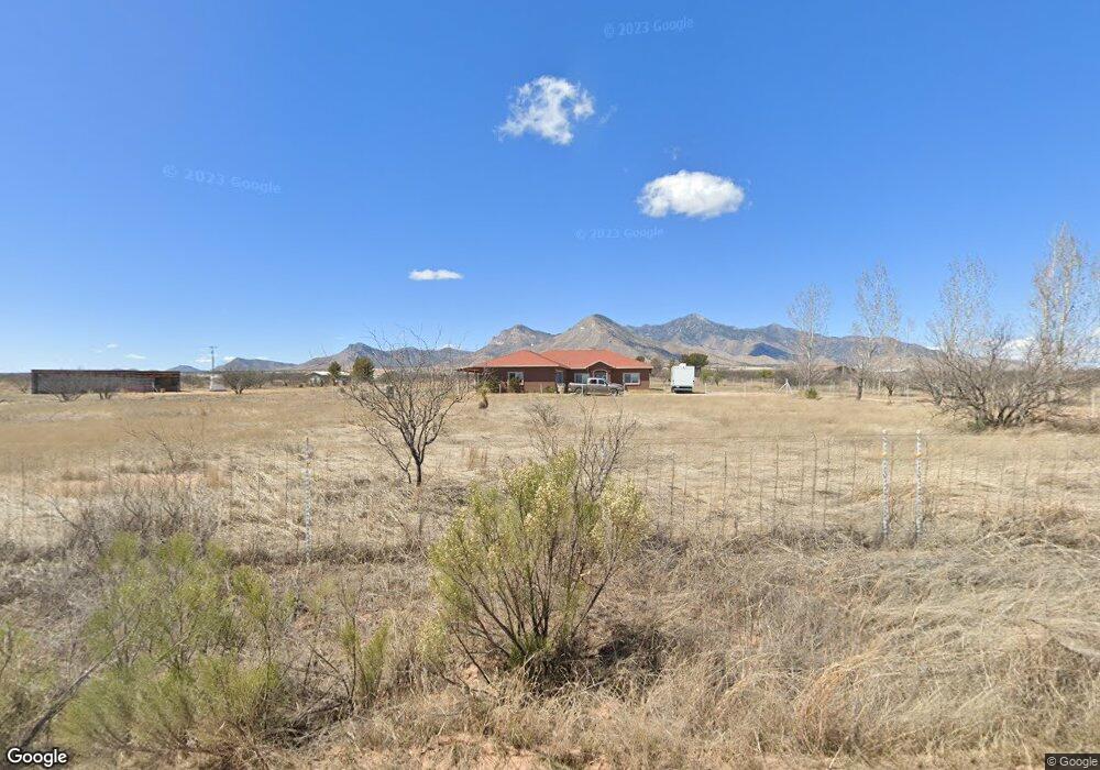
10978 S Hutchinson Rd Hereford, AZ 85615
Estimated Value: $335,000 - $440,000
--
Bed
--
Bath
2,178
Sq Ft
$175/Sq Ft
Est. Value
About This Home
This home is located at 10978 S Hutchinson Rd, Hereford, AZ 85615 and is currently estimated at $380,136, approximately $174 per square foot. 10978 S Hutchinson Rd is a home located in Cochise County with nearby schools including Palominas Elementary School.
Ownership History
Date
Name
Owned For
Owner Type
Purchase Details
Closed on
May 8, 2012
Sold by
Lichti George R and Lighti Crustina M
Bought by
George Anna A
Current Estimated Value
Home Financials for this Owner
Home Financials are based on the most recent Mortgage that was taken out on this home.
Original Mortgage
$192,346
Outstanding Balance
$133,293
Interest Rate
3.98%
Mortgage Type
New Conventional
Estimated Equity
$246,843
Purchase Details
Closed on
Jan 11, 2005
Sold by
Shaw Gene
Bought by
Lichti George R and Lichti Cristina M
Home Financials for this Owner
Home Financials are based on the most recent Mortgage that was taken out on this home.
Original Mortgage
$55,500
Interest Rate
6.25%
Mortgage Type
Seller Take Back
Create a Home Valuation Report for This Property
The Home Valuation Report is an in-depth analysis detailing your home's value as well as a comparison with similar homes in the area
Home Values in the Area
Average Home Value in this Area
Purchase History
| Date | Buyer | Sale Price | Title Company |
|---|---|---|---|
| George Anna A | $188,500 | Pioneer Title Agency | |
| Lichti George R | $59,500 | Pioneer Title Agency |
Source: Public Records
Mortgage History
| Date | Status | Borrower | Loan Amount |
|---|---|---|---|
| Open | George Anna A | $192,346 | |
| Previous Owner | Lichti George R | $55,500 |
Source: Public Records
Tax History Compared to Growth
Tax History
| Year | Tax Paid | Tax Assessment Tax Assessment Total Assessment is a certain percentage of the fair market value that is determined by local assessors to be the total taxable value of land and additions on the property. | Land | Improvement |
|---|---|---|---|---|
| 2025 | $2,121 | $24,295 | $2,650 | $21,645 |
| 2024 | $2,121 | $24,138 | $2,650 | $21,488 |
| 2023 | $2,094 | $20,951 | $2,650 | $18,301 |
| 2022 | $2,050 | $16,792 | $2,650 | $14,142 |
| 2021 | $2,144 | $16,751 | $2,650 | $14,101 |
| 2020 | $2,155 | $0 | $0 | $0 |
| 2019 | $2,039 | $0 | $0 | $0 |
| 2018 | $1,995 | $0 | $0 | $0 |
| 2017 | $2,162 | $0 | $0 | $0 |
| 2016 | $2,030 | $0 | $0 | $0 |
| 2015 | -- | $0 | $0 | $0 |
Source: Public Records
Map
Nearby Homes
- 8654 E Brianna Ln
- tbd S Paint Ranch Rd Unit A
- TBD S Rd Unit L
- TBD S Logans Run Unit 18
- 9519 E Guardian Ln
- 10157 S Honeysuckle Dr
- 10019 S Honeysuckle Dr
- 9429 E Kedron Dr
- 9530 E Kedron Dr Unit 14
- 9647 E Joy Ave
- 10490 S Smith Ave
- TBD E Gunpowder (15 781 Acres) Trail Unit 40
- TBD E Trail Unit 40
- 8800 E Cuervos Viejos Trail
- 037 E Desperado Dr Unit 20
- 6603 E Renegade Trail
- 6596 E Renegade Trail
- TBD E Gunpowder (23 58 Acres) Trail Unit 40
- 9456 S Springtail Dr
- 7095 E Presidio Ln Unit Lot 196
- 8498 E Mustang Trail
- 8488 E Mustang Trail
- 10915 S Hutchinson Rd
- 10889 S Kings Ranch Rd
- 8621 E Mustang Trail
- 10901 S Hutchinson Rd
- 001B E Mustang Trail Unit 1
- TBD E Mustang Trail Unit 5
- TBD E Mustang Trail
- 6a S Samuel Rd
- 4ac E Mustang Trail
- 4ac E Mustang Trail
- TBD E Mustang Trail Unit 1
- 6a S Samuel Rd
- 8636 E Mustang Trail
- 13 Acres E Lane Ranch Rd Unit 30
- 0 E Lane Ranch Rd Unit 6694953
- 1 E Lane Ranch Rd Unit 30
- 0 E Lane Ranch Rd Unit C
- 021 E Lane Ranch Rd Unit 12