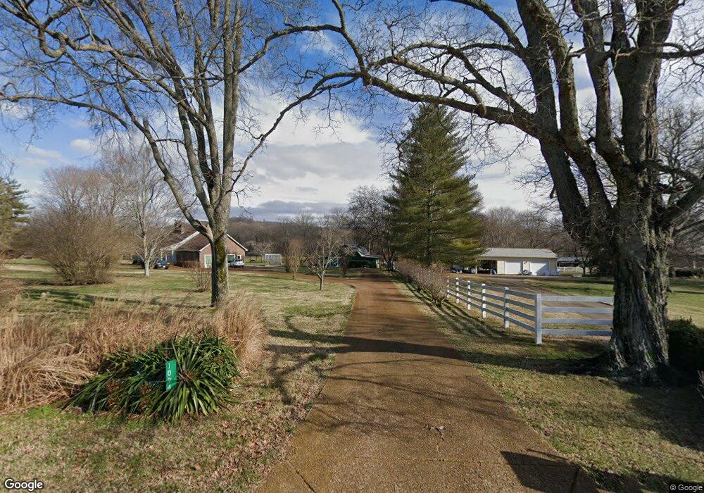
1098 Tulloss Rd Franklin, TN 37067
Estimated Value: $1,312,000 - $1,634,000
--
Bed
4
Baths
2,450
Sq Ft
$588/Sq Ft
Est. Value
About This Home
This home is located at 1098 Tulloss Rd, Franklin, TN 37067 and is currently estimated at $1,440,780, approximately $588 per square foot. 1098 Tulloss Rd is a home located in Williamson County with nearby schools including Clovercroft Elementary School, Woodland Middle School, and Ravenwood High School.
Ownership History
Date
Name
Owned For
Owner Type
Purchase Details
Closed on
Aug 16, 2007
Sold by
Preer John F
Bought by
Turner Richard N and Turner Cathy J
Current Estimated Value
Home Financials for this Owner
Home Financials are based on the most recent Mortgage that was taken out on this home.
Original Mortgage
$500,000
Outstanding Balance
$224,158
Interest Rate
6.56%
Mortgage Type
Purchase Money Mortgage
Estimated Equity
$1,216,622
Purchase Details
Closed on
Mar 30, 1998
Sold by
Tomlinson Donald A and Tomlinson Linda S
Bought by
Preer John F
Create a Home Valuation Report for This Property
The Home Valuation Report is an in-depth analysis detailing your home's value as well as a comparison with similar homes in the area
Home Values in the Area
Average Home Value in this Area
Purchase History
| Date | Buyer | Sale Price | Title Company |
|---|---|---|---|
| Turner Richard N | $625,000 | Chapman & Rosenthal Title In | |
| Preer John F | $332,000 | -- |
Source: Public Records
Mortgage History
| Date | Status | Borrower | Loan Amount |
|---|---|---|---|
| Open | Turner Richard N | $500,000 |
Source: Public Records
Tax History Compared to Growth
Tax History
| Year | Tax Paid | Tax Assessment Tax Assessment Total Assessment is a certain percentage of the fair market value that is determined by local assessors to be the total taxable value of land and additions on the property. | Land | Improvement |
|---|---|---|---|---|
| 2024 | $3,765 | $200,275 | $119,600 | $80,675 |
| 2023 | $3,765 | $200,275 | $119,600 | $80,675 |
| 2022 | $3,765 | $200,275 | $119,600 | $80,675 |
| 2021 | $3,765 | $200,275 | $119,600 | $80,675 |
| 2020 | $3,530 | $159,025 | $79,725 | $79,300 |
| 2019 | $3,530 | $159,025 | $79,725 | $79,300 |
| 2018 | $3,419 | $159,025 | $79,725 | $79,300 |
| 2017 | $3,419 | $159,025 | $79,725 | $79,300 |
| 2016 | $3,419 | $159,025 | $79,725 | $79,300 |
| 2015 | -- | $128,675 | $61,325 | $67,350 |
| 2014 | -- | $128,675 | $61,325 | $67,350 |
Source: Public Records
Map
Nearby Homes
- 2085 Wilson Pike
- 0 Wilson Pike Unit RTC2991143
- 1 Wilson Pike
- 2081 Wilson Pike
- 0 Lasata Unit RTC2787689
- 3416 Dunchurch Ct
- 1929 Springcroft Dr
- 1659 Guy Ferrell Rd
- 9065 Chardonnay Trace
- 9092 Chardonnay Trace
- 6000 Lookaway Cir
- Plan 25047 at Lookaway Farms
- Plan 25866 at Lookaway Farms
- Plan 25840 at Lookaway Farms
- Plan 25800 at Lookaway Farms
- Plan 25878 at Lookaway Farms
- 6129 Open Meadow Ln
- 9409 Clovercroft Rd
- 6004 Lookaway Cir
- 6112 Open Meadow Ln
- 1094 Tulloss Rd
- 1090 Tulloss Rd
- 2092 Wilson Pike
- 1086 Tulloss Rd
- 1102 Tulloss Rd
- 1084 Tulloss Rd
- 0A Wilson Pike
- 3034 Wilson Pike
- 2077 Wilson Pike
- 1080 Tulloss Rd
- 2086 Wilson Pike
- 1103 Tulloss Rd
- 1620 Guy Ferrell Rd
- 1091 Tulloss Rd
- 0 Guy Ferrell Rd
- 0 Guy Ferrell Rd Unit RTC2920452
- 0 Guy Ferrell Rd Unit RTC2581293
- 0 Guy Ferrell Rd Unit RTC2581288
- 0 Guy Ferrell Rd Unit RTC2581281
- 2097 Wilson Pike Unit 7