Estimated Value: $592,000 - $725,000
4
Beds
3
Baths
2,500
Sq Ft
$262/Sq Ft
Est. Value
About This Home
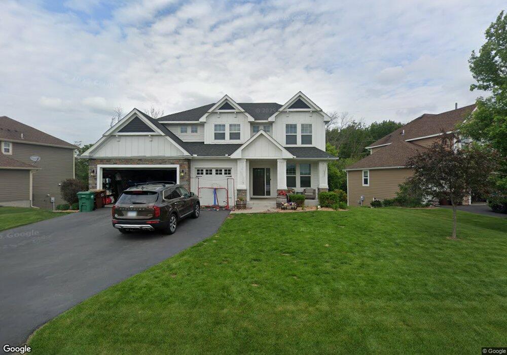
This home is located at 10980 Cattail Path, Osseo, MN 55369 and is currently estimated at $655,410, approximately $262 per square foot. 10980 Cattail Path is a home located in Hennepin County with nearby schools including Fernbrook Elementary School, Osseo Middle School, and Maple Grove Senior High School.
Ownership History
Date
Name
Owned For
Owner Type
Purchase Details
Closed on
Aug 16, 2019
Sold by
Banks Derek Franklin and Banks Heather Elizabeth
Bought by
Banks Revocable Trust and Banks
Current Estimated Value
Home Financials for this Owner
Home Financials are based on the most recent Mortgage that was taken out on this home.
Original Mortgage
$243,000
Outstanding Balance
$212,823
Interest Rate
3.7%
Mortgage Type
New Conventional
Estimated Equity
$442,587
Purchase Details
Closed on
Nov 4, 2016
Sold by
Us Home Corporation
Bought by
Banks Heather and Hanks Derek
Home Financials for this Owner
Home Financials are based on the most recent Mortgage that was taken out on this home.
Original Mortgage
$417,000
Interest Rate
3.48%
Mortgage Type
New Conventional
Purchase Details
Closed on
Sep 29, 2014
Create a Home Valuation Report for This Property
The Home Valuation Report is an in-depth analysis detailing your home's value as well as a comparison with similar homes in the area
Home Values in the Area
Average Home Value in this Area
Purchase History
| Date | Buyer | Sale Price | Title Company |
|---|---|---|---|
| Banks Revocable Trust | $500 | None Listed On Document | |
| Banks Heather | $457,500 | North American Title Company | |
| -- | $3,343,500 | -- |
Source: Public Records
Mortgage History
| Date | Status | Borrower | Loan Amount |
|---|---|---|---|
| Open | Banks Revocable Trust | $243,000 | |
| Previous Owner | Banks Heather | $417,000 |
Source: Public Records
Tax History
| Year | Tax Paid | Tax Assessment Tax Assessment Total Assessment is a certain percentage of the fair market value that is determined by local assessors to be the total taxable value of land and additions on the property. | Land | Improvement |
|---|---|---|---|---|
| 2024 | $7,597 | $583,200 | $131,300 | $451,900 |
| 2023 | $7,437 | $580,200 | $126,000 | $454,200 |
| 2022 | $6,490 | $559,000 | $137,000 | $422,000 |
| 2021 | $6,494 | $473,000 | $107,000 | $366,000 |
| 2020 | $6,883 | $454,000 | $100,000 | $354,000 |
| 2019 | $6,857 | $456,000 | $105,000 | $351,000 |
| 2018 | $7,137 | $435,000 | $105,000 | $330,000 |
| 2017 | $1,959 | $100,000 | $100,000 | $0 |
| 2016 | $1,022 | $51,300 | $51,300 | $0 |
| 2015 | $456 | $22,400 | $22,400 | $0 |
Source: Public Records
Map
Nearby Homes
- 15251 110th Ave N
- 15261 110th Ave N
- 11057 Kingsview Ln N
- 15171 110th Ave N
- 15161 110th Ave N
- 15351 110th Ave N
- 10945 Glacier Ln N
- 11158 Kingsview Ln N
- 11068 Kingsview Ln N
- 15350 110th Ave N
- 11088 N Kingsview Ln N
- 14755 108th Ave N
- 15531 111th Ave N
- 11071 Sundance Ridge
- 000 110th Ave N
- 15650 112th Ave N
- 15442 111th Ave N
- 11389 Kingsview Ln N
- 10967 Harbor Ln N
- 11290 Niagara Ln N
- 10970 Cattail Path
- 10970 Cattail Path
- 10990 Cattail Path
- 10960 Cattail Path
- 11000 Cattail Path
- 10950 Cattail Path
- 10951 Cattail Path
- 15211 Creekside Ln
- 10950 Cattail Path
- 10950 10950 Cattail Path
- 13999 11021 Cattail Path Ave N
- 13985 11021 Cattail Path Ave N
- 10995 Cattail Path
- 10940 Cattail Path
- 15231 Creekside Ln
- 15230 Creekside Ln
- 10945 Cattail Path
- 11010 Cattail Path
- 15250 Creekside Ln
- 15251 Creekside Ln
Your Personal Tour Guide
Ask me questions while you tour the home.