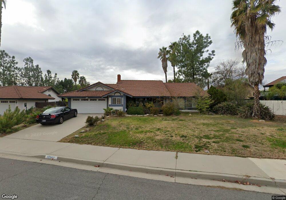
10987 Brener Cir Moreno Valley, CA 92557
North Moreno Valley NeighborhoodEstimated Value: $557,000 - $585,013
3
Beds
2
Baths
1,717
Sq Ft
$331/Sq Ft
Est. Value
About This Home
This home is located at 10987 Brener Cir, Moreno Valley, CA 92557 and is currently estimated at $569,003, approximately $331 per square foot. 10987 Brener Cir is a home located in Riverside County with nearby schools including Sugar Hill Elementary School, Palm Middle School, and Canyon Springs High School.
Ownership History
Date
Name
Owned For
Owner Type
Purchase Details
Closed on
May 2, 2024
Sold by
El-Amin-Harvest Lovie
Bought by
Lovie El-Amin-Harvest Revocable Living Trust and El-Amin-Harvest
Current Estimated Value
Purchase Details
Closed on
Sep 10, 1996
Sold by
Kontogianis Chris and Kontogianis Karin
Bought by
El Amin Harvst Lovin
Home Financials for this Owner
Home Financials are based on the most recent Mortgage that was taken out on this home.
Original Mortgage
$118,750
Interest Rate
7.87%
Create a Home Valuation Report for This Property
The Home Valuation Report is an in-depth analysis detailing your home's value as well as a comparison with similar homes in the area
Home Values in the Area
Average Home Value in this Area
Purchase History
| Date | Buyer | Sale Price | Title Company |
|---|---|---|---|
| Lovie El-Amin-Harvest Revocable Living Trust | -- | None Listed On Document | |
| El Amin Harvst Lovin | $125,000 | Commonwealth Land Title Co |
Source: Public Records
Mortgage History
| Date | Status | Borrower | Loan Amount |
|---|---|---|---|
| Previous Owner | El Amin Harvst Lovin | $118,750 |
Source: Public Records
Tax History Compared to Growth
Tax History
| Year | Tax Paid | Tax Assessment Tax Assessment Total Assessment is a certain percentage of the fair market value that is determined by local assessors to be the total taxable value of land and additions on the property. | Land | Improvement |
|---|---|---|---|---|
| 2025 | $2,382 | $203,545 | $65,125 | $138,420 |
| 2023 | $2,382 | $195,644 | $62,598 | $133,046 |
| 2022 | $2,293 | $191,809 | $61,371 | $130,438 |
| 2021 | $2,251 | $188,049 | $60,168 | $127,881 |
| 2020 | $2,228 | $186,122 | $59,552 | $126,570 |
| 2019 | $2,192 | $182,474 | $58,385 | $124,089 |
| 2018 | $2,150 | $178,897 | $57,241 | $121,656 |
| 2017 | $2,104 | $175,390 | $56,119 | $119,271 |
| 2016 | $2,083 | $171,952 | $55,019 | $116,933 |
| 2015 | $2,054 | $169,372 | $54,194 | $115,178 |
| 2014 | $1,916 | $166,057 | $53,134 | $112,923 |
Source: Public Records
Map
Nearby Homes
- 24321 Barley Rd
- 24316 Chippewa Trail
- 24118 Forsyte St
- 24461 Willow Run Rd
- 24553 Wild Calla Dr
- 24472 Old Country Rd
- 24022 Forsyte St
- 10731 Park Rim Cir
- 24309 Rimview Rd
- 24321 Rimview Rd
- 11119 Silver Run
- 10560 Canyon Vista Rd
- 24735 Thornberry Cir
- 10479 Sagecrest Dr
- 23886 Mark Twain
- 23865 Parkland Ave
- 23809 Parkland Ave
- 23919 Mark Twain
- 23779 Parkland Ave
- 23878 Bouquet Canyon Place
- 10997 Brener Cir
- 24225 Old Country Rd
- 24215 Old Country Rd
- 10984 Lemonwood Cir
- 10994 Lemonwood Cir
- 24207 Old Country Rd
- 10986 Brener Cir
- 10976 Brener Cir
- 24245 Old Country Rd
- 10996 Brener Cir
- 24255 Old Country Rd
- 24222 Old Country Rd
- 24236 Old Country Rd
- 10985 Duckbill Rd
- 10975 Duckbill Rd
- 24290 Quapaw Trail
- 24208 Old Country Rd
- 10995 Duckbill Rd
- 24191 Old Country Rd
- 24304 Quapaw Trail