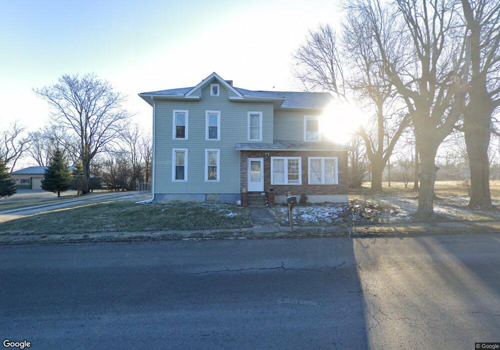
10988 Us Highway 68 Kenton, OH 43326
Estimated Value: $152,000 - $281,000
4
Beds
2
Baths
2,264
Sq Ft
$97/Sq Ft
Est. Value
About This Home
This home is located at 10988 Us Highway 68, Kenton, OH 43326 and is currently estimated at $218,719, approximately $96 per square foot. 10988 Us Highway 68 is a home located in Hardin County with nearby schools including Kenton Elementary School, Kenton Middle School, and Kenton High School.
Ownership History
Date
Name
Owned For
Owner Type
Purchase Details
Closed on
May 10, 2011
Sold by
Berea Baptist Church Of Kenton
Bought by
Elsasser Natasha R
Current Estimated Value
Home Financials for this Owner
Home Financials are based on the most recent Mortgage that was taken out on this home.
Original Mortgage
$32,000
Outstanding Balance
$12,399
Interest Rate
4.88%
Mortgage Type
New Conventional
Estimated Equity
$206,320
Purchase Details
Closed on
Jun 21, 1996
Bought by
Berea Baptist Church Of
Purchase Details
Closed on
Dec 27, 1995
Bought by
Higgins Ben A and Higgins Ben F
Create a Home Valuation Report for This Property
The Home Valuation Report is an in-depth analysis detailing your home's value as well as a comparison with similar homes in the area
Home Values in the Area
Average Home Value in this Area
Purchase History
| Date | Buyer | Sale Price | Title Company |
|---|---|---|---|
| Elsasser Natasha R | $40,000 | None Available | |
| Berea Baptist Church Of | $48,000 | -- | |
| Higgins Ben A | $58,100 | -- |
Source: Public Records
Mortgage History
| Date | Status | Borrower | Loan Amount |
|---|---|---|---|
| Open | Elsasser Natasha R | $32,000 |
Source: Public Records
Tax History Compared to Growth
Tax History
| Year | Tax Paid | Tax Assessment Tax Assessment Total Assessment is a certain percentage of the fair market value that is determined by local assessors to be the total taxable value of land and additions on the property. | Land | Improvement |
|---|---|---|---|---|
| 2024 | $2,028 | $48,200 | $9,100 | $39,100 |
| 2023 | $2,028 | $48,200 | $9,100 | $39,100 |
| 2022 | $1,152 | $25,160 | $6,090 | $19,070 |
| 2021 | $1,156 | $25,160 | $6,090 | $19,070 |
| 2020 | $1,001 | $25,160 | $6,090 | $19,070 |
| 2019 | $833 | $21,630 | $5,880 | $15,750 |
| 2018 | $835 | $21,630 | $5,880 | $15,750 |
| 2017 | $806 | $21,630 | $5,880 | $15,750 |
| 2016 | $777 | $21,120 | $5,360 | $15,760 |
| 2015 | $738 | $21,120 | $5,360 | $15,760 |
| 2014 | $769 | $21,120 | $5,360 | $15,760 |
| 2013 | $826 | $21,970 | $5,360 | $16,610 |
Source: Public Records
Map
Nearby Homes
- 299 Marie Ave
- 109 Lark Ln
- 416 E Eliza St
- 0 Gilmore St
- 777 Maydoll Dr
- 700 N Ida St
- 416 N Cherry St
- 503 Jennings St
- 416 Center St
- 104 Oak Ln Unit 15
- 0 N Barron St
- 328 N Detroit St
- 310 N Market St
- 324 Stone Hedge Ln Unit 324
- 233 N Main St
- 215 N Main St
- 368 N Ida St
- 219 W Carrol St
- 424 W Carrol St
- 509 E Carrol St
- 10988 State Route 68
- 10956 Us Highway 68
- 10928 Us Highway 68
- 202 W Pattison Ave
- 1234 N Market St
- 200 E Forest Rd
- 928 N Main St
- 914 N Market St
- 14201 W Pattison Ave
- 924 N Main St
- 910 N Market St
- 10902 Us Highway 68
- 206 Garfield Ave
- 916 N Main St
- 301 W Pattison Ave
- 901 N Main St
- 210 Garfield Ave
- 819 N Detroit St