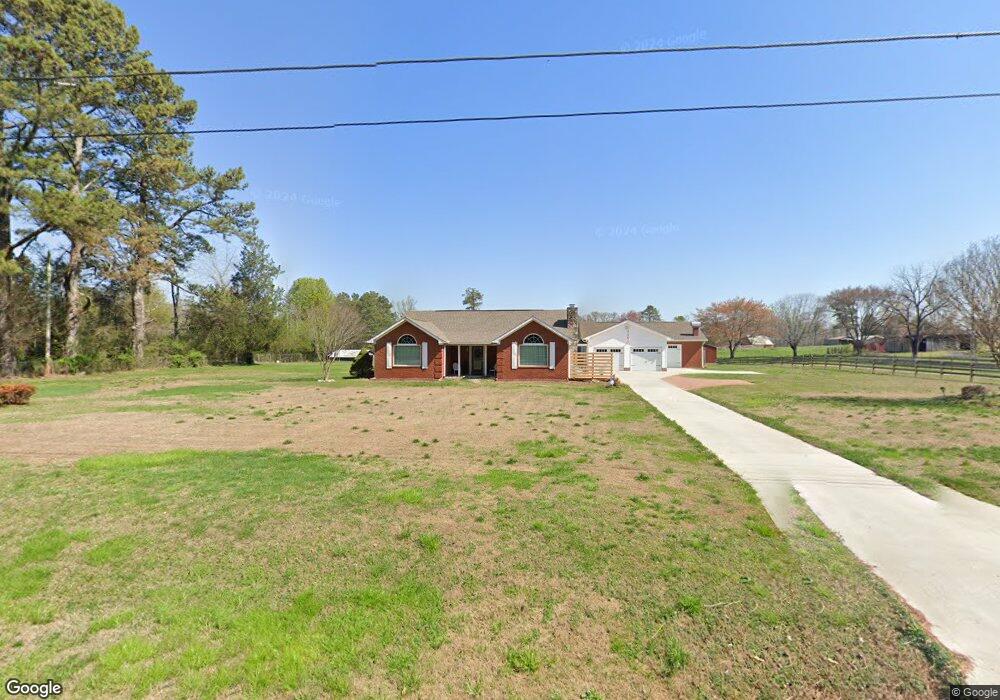
1099 Highway 95 Rock Spring, GA 30739
Rock Spring NeighborhoodEstimated Value: $289,222 - $414,000
--
Bed
2
Baths
2,088
Sq Ft
$169/Sq Ft
Est. Value
About This Home
This home is located at 1099 Highway 95, Rock Spring, GA 30739 and is currently estimated at $352,556, approximately $168 per square foot. 1099 Highway 95 is a home located in Walker County with nearby schools including Rock Spring Elementary School, Lafayette High School, and Alice M Daley Adventist School.
Ownership History
Date
Name
Owned For
Owner Type
Purchase Details
Closed on
Dec 1, 1993
Sold by
Gilbreath John H
Bought by
Ladd Robert C and Ladd Charlotte
Current Estimated Value
Purchase Details
Closed on
Jan 1, 1972
Bought by
Gilbreath John H
Create a Home Valuation Report for This Property
The Home Valuation Report is an in-depth analysis detailing your home's value as well as a comparison with similar homes in the area
Home Values in the Area
Average Home Value in this Area
Purchase History
| Date | Buyer | Sale Price | Title Company |
|---|---|---|---|
| Ladd Robert C | $80,000 | -- | |
| Gilbreath John H | -- | -- |
Source: Public Records
Tax History Compared to Growth
Tax History
| Year | Tax Paid | Tax Assessment Tax Assessment Total Assessment is a certain percentage of the fair market value that is determined by local assessors to be the total taxable value of land and additions on the property. | Land | Improvement |
|---|---|---|---|---|
| 2024 | $1,396 | $99,659 | $7,733 | $91,926 |
| 2023 | $1,310 | $93,625 | $6,137 | $87,488 |
| 2022 | $1,083 | $81,154 | $4,996 | $76,158 |
| 2021 | $845 | $66,631 | $4,996 | $61,635 |
| 2020 | $696 | $56,447 | $4,996 | $51,451 |
| 2019 | $1,532 | $56,447 | $4,996 | $51,451 |
| 2018 | $1,494 | $56,447 | $4,996 | $51,451 |
| 2017 | $1,694 | $56,447 | $4,996 | $51,451 |
| 2016 | $1,314 | $56,447 | $4,996 | $51,451 |
| 2015 | $1,484 | $54,001 | $9,296 | $44,705 |
| 2014 | $1,377 | $54,001 | $9,296 | $44,705 |
| 2013 | -- | $54,000 | $9,296 | $44,704 |
Source: Public Records
Map
Nearby Homes
- 5602 Georgia 95
- 00 Georgia 95
- 10180 Us Highway 27
- 1003 Highway N Old 27
- 1370 Old Highway 27
- 701 Bicentennial Trail
- 0 Cheshire Crossing Dr Unit 1387793
- 23 Willow Cir
- 16 Willow Cir
- 11 Willow Cir
- The Pearson Plan at Laurel Ridge
- The Benson II Plan at Laurel Ridge
- The Langford Plan at Laurel Ridge
- The Lawson Plan at Laurel Ridge
- The Coleman Plan at Laurel Ridge
- The McGinnis Plan at Laurel Ridge
- The Caldwell Plan at Laurel Ridge
- 1902 Long Hollow Rd
- 195 Honeysuckle Dr
- 36 Pheonix Cir
- 0 Moon Beam Cir Unit 8270725
- 0 Moon Beam Cir Unit 1375386
- 0 Moon Beam Cir Unit 942766
- 0 Moon Beam Cir Unit 1271496
- 0 Moon Beam Cir Unit 1149977
- 1017 Highway 95
- 1145 Highway 95
- 50 Moon Beam Cir
- 1145 Georgia 95
- 983 Highway 95
- 9 Starlight Dr
- 80 Moon Beam Cir
- 1140 Highway 95
- 1140 Georgia 95
- 85 Moon Beam Cir
- 1121 Highway 95
- 108 Moon Beam Cir
- 1215 Highway 95
- 965 Highway 95
- 38 Starlight Dr