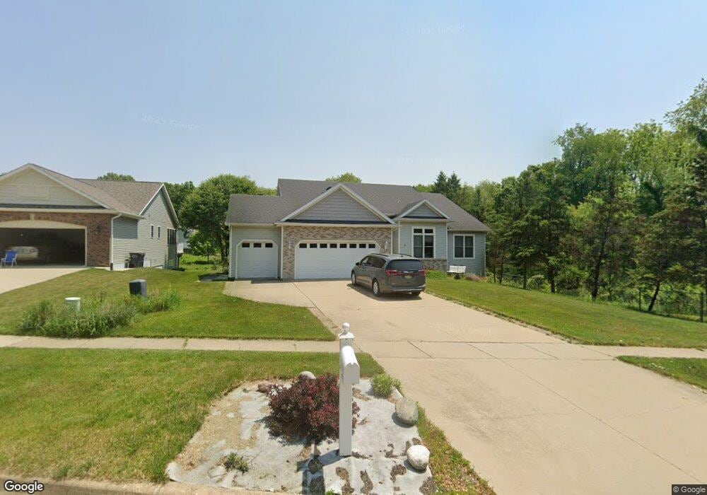
10991 Country Grove Cir Portage, MI 49024
Estimated Value: $418,000 - $448,000
--
Bed
--
Bath
1,899
Sq Ft
$226/Sq Ft
Est. Value
About This Home
This home is located at 10991 Country Grove Cir, Portage, MI 49024 and is currently estimated at $429,479, approximately $226 per square foot. 10991 Country Grove Cir is a home located in Kalamazoo County with nearby schools including Moorsbridge Elementary School, Portage Central Middle School, and Portage Central High School.
Ownership History
Date
Name
Owned For
Owner Type
Purchase Details
Closed on
Apr 28, 2005
Sold by
Gems Associates Lp
Bought by
Haun Kevin L and Haun Kathy L
Current Estimated Value
Home Financials for this Owner
Home Financials are based on the most recent Mortgage that was taken out on this home.
Original Mortgage
$204,000
Outstanding Balance
$107,798
Interest Rate
6.05%
Mortgage Type
Fannie Mae Freddie Mac
Estimated Equity
$321,681
Create a Home Valuation Report for This Property
The Home Valuation Report is an in-depth analysis detailing your home's value as well as a comparison with similar homes in the area
Home Values in the Area
Average Home Value in this Area
Purchase History
| Date | Buyer | Sale Price | Title Company |
|---|---|---|---|
| Haun Kevin L | -- | Metropolitan |
Source: Public Records
Mortgage History
| Date | Status | Borrower | Loan Amount |
|---|---|---|---|
| Open | Haun Kevin L | $204,000 |
Source: Public Records
Tax History Compared to Growth
Tax History
| Year | Tax Paid | Tax Assessment Tax Assessment Total Assessment is a certain percentage of the fair market value that is determined by local assessors to be the total taxable value of land and additions on the property. | Land | Improvement |
|---|---|---|---|---|
| 2025 | $5,997 | $190,000 | $0 | $0 |
| 2024 | $5,279 | $178,100 | $0 | $0 |
| 2023 | $5,032 | $154,200 | $0 | $0 |
| 2022 | $5,438 | $146,100 | $0 | $0 |
| 2021 | $5,255 | $143,000 | $0 | $0 |
| 2020 | $5,141 | $132,600 | $0 | $0 |
| 2019 | $463 | $128,300 | $0 | $0 |
| 2018 | $0 | $120,200 | $0 | $0 |
| 2017 | $0 | $123,000 | $0 | $0 |
| 2016 | -- | $115,700 | $0 | $0 |
| 2015 | -- | $111,400 | $0 | $0 |
| 2014 | -- | $105,100 | $0 | $0 |
Source: Public Records
Map
Nearby Homes
- 1817 Alder Ave
- 2633 Rolling Hill Ave
- 2223 Surry
- 10381 Schrier Ln
- 10382 Pennridge Dr
- Integrity 1800 Plan at Pennridge Trail North
- Integrity 2085 Plan at Pennridge Trail North
- Integrity 1910 Plan at Pennridge Trail North
- 10197 Pennridge Dr
- 10187 Pennridge Dr
- 10565 Pierport Dr
- 10118 Pennridge Dr
- 11025 Higley Cir W
- 10077 Kearns Ct
- 10025 Kearns Ct
- 10029 Kearns Ct
- 821 Janelle Ct
- 10631 Gracie Ln Unit 6
- 10025 Shuman St
- 775 Chloe Jane Ave
- 10979 Country Grove Cir
- 10995 Country Grove Cir
- 10967 Country Grove Cir
- 10970 Poplar Bluff Ct
- 10950 Poplar Bluff Ct
- 10974 Country Grove Cir
- 10947 Country Grove Cir
- 10986 Country Grove Cir
- 10998 Country Grove Cir
- 10952 Country Grove Cir
- 10930 Poplar Bluff Ct
- 10925 Country Grove Cir
- 10971 Poplar Bluff Ct
- 10932 Country Grove Cir
- 10910 Poplar Bluff Ct
- 10949 Poplar Bluff Ct
- Lot 35 Country Grove Cir
- 35 Country Grove Cir
- 10899 Country Grove Cir
- 10904 Country Grove Cir