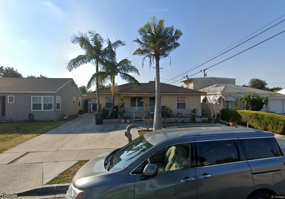
10993 Sampson Ave Lynwood, CA 90262
Estimated Value: $611,840 - $718,000
2
Beds
1
Bath
1,100
Sq Ft
$619/Sq Ft
Est. Value
About This Home
This home is located at 10993 Sampson Ave, Lynwood, CA 90262 and is currently estimated at $681,210, approximately $619 per square foot. 10993 Sampson Ave is a home located in Los Angeles County with nearby schools including Lugo Elementary School, Hosler Middle School, and Lynwood High School.
Ownership History
Date
Name
Owned For
Owner Type
Purchase Details
Closed on
Oct 24, 2006
Sold by
Ortega Linda Marron
Bought by
Ortega Raul and Ortega Linda Marron
Current Estimated Value
Home Financials for this Owner
Home Financials are based on the most recent Mortgage that was taken out on this home.
Original Mortgage
$400,000
Interest Rate
8.25%
Mortgage Type
Negative Amortization
Purchase Details
Closed on
Aug 19, 2005
Sold by
Ortega Linda M
Bought by
Ortega Linda Marron
Home Financials for this Owner
Home Financials are based on the most recent Mortgage that was taken out on this home.
Original Mortgage
$270,000
Interest Rate
1%
Mortgage Type
Fannie Mae Freddie Mac
Create a Home Valuation Report for This Property
The Home Valuation Report is an in-depth analysis detailing your home's value as well as a comparison with similar homes in the area
Home Values in the Area
Average Home Value in this Area
Purchase History
| Date | Buyer | Sale Price | Title Company |
|---|---|---|---|
| Ortega Raul | -- | Fidelity National Title Co | |
| Ortega Linda Marron | -- | Financial Title Company | |
| Ortega Linda Marron | -- | Financial Title Company |
Source: Public Records
Mortgage History
| Date | Status | Borrower | Loan Amount |
|---|---|---|---|
| Previous Owner | Ortega Raul | $400,000 | |
| Previous Owner | Ortega Linda Marron | $270,000 |
Source: Public Records
Tax History Compared to Growth
Tax History
| Year | Tax Paid | Tax Assessment Tax Assessment Total Assessment is a certain percentage of the fair market value that is determined by local assessors to be the total taxable value of land and additions on the property. | Land | Improvement |
|---|---|---|---|---|
| 2025 | $3,206 | $195,197 | $114,253 | $80,944 |
| 2024 | $3,206 | $191,370 | $112,013 | $79,357 |
| 2023 | $3,183 | $187,618 | $109,817 | $77,801 |
| 2022 | $3,079 | $183,940 | $107,664 | $76,276 |
| 2021 | $4,946 | $180,334 | $105,553 | $74,781 |
| 2019 | $3,034 | $174,987 | $102,423 | $72,564 |
| 2018 | $2,733 | $171,557 | $100,415 | $71,142 |
| 2016 | $2,554 | $164,898 | $96,517 | $68,381 |
| 2015 | $2,506 | $162,422 | $95,068 | $67,354 |
| 2014 | $2,457 | $159,241 | $93,206 | $66,035 |
Source: Public Records
Map
Nearby Homes
- 10891 Standard Ave
- 10502 Bryson Ave
- 11267 Sampson Ave
- 11309 Annetta Ave
- 10307 Alexander Ave
- 4000 Platt Ave
- 10240 Atlantic Ave
- 4296 Platt Ave
- 3831 Walnut Ave
- 11340 Virginia Ave
- 11363 Virginia Ave
- 4274 Walnut Ave
- 4296 Walnut Ave
- 3805 Lugo Ave
- 11230 Louise Ave
- 4236 Cortland St
- 3886 Cortland St
- 3633 Platt Ave
- 3644 Platt Ave
- 3685 Fernwood Ave
- 10999 Sampson Ave
- 10983 Sampson Ave
- 10973 Sampson Ave
- 10990 Colyer Ave
- 10998 Colyer Ave
- 10982 Colyer Ave
- 10963 Sampson Ave
- 10972 Colyer Ave
- 10992 Sampson Ave
- 10998 Sampson Ave
- 10982 Sampson Ave
- 10962 Colyer Ave
- 10972 Sampson Ave
- 10953 Sampson Ave
- 10962 Sampson Ave
- 10952 Colyer Ave
- 10943 Sampson Ave
- 10952 Sampson Ave
- 10942 Colyer Ave
- 10993 Jackson Ave