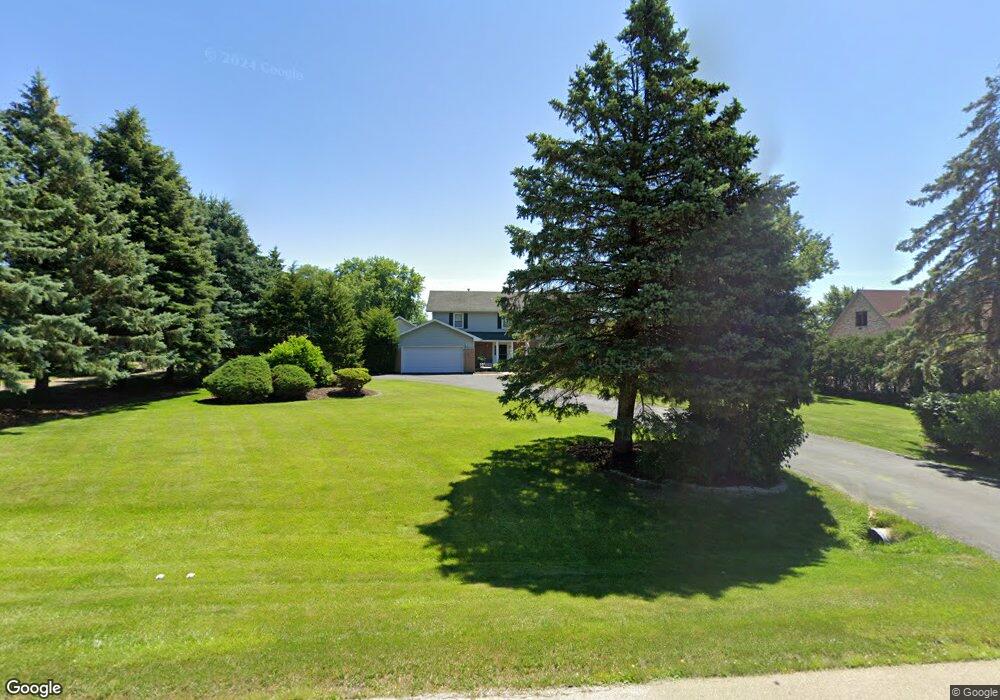
10S533 Curtis Ln Naperville, IL 60564
Springbrook Prairie NeighborhoodEstimated Value: $683,000 - $793,000
--
Bed
1
Bath
3,119
Sq Ft
$231/Sq Ft
Est. Value
About This Home
This home is located at 10S533 Curtis Ln, Naperville, IL 60564 and is currently estimated at $721,197, approximately $231 per square foot. 10S533 Curtis Ln is a home located in Will County with nearby schools including Robert Clow Elementary School, Ellsworth Elementary School, and Gordon Gregory Middle School.
Ownership History
Date
Name
Owned For
Owner Type
Purchase Details
Closed on
Apr 15, 1988
Bought by
Buenger Harry Ka
Current Estimated Value
Create a Home Valuation Report for This Property
The Home Valuation Report is an in-depth analysis detailing your home's value as well as a comparison with similar homes in the area
Home Values in the Area
Average Home Value in this Area
Purchase History
| Date | Buyer | Sale Price | Title Company |
|---|---|---|---|
| Buenger Harry Ka | $181,500 | -- |
Source: Public Records
Tax History Compared to Growth
Tax History
| Year | Tax Paid | Tax Assessment Tax Assessment Total Assessment is a certain percentage of the fair market value that is determined by local assessors to be the total taxable value of land and additions on the property. | Land | Improvement |
|---|---|---|---|---|
| 2024 | $11,533 | $208,898 | $58,902 | $149,996 |
| 2023 | $11,533 | $184,539 | $52,034 | $132,505 |
| 2022 | $11,150 | $174,571 | $49,223 | $125,348 |
| 2021 | $10,619 | $166,258 | $46,879 | $119,379 |
| 2020 | $10,503 | $163,623 | $46,136 | $117,487 |
| 2019 | $10,249 | $159,012 | $44,836 | $114,176 |
| 2018 | $12,642 | $190,834 | $43,850 | $146,984 |
| 2017 | $12,478 | $185,907 | $42,718 | $143,189 |
| 2016 | $12,452 | $181,905 | $41,798 | $140,107 |
| 2015 | $12,836 | $174,908 | $40,190 | $134,718 |
| 2014 | $12,836 | $174,908 | $40,190 | $134,718 |
| 2013 | $12,836 | $174,908 | $40,190 | $134,718 |
Source: Public Records
Map
Nearby Homes
- 2636 Salix Cir
- 28W555 Leverenz Rd
- 2949 Brossman St
- 2207 Sisters Ave
- 1305 Morningstar Ct Unit 1A
- 3004 Bennett Dr
- 1329 Neskola Ct
- 2736 Bluewater Cir
- 2301 Mecan Dr
- 2741 Gateshead Dr
- 1321 Galena Ct
- 2543 Dewes Ln
- 1134 Gateshead Dr
- 1123 Thackery Ln
- 2866 Stonewater Dr Unit 102
- 3432 Caine Dr
- 1116 Hollingswood Ave
- 2611 Cedar Glade Dr Unit 204
- 3616 Eliot Ln
- 3508 Tussell St
- 10S525 Curtis Ln
- 10S573 Curtis Ln
- 10S515 Curtis Ln
- 2643 Salix Cir
- 10S558 Curtis Ln
- 2647 Salix Cir
- 10S542 Curtis Ln
- 10S542 Curtis Ln Unit 10S542
- 10S542 Curtis Ln Unit 1
- 2635 Salix Cir
- 10S526 Curtis Ln
- 2651 Salix Cir
- 10S574 Curtis Ln Unit 7
- 2631 Salix Cir
- 9307 Curtis Ln
- 2655 Salix Cir
- 10S510 Curtis Ln
- 10S588 Curtis Ln
- 2627 Salix Cir
- 2659 Salix Cir