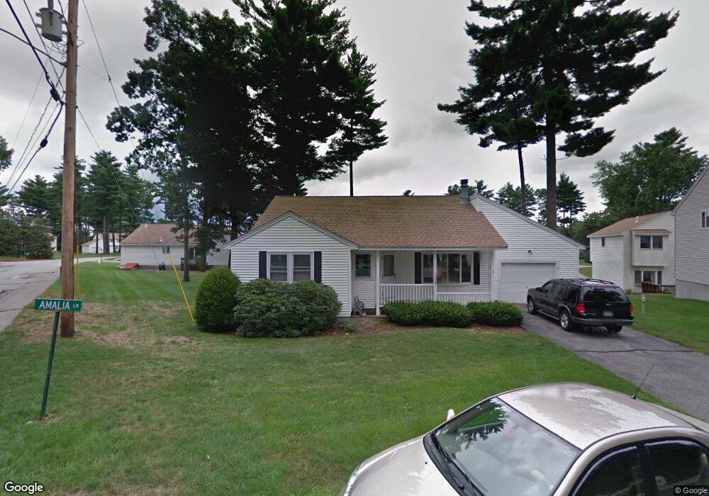
11 Amalia Dr Unit U62 Nashua, NH 03063
Northwest Nashua NeighborhoodEstimated Value: $373,000 - $411,000
2
Beds
2
Baths
1,660
Sq Ft
$238/Sq Ft
Est. Value
About This Home
This home is located at 11 Amalia Dr Unit U62, Nashua, NH 03063 and is currently estimated at $395,454, approximately $238 per square foot. 11 Amalia Dr Unit U62 is a home located in Hillsborough County with nearby schools including Broad Street Elementary School, Elm Street Middle School, and Nashua High School North.
Ownership History
Date
Name
Owned For
Owner Type
Purchase Details
Closed on
Sep 11, 2023
Sold by
Grant Peter R and Grant Joanne M
Bought by
Grant Peter R and Grant Joanne M
Current Estimated Value
Home Financials for this Owner
Home Financials are based on the most recent Mortgage that was taken out on this home.
Original Mortgage
$175,000
Outstanding Balance
$170,910
Interest Rate
6.9%
Mortgage Type
New Conventional
Estimated Equity
$224,544
Purchase Details
Closed on
Aug 19, 2019
Sold by
Clarence Lee T 1999
Bought by
Grant Peter R
Home Financials for this Owner
Home Financials are based on the most recent Mortgage that was taken out on this home.
Original Mortgage
$132,000
Interest Rate
3.8%
Mortgage Type
New Conventional
Create a Home Valuation Report for This Property
The Home Valuation Report is an in-depth analysis detailing your home's value as well as a comparison with similar homes in the area
Home Values in the Area
Average Home Value in this Area
Purchase History
| Date | Buyer | Sale Price | Title Company |
|---|---|---|---|
| Grant Peter R | -- | None Available | |
| Grant Peter R | -- | None Available | |
| Grant Peter R | -- | -- |
Source: Public Records
Mortgage History
| Date | Status | Borrower | Loan Amount |
|---|---|---|---|
| Open | Grant Peter R | $175,000 | |
| Closed | Grant Peter R | $175,000 | |
| Previous Owner | Grant Peter R | $132,000 |
Source: Public Records
Tax History Compared to Growth
Tax History
| Year | Tax Paid | Tax Assessment Tax Assessment Total Assessment is a certain percentage of the fair market value that is determined by local assessors to be the total taxable value of land and additions on the property. | Land | Improvement |
|---|---|---|---|---|
| 2024 | $6,099 | $383,600 | $0 | $383,600 |
| 2023 | $5,737 | $314,700 | $0 | $314,700 |
| 2022 | $5,687 | $314,700 | $0 | $314,700 |
| 2021 | $5,134 | $221,100 | $0 | $221,100 |
| 2020 | $4,990 | $220,700 | $0 | $220,700 |
| 2019 | $4,802 | $220,700 | $0 | $220,700 |
| 2018 | $4,681 | $220,700 | $0 | $220,700 |
| 2017 | $4,547 | $176,300 | $0 | $176,300 |
| 2016 | $4,420 | $176,300 | $0 | $176,300 |
| 2015 | $4,325 | $176,300 | $0 | $176,300 |
| 2014 | $4,240 | $176,300 | $0 | $176,300 |
Source: Public Records
Map
Nearby Homes
- 27 Country Hill Rd Unit U90
- 4 Nelson St
- 3 Richmond St
- 5 Meghan Dr Unit U23
- 6 Cornwall Ln Unit 7
- 11 Inca Dr
- 14 Parrish Hill Dr
- 46 Scenic Dr
- 424 Broad St
- 22 Cathedral Cir
- 599 W Hollis St
- 76 Bartemus Trail Unit U231
- 11 Bartemus Trail Unit 204
- 40 Spring Cove Rd Unit U117
- 12 Spring Cove Rd Unit U103
- 334 Broad St
- 8 Althea Ln Unit U26
- 20 Martha St
- 47 Dogwood Dr Unit U202
- 16 Laurel Ct Unit U320
- 9 Amalia Dr Unit U61
- 7 Scarborough Dr Unit U65
- 5 Scarborough Dr Unit U64
- 9 Scarborough Dr Unit U66
- 7 Amalia Dr Unit U60
- 3 Scarborough Dr Unit U63
- 11 Jamaica Ln Unit U53
- 11 Scarborough Dr Unit U67
- 15 Jamaica Ln Unit U52
- 5 Amalia Dr Unit U59
- 5 Amalia Dr Unit 5
- 10 Scarborough Dr Unit U73
- 8 Scarborough Dr Unit U74
- 3 Jamaica Ln Unit U57
- 3 Amalia Dr Unit U58
- 6 Scarborough Dr Unit U75
- 9 Jamaica Ln Unit U54
- 15 Fenwick St Unit U98
- 15 Scarborough Dr Unit U68
- 17 Jamaica Ln Unit U51