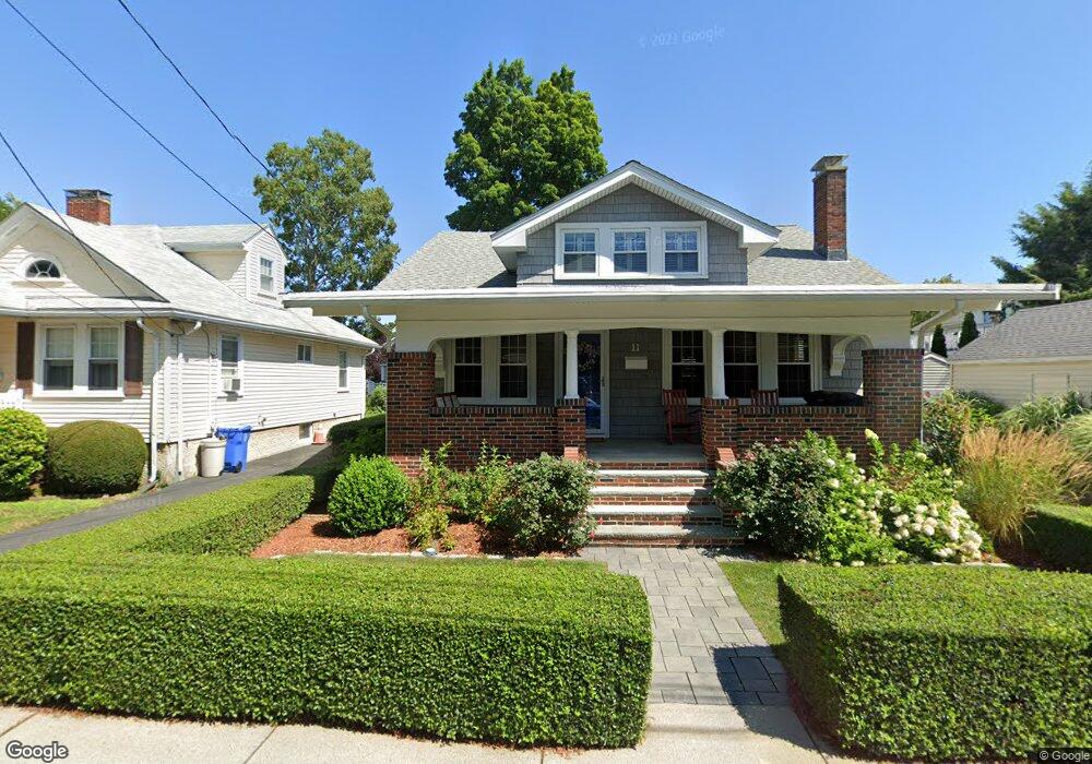
11 Arlington Rd Waltham, MA 02453
South Side NeighborhoodEstimated Value: $900,000 - $1,075,000
4
Beds
3
Baths
1,710
Sq Ft
$580/Sq Ft
Est. Value
About This Home
This home is located at 11 Arlington Rd, Waltham, MA 02453 and is currently estimated at $992,366, approximately $580 per square foot. 11 Arlington Rd is a home located in Middlesex County with nearby schools including Henry Whittemore Elementary School, John W. Mcdevitt Middle School, and Waltham Sr High School.
Ownership History
Date
Name
Owned For
Owner Type
Purchase Details
Closed on
Feb 23, 2005
Sold by
Maiocca Mark
Bought by
Cutright Susan
Current Estimated Value
Home Financials for this Owner
Home Financials are based on the most recent Mortgage that was taken out on this home.
Original Mortgage
$352,000
Interest Rate
5.73%
Mortgage Type
Purchase Money Mortgage
Purchase Details
Closed on
Jul 30, 2004
Sold by
Chase Manhattan Mtg Co
Bought by
Maiocca Mark J
Home Financials for this Owner
Home Financials are based on the most recent Mortgage that was taken out on this home.
Original Mortgage
$302,000
Interest Rate
6.33%
Mortgage Type
Purchase Money Mortgage
Purchase Details
Closed on
Apr 13, 2004
Sold by
Citibank N A
Bought by
Citibank N A
Purchase Details
Closed on
Aug 1, 1997
Sold by
Norman Emily and Norman Michael A
Bought by
Bemis Phillip R
Create a Home Valuation Report for This Property
The Home Valuation Report is an in-depth analysis detailing your home's value as well as a comparison with similar homes in the area
Home Values in the Area
Average Home Value in this Area
Purchase History
| Date | Buyer | Sale Price | Title Company |
|---|---|---|---|
| Cutright Susan | $440,000 | -- | |
| Maiocca Mark J | $377,500 | -- | |
| Citibank N A | $372,649 | -- | |
| Bemis Phillip R | $192,500 | -- |
Source: Public Records
Mortgage History
| Date | Status | Borrower | Loan Amount |
|---|---|---|---|
| Open | Bemis Phillip R | $300,000 | |
| Closed | Bemis Phillip R | $371,450 | |
| Closed | Cutright Susan | $352,000 | |
| Previous Owner | Maiocca Mark J | $302,000 | |
| Previous Owner | Bemis Phillip R | $323,000 |
Source: Public Records
Tax History
| Year | Tax Paid | Tax Assessment Tax Assessment Total Assessment is a certain percentage of the fair market value that is determined by local assessors to be the total taxable value of land and additions on the property. | Land | Improvement |
|---|---|---|---|---|
| 2025 | $7,168 | $729,900 | $353,500 | $376,400 |
| 2024 | $6,994 | $725,500 | $353,500 | $372,000 |
| 2023 | $6,989 | $677,200 | $322,000 | $355,200 |
| 2022 | $7,072 | $634,800 | $294,000 | $340,800 |
| 2021 | $6,682 | $590,300 | $266,000 | $324,300 |
| 2020 | $6,573 | $550,000 | $252,000 | $298,000 |
| 2019 | $6,412 | $506,500 | $249,500 | $257,000 |
| 2018 | $4,033 | $447,000 | $231,000 | $216,000 |
| 2017 | $5,351 | $426,000 | $210,000 | $216,000 |
| 2016 | $4,914 | $401,500 | $185,500 | $216,000 |
| 2015 | $5,172 | $393,900 | $182,000 | $211,900 |
Source: Public Records
Map
Nearby Homes
- 279-281 Ash St
- 138 Myrtle St Unit 2
- 26 Friend St
- 308 Newton St Unit 1
- 312 Newton St Unit 1A
- 215 Ash St Unit 3
- 24 Tolman St Unit 1
- 163-165 Chestnut St
- 47 Alder St Unit 3
- 28-32 Calvary St
- 176 River St
- 133 Ash St Unit 3
- 31-37 Washington Ave
- 15 Alder St Unit 1
- 40 Dexter St
- 61 Hall St Unit 1
- 61 Hall St Unit 9
- 61 Hall St Unit 2
- 105 Adams Ave
- 266-274 River St
- 15 Arlington Rd
- 7 Joyce Rd
- 79 Joyce Rd
- 19 Arlington Rd Unit 19
- 8 Hamblin Rd Unit 10
- 5 Arbor Rd
- 3 Joyce Rd
- 14 Hamblin Rd
- 1 Joyce Rd
- 21 Arlington Rd
- 10 Arbor Rd
- 16 Arbor Rd
- 16 Hamblin Rd Unit 18
- 16 Hamblin Rd Unit 2
- 18 Arlington Rd
- 4 Arbor Rd
- 22 Hamblin Rd
- 25 Arlington Rd Unit 27
- 25-27 Arlington Rd
- 27 Arlington Rd
Your Personal Tour Guide
Ask me questions while you tour the home.