Estimated Value: $678,770 - $745,000
3
Beds
3
Baths
2,060
Sq Ft
$348/Sq Ft
Est. Value
About This Home
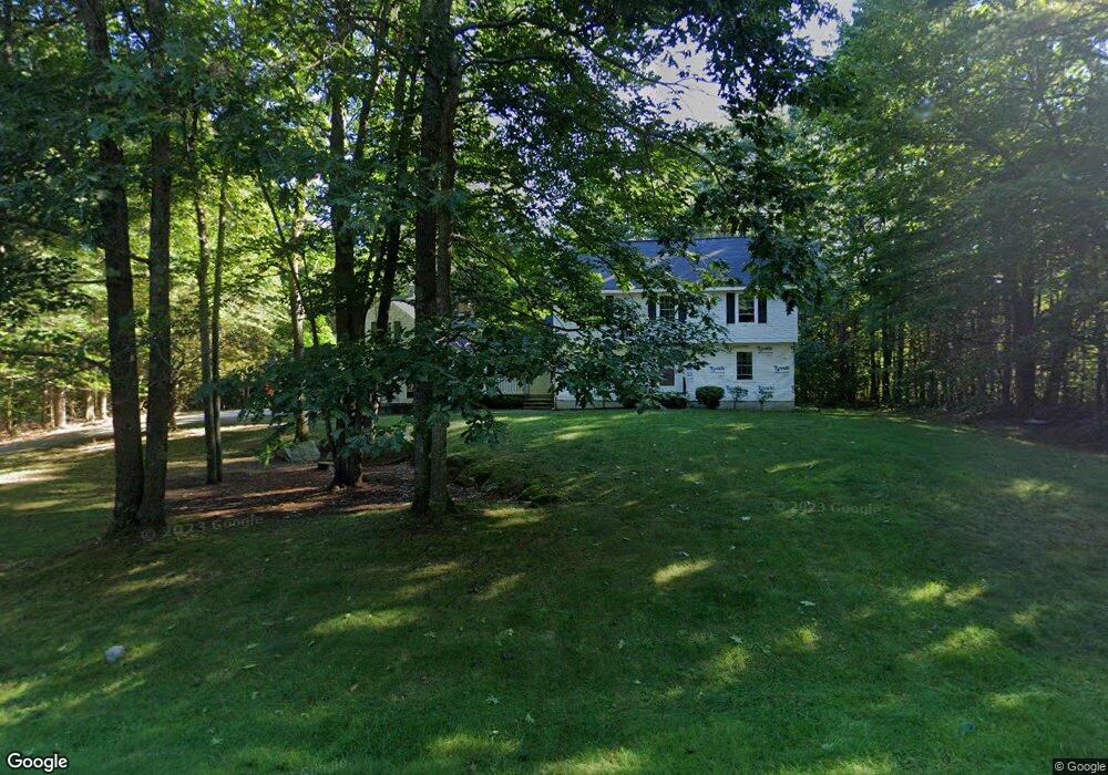
This home is located at 11 Arrowhead Dr, Bow, NH 03304 and is currently estimated at $716,693, approximately $347 per square foot. 11 Arrowhead Dr is a home with nearby schools including Bow Elementary School, Bow Memorial School, and Bow High School.
Ownership History
Date
Name
Owned For
Owner Type
Purchase Details
Closed on
Aug 27, 1997
Sold by
Colby Clifford L and Colby Beverly J
Bought by
Low Benjamin F and Low Susan H
Current Estimated Value
Home Financials for this Owner
Home Financials are based on the most recent Mortgage that was taken out on this home.
Original Mortgage
$140,000
Interest Rate
7.41%
Create a Home Valuation Report for This Property
The Home Valuation Report is an in-depth analysis detailing your home's value as well as a comparison with similar homes in the area
Home Values in the Area
Average Home Value in this Area
Purchase History
| Date | Buyer | Sale Price | Title Company |
|---|---|---|---|
| Low Benjamin F | $204,500 | -- |
Source: Public Records
Mortgage History
| Date | Status | Borrower | Loan Amount |
|---|---|---|---|
| Open | Low Benjamin F | $100,000 | |
| Closed | Low Benjamin F | $140,000 |
Source: Public Records
Tax History
| Year | Tax Paid | Tax Assessment Tax Assessment Total Assessment is a certain percentage of the fair market value that is determined by local assessors to be the total taxable value of land and additions on the property. | Land | Improvement |
|---|---|---|---|---|
| 2024 | $11,468 | $579,800 | $173,600 | $406,200 |
| 2023 | $10,245 | $368,400 | $117,400 | $251,000 |
| 2022 | $9,770 | $368,400 | $117,400 | $251,000 |
| 2021 | $9,391 | $368,400 | $117,400 | $251,000 |
| 2020 | $9,424 | $368,400 | $117,400 | $251,000 |
| 2019 | $9,656 | $368,400 | $117,400 | $251,000 |
| 2018 | $8,945 | $322,000 | $108,700 | $213,300 |
| 2017 | $8,942 | $322,000 | $108,700 | $213,300 |
| 2016 | $8,465 | $322,000 | $108,700 | $213,300 |
| 2015 | $8,442 | $295,800 | $108,700 | $187,100 |
| 2014 | $8,729 | $295,800 | $108,700 | $187,100 |
| 2011 | $7,743 | $285,200 | $108,700 | $176,500 |
Source: Public Records
Map
Nearby Homes
- 104 White Rock Hill Rd
- 22 Bow Bog Rd
- 29 Westover Ln
- 99 Bow Bog Rd
- 77 White Rock Hill Rd
- 36 Westover Ln Unit k
- 3 Abbey Rd
- 13 van Ger Dr
- 0 Brown Hill Rd Unit 5032600
- 107 Page Rd
- 42 Westover Ln
- 6 Abbey Rd
- 43 Sterling Place
- 100 Allen Rd
- 4 Bow Center Rd Unit F2
- 4 Bow Center Rd Unit B2
- 13 Birchdale Rd
- 7 Morgan Dr
- 8 Longview Dr
- 192 Grapevine Rd
- 10 Arrowhead Dr
- 9 Arrowhead Dr
- 12 Arrowhead Dr
- 26/5/40A Dow Rd Route 3a
- 8 Arrowhead Dr
- 7 Arrowhead Dr
- 6 Arrowhead Dr
- 5 Arrowhead Dr
- Lot 40-4 Quimby Rd
- lOT 40-2 S Bow Dunbarton Rd
- LOT 40-1 S Bow Dunbarton Rd
- AX Astor Ln
- 30 Branch Londonderry Turnpike E
- 32 Branch Londonderry Turnpike E
- 28 Branch Londonderry Turnpike E
- 26 Branch Londonderry Turnpike E
- 34 Branch Londonderry Turnpike E
- 24 Branch Londonderry Turnpike E
- 4 Arrowhead Dr
- 3 Arrowhead Dr
Your Personal Tour Guide
Ask me questions while you tour the home.