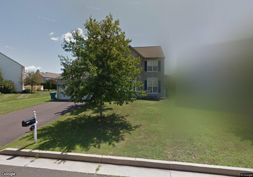
11 Atkinson Ln Newtown, PA 18940
Estimated Value: $995,731 - $1,042,000
4
Beds
3
Baths
2,692
Sq Ft
$378/Sq Ft
Est. Value
About This Home
This home is located at 11 Atkinson Ln, Newtown, PA 18940 and is currently estimated at $1,018,183, approximately $378 per square foot. 11 Atkinson Ln is a home located in Bucks County with nearby schools including Sol Feinstone Elementary School, Newtown Middle School, and Council Rock High School North.
Ownership History
Date
Name
Owned For
Owner Type
Purchase Details
Closed on
Oct 26, 2009
Sold by
Gratz Caryn and Gratz Ruth
Bought by
Gratz Caryn
Current Estimated Value
Home Financials for this Owner
Home Financials are based on the most recent Mortgage that was taken out on this home.
Original Mortgage
$402,500
Outstanding Balance
$263,622
Interest Rate
5.06%
Mortgage Type
New Conventional
Estimated Equity
$754,561
Purchase Details
Closed on
Dec 28, 2006
Sold by
Devlin Sean R and Devlin Pauline L
Bought by
Gratz Caryn and Gratz Ruth
Home Financials for this Owner
Home Financials are based on the most recent Mortgage that was taken out on this home.
Original Mortgage
$400,000
Interest Rate
6.24%
Mortgage Type
Purchase Money Mortgage
Create a Home Valuation Report for This Property
The Home Valuation Report is an in-depth analysis detailing your home's value as well as a comparison with similar homes in the area
Home Values in the Area
Average Home Value in this Area
Purchase History
| Date | Buyer | Sale Price | Title Company |
|---|---|---|---|
| Gratz Caryn | -- | None Available | |
| Gratz Caryn | $610,000 | None Available |
Source: Public Records
Mortgage History
| Date | Status | Borrower | Loan Amount |
|---|---|---|---|
| Open | Gratz Caryn | $402,500 | |
| Previous Owner | Gratz Caryn | $400,000 |
Source: Public Records
Tax History Compared to Growth
Tax History
| Year | Tax Paid | Tax Assessment Tax Assessment Total Assessment is a certain percentage of the fair market value that is determined by local assessors to be the total taxable value of land and additions on the property. | Land | Improvement |
|---|---|---|---|---|
| 2025 | $10,080 | $56,720 | $7,360 | $49,360 |
| 2024 | $10,080 | $56,720 | $7,360 | $49,360 |
| 2023 | $9,644 | $56,720 | $7,360 | $49,360 |
| 2022 | $9,458 | $56,720 | $7,360 | $49,360 |
| 2021 | $9,311 | $56,720 | $7,360 | $49,360 |
| 2020 | $8,863 | $56,720 | $7,360 | $49,360 |
| 2019 | $8,653 | $56,720 | $7,360 | $49,360 |
| 2018 | $8,489 | $56,720 | $7,360 | $49,360 |
| 2017 | $8,194 | $56,720 | $7,360 | $49,360 |
| 2016 | $8,138 | $56,720 | $7,360 | $49,360 |
| 2015 | -- | $56,720 | $7,360 | $49,360 |
| 2014 | -- | $56,720 | $7,360 | $49,360 |
Source: Public Records
Map
Nearby Homes
- 2704 Society Place Unit 27B2
- 324 Monterey Place
- Lot 4 Ava Ct
- 3104 Society Place Unit B2
- 220 Stoopville Rd
- 288 Jane Chapman Dr E Unit E
- 216 Jane Chapman Dr E Unit E
- 603 Society Place
- 95 Rittenhouse Cir Unit 92
- 19 Goldney Dr
- 0 Augusta Dr Unit KINGSWOOD
- 0 Augusta Dr Unit MAYWEATHER
- 0 Augusta Dr Unit RAINTREE
- 0 Augusta Dr Unit CLOVERFIELD
- 0 Augusta Dr Unit ROLLINS
- 0 Augusta Dr Unit LANEY
- Raintree Plan at Lyondale Meadows
- Kingswood Plan at Lyondale Meadows
- Cloverfield Plan at Lyondale Meadows
- Laney Plan at Lyondale Meadows