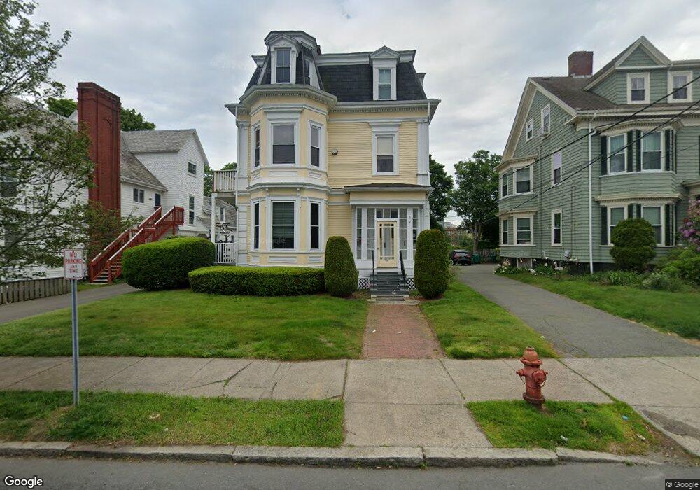
11 Atlantic St Unit 2 Lynn, MA 01902
Diamond District NeighborhoodEstimated Value: $325,000 - $451,000
2
Beds
1
Bath
812
Sq Ft
$450/Sq Ft
Est. Value
About This Home
This home is located at 11 Atlantic St Unit 2, Lynn, MA 01902 and is currently estimated at $365,559, approximately $450 per square foot. 11 Atlantic St Unit 2 is a home located in Essex County with nearby schools including E.J. Harrington School, William R. Fallon School, and Marshall Middle School.
Ownership History
Date
Name
Owned For
Owner Type
Purchase Details
Closed on
Aug 28, 2002
Sold by
Serenity Real Est T and Roscoe David
Bought by
Satterwhite Shannon
Current Estimated Value
Home Financials for this Owner
Home Financials are based on the most recent Mortgage that was taken out on this home.
Original Mortgage
$198,500
Outstanding Balance
$84,794
Interest Rate
6.55%
Mortgage Type
Purchase Money Mortgage
Estimated Equity
$280,766
Create a Home Valuation Report for This Property
The Home Valuation Report is an in-depth analysis detailing your home's value as well as a comparison with similar homes in the area
Home Values in the Area
Average Home Value in this Area
Purchase History
| Date | Buyer | Sale Price | Title Company |
|---|---|---|---|
| Satterwhite Shannon | $209,000 | -- |
Source: Public Records
Mortgage History
| Date | Status | Borrower | Loan Amount |
|---|---|---|---|
| Open | Satterwhite Shannon | $198,500 |
Source: Public Records
Tax History Compared to Growth
Tax History
| Year | Tax Paid | Tax Assessment Tax Assessment Total Assessment is a certain percentage of the fair market value that is determined by local assessors to be the total taxable value of land and additions on the property. | Land | Improvement |
|---|---|---|---|---|
| 2025 | $2,945 | $284,300 | $0 | $284,300 |
| 2024 | $3,147 | $298,900 | $0 | $298,900 |
| 2023 | $3,115 | $279,400 | $0 | $279,400 |
| 2022 | $3,117 | $250,800 | $0 | $250,800 |
| 2021 | $3,096 | $237,600 | $0 | $237,600 |
| 2020 | $3,851 | $287,400 | $0 | $287,400 |
| 2019 | $2,774 | $194,000 | $0 | $194,000 |
| 2018 | $2,913 | $192,300 | $0 | $192,300 |
| 2017 | $2,716 | $174,100 | $0 | $174,100 |
| 2016 | $2,891 | $178,700 | $0 | $178,700 |
| 2015 | $2,647 | $158,000 | $0 | $158,000 |
Source: Public Records
Map
Nearby Homes
- 13 Portland St Unit 4
- 62 Estes St Unit 2
- 7 Cherry St
- 38 Chestnut St
- 38 Cherry St Unit 1
- 23 Atlantic Terrace Unit 2
- 21 Atlantic Terrace Unit 1
- 13 Nahant St Unit 4C
- 13 Nahant St Unit 4A
- 13 Nahant St Unit 3A
- 13 Nahant St Unit 2B
- 13 Nahant St Unit 2C
- 13 Nahant St Unit 4D
- 285 Lynn Shore Dr Unit 203
- 285 Lynn Shore Dr Unit 304
- 285 Lynn Shore Dr Unit 205
- 285 Lynn Shore Dr Unit 508
- 285 Lynn Shore Dr Unit 207
- 285 Lynn Shore Dr Unit 208
- 295 Lynn Shore Dr Unit 401
- 11 Atlantic St Unit 5
- 11 Atlantic St Unit 4
- 11 Atlantic St Unit 3
- 11 Atlantic St Unit 1
- 17 Atlantic St
- 7 Atlantic St Unit 4
- 7 Atlantic St Unit 3
- 7 Atlantic St Unit 2
- 7 Atlantic St Unit 1
- 07 Atlantic St Unit 3
- 07 Atlantic St Unit 1 RIGHT
- 7 Broad St Unit 11
- 7 Broad St
- 7 Baltimore St
- 23 Atlantic St
- 23 Atlantic St Unit 3
- 23 Atlantic St Unit 1
- 11 Baltimore St
- 1 Atlantic St Unit 6
- 1 Atlantic St Unit 5