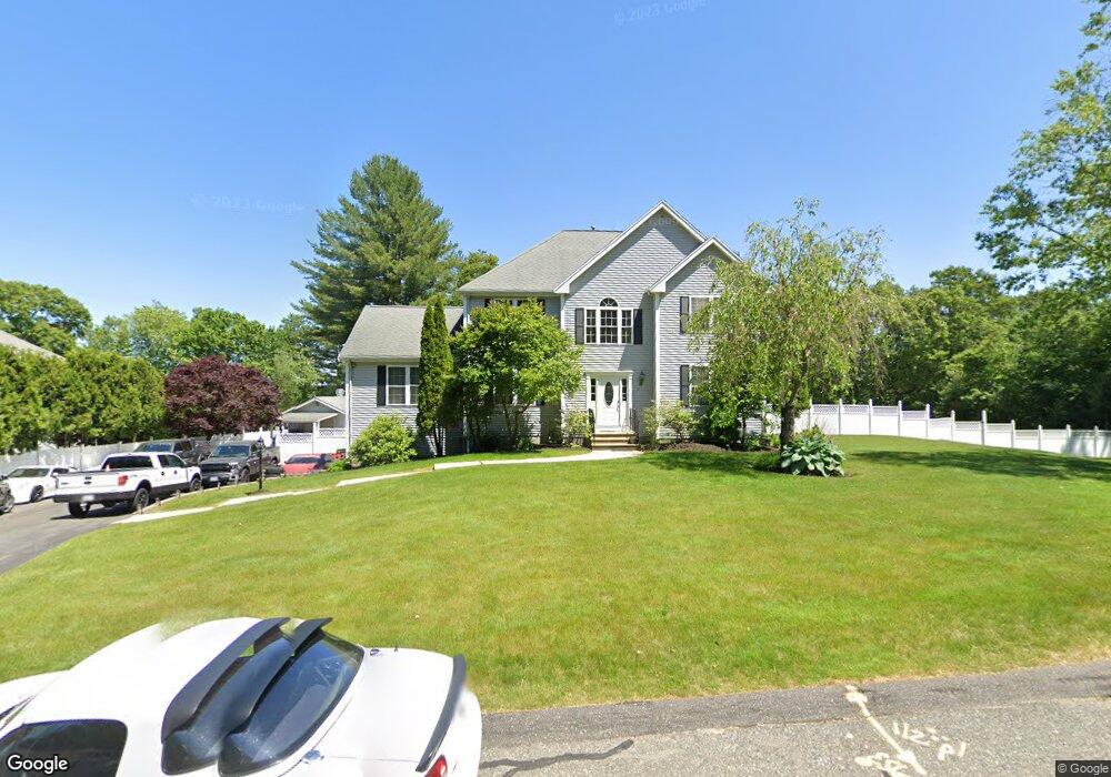
11 Bazaleel Cir Uxbridge, MA 01569
Estimated Value: $755,000 - $833,000
3
Beds
3
Baths
2,756
Sq Ft
$283/Sq Ft
Est. Value
About This Home
This home is located at 11 Bazaleel Cir, Uxbridge, MA 01569 and is currently estimated at $780,620, approximately $283 per square foot. 11 Bazaleel Cir is a home located in Worcester County with nearby schools including Uxbridge High School and Our Lady of the Valley Regional School.
Ownership History
Date
Name
Owned For
Owner Type
Purchase Details
Closed on
Sep 30, 2005
Sold by
Langevin Debora L and Langevin Paul E
Bought by
Koutroumanos Christos and Koutroumanos Irene
Current Estimated Value
Home Financials for this Owner
Home Financials are based on the most recent Mortgage that was taken out on this home.
Original Mortgage
$273,900
Interest Rate
5.84%
Mortgage Type
Purchase Money Mortgage
Purchase Details
Closed on
May 18, 2001
Sold by
New American Homes Llc
Bought by
Langevin Paul E and Langevin Debora L
Create a Home Valuation Report for This Property
The Home Valuation Report is an in-depth analysis detailing your home's value as well as a comparison with similar homes in the area
Home Values in the Area
Average Home Value in this Area
Purchase History
| Date | Buyer | Sale Price | Title Company |
|---|---|---|---|
| Koutroumanos Christos | $499,900 | -- | |
| Langevin Paul E | $343,940 | -- |
Source: Public Records
Mortgage History
| Date | Status | Borrower | Loan Amount |
|---|---|---|---|
| Open | Langevin Paul E | $256,000 | |
| Closed | Langevin Paul E | $50,000 | |
| Closed | Koutroumanos Christos | $273,900 | |
| Previous Owner | Langevin Paul E | $296,000 |
Source: Public Records
Tax History Compared to Growth
Tax History
| Year | Tax Paid | Tax Assessment Tax Assessment Total Assessment is a certain percentage of the fair market value that is determined by local assessors to be the total taxable value of land and additions on the property. | Land | Improvement |
|---|---|---|---|---|
| 2025 | $80 | $612,800 | $153,500 | $459,300 |
| 2024 | $7,552 | $584,500 | $145,700 | $438,800 |
| 2023 | $7,191 | $515,500 | $125,900 | $389,600 |
| 2022 | $6,470 | $426,800 | $110,200 | $316,600 |
| 2021 | $6,752 | $426,800 | $110,200 | $316,600 |
| 2020 | $7,093 | $423,700 | $118,000 | $305,700 |
| 2019 | $7,225 | $416,400 | $129,800 | $286,600 |
| 2018 | $6,993 | $407,300 | $129,800 | $277,500 |
| 2017 | $6,635 | $391,200 | $124,600 | $266,600 |
| 2016 | $6,468 | $368,100 | $95,400 | $272,700 |
| 2015 | $6,311 | $362,700 | $95,400 | $267,300 |
Source: Public Records
Map
Nearby Homes
- The Contemporary Villager Plan at Patriot's Landing
- Karenrose Sunnery Plan at Patriot's Landing
- 24 Road Ahr
- 328 Millville Rd
- 129 Quaker Hwy Unit 6
- 346 Millville Rd
- 288 High St
- 128 Mantell Rd
- 33 Seagrave St
- 100 Spring Hill Dr Unit 100
- Layla Plan at Pine Ridge
- Ashley Plan at Pine Ridge
- Lily Plan at Pine Ridge
- Brooklyn Plan at Pine Ridge
- Tucker Plan at Pine Ridge
- Everleigh Plan at Pine Ridge
- 395 High St
- 37 Elizabeth St
- 24 Olde Canal Way Unit 24
- 48 Homeward Ave
- 21 Bazaleel Cir
- 6 Bazaleel Cir
- 12 Bazaleel Cir
- 12 Bazaleel Cir Unit 12
- 117 Country Squire Rd
- 115 Country Squire Rd
- 111 Country Squire Rd
- 109 Country Squire Rd
- 81 Elmshade Dr
- 111 Elmshade Dr
- 96 Country Squire Rd
- 94 Country Squire Rd
- 99 Country Squire Rd
- 97 Country Squire Rd
- 71 Elmshade Dr
- 110 Elmshade Dr
- 100 Elmshade Dr
- 90 Country Squire Rd
- 88 Country Squire Rd
- 93 Country Squire Rd