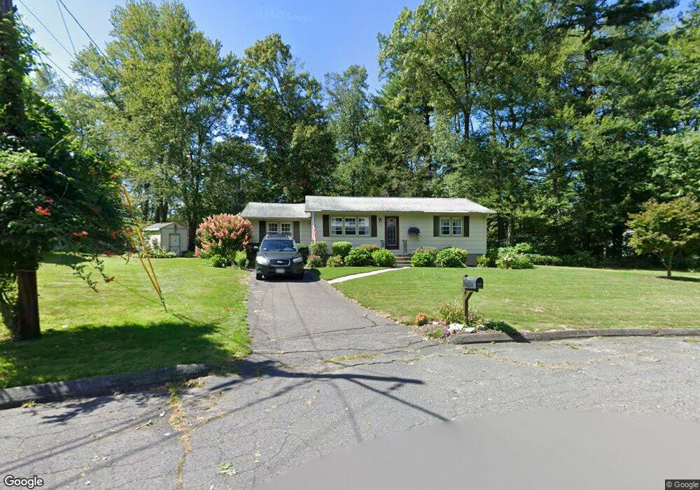
11 Beattie Dr Florence, MA 01062
Florence NeighborhoodEstimated Value: $354,000 - $381,000
2
Beds
1
Bath
1,128
Sq Ft
$326/Sq Ft
Est. Value
About This Home
This home is located at 11 Beattie Dr, Florence, MA 01062 and is currently estimated at $367,390, approximately $325 per square foot. 11 Beattie Dr is a home located in Hampshire County with nearby schools including Northampton High School, Hilltown Cooperative Charter Public School, and The Montessori School of Northampton.
Ownership History
Date
Name
Owned For
Owner Type
Purchase Details
Closed on
Oct 1, 1984
Bought by
Wichowski Thomas S and Wichowski Donna M
Current Estimated Value
Create a Home Valuation Report for This Property
The Home Valuation Report is an in-depth analysis detailing your home's value as well as a comparison with similar homes in the area
Home Values in the Area
Average Home Value in this Area
Purchase History
| Date | Buyer | Sale Price | Title Company |
|---|---|---|---|
| Wichowski Thomas S | $57,000 | -- |
Source: Public Records
Mortgage History
| Date | Status | Borrower | Loan Amount |
|---|---|---|---|
| Closed | Wichowski Thomas S | $140,000 | |
| Closed | Wichowski Thomas S | $120,000 | |
| Closed | Wichowski Thomas S | $30,000 |
Source: Public Records
Tax History Compared to Growth
Tax History
| Year | Tax Paid | Tax Assessment Tax Assessment Total Assessment is a certain percentage of the fair market value that is determined by local assessors to be the total taxable value of land and additions on the property. | Land | Improvement |
|---|---|---|---|---|
| 2025 | $4,465 | $320,500 | $122,800 | $197,700 |
| 2024 | $4,416 | $290,700 | $122,800 | $167,900 |
| 2023 | $3,760 | $237,400 | $111,600 | $125,800 |
| 2022 | $3,968 | $221,800 | $111,600 | $110,200 |
| 2021 | $3,519 | $202,600 | $106,600 | $96,000 |
| 2020 | $3,404 | $202,600 | $106,600 | $96,000 |
| 2019 | $3,163 | $182,100 | $91,600 | $90,500 |
| 2018 | $3,060 | $179,600 | $91,600 | $88,000 |
| 2017 | $2,998 | $179,600 | $91,600 | $88,000 |
| 2016 | $2,902 | $179,600 | $91,600 | $88,000 |
| 2015 | $2,910 | $184,200 | $91,600 | $92,600 |
| 2014 | $2,835 | $184,200 | $91,600 | $92,600 |
Source: Public Records
Map
Nearby Homes
- 138 Overlook Dr
- 447 Ryan Rd
- 8 Tara Cir
- 39 Matthew Dr
- 269 Ryan Rd
- 815 Burts Pit Rd
- 634 Burts Pit Rd
- 100 Emerson Way
- 137 Emerson Way
- 167 Emerson Way
- 133 Cardinal Way
- 7 Pine Valley Rd
- 383 Westhampton Rd
- 225 Nonotuck St Unit C
- 37 Landy Ave
- 36 Landy Ave
- 325 Riverside Dr
- 321 Riverside Dr
- 48 Dunphy Dr
- 80 Pine St