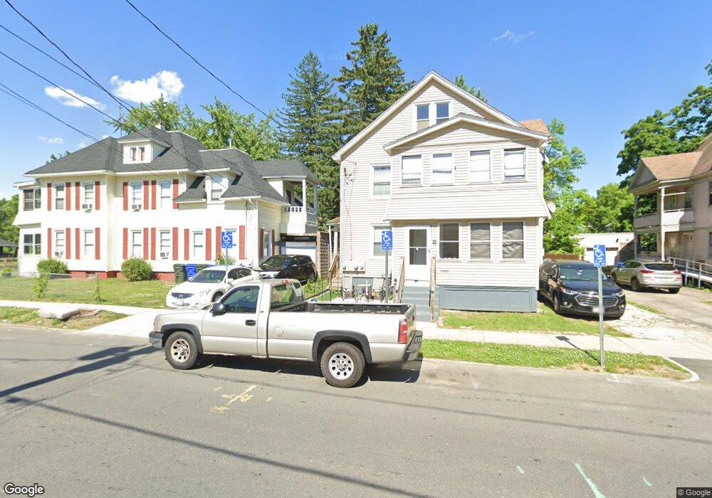
11 Bristol St Springfield, MA 01109
Upper Hill NeighborhoodEstimated Value: $332,839 - $415,000
4
Beds
2
Baths
2,238
Sq Ft
$169/Sq Ft
Est. Value
About This Home
This home is located at 11 Bristol St, Springfield, MA 01109 and is currently estimated at $378,210, approximately $168 per square foot. 11 Bristol St is a home located in Hampden County with nearby schools including John J Duggan Middle, Springfield High School of Science and Technology, and Roger L. Putnam Vocational Technical Academy.
Ownership History
Date
Name
Owned For
Owner Type
Purchase Details
Closed on
Apr 29, 2022
Sold by
Yellowbrick Property Llc
Bought by
Parrilla Natalia and Parrilla Jahaira
Current Estimated Value
Home Financials for this Owner
Home Financials are based on the most recent Mortgage that was taken out on this home.
Original Mortgage
$308,312
Outstanding Balance
$291,319
Interest Rate
4.99%
Mortgage Type
FHA
Estimated Equity
$86,891
Purchase Details
Closed on
Jul 31, 2013
Sold by
Yellowbrick Props Llc and Springfld City Code En
Bought by
Yellowbrick Props Llc
Purchase Details
Closed on
Sep 22, 1997
Sold by
Thompson Merle
Bought by
Kokaram Edmund
Home Financials for this Owner
Home Financials are based on the most recent Mortgage that was taken out on this home.
Original Mortgage
$17,000
Interest Rate
7.38%
Mortgage Type
Purchase Money Mortgage
Purchase Details
Closed on
Jul 25, 1996
Sold by
White Rosetta and Garrison Diana
Bought by
Bank Of America Fsb
Create a Home Valuation Report for This Property
The Home Valuation Report is an in-depth analysis detailing your home's value as well as a comparison with similar homes in the area
Home Values in the Area
Average Home Value in this Area
Purchase History
| Date | Buyer | Sale Price | Title Company |
|---|---|---|---|
| Parrilla Natalia | $314,000 | None Available | |
| Yellowbrick Props Llc | $90,000 | -- | |
| Yellowbrick Props Llc | $90,000 | -- | |
| Kokaram Edmund | $17,000 | -- | |
| Thompson Merle | $12,000 | -- | |
| Kokaram Edmund | $17,000 | -- | |
| Bank Of America Fsb | $51,114 | -- | |
| Bank Of America Fsb | $51,114 | -- |
Source: Public Records
Mortgage History
| Date | Status | Borrower | Loan Amount |
|---|---|---|---|
| Open | Parrilla Natalia | $308,312 | |
| Previous Owner | Bank Of America Fsb | $42,250 | |
| Previous Owner | Bank Of America Fsb | $17,000 |
Source: Public Records
Tax History Compared to Growth
Tax History
| Year | Tax Paid | Tax Assessment Tax Assessment Total Assessment is a certain percentage of the fair market value that is determined by local assessors to be the total taxable value of land and additions on the property. | Land | Improvement |
|---|---|---|---|---|
| 2025 | $4,991 | $318,300 | $30,200 | $288,100 |
| 2024 | $4,694 | $292,300 | $30,200 | $262,100 |
| 2023 | $4,196 | $246,100 | $27,500 | $218,600 |
| 2022 | $3,090 | $164,200 | $25,700 | $138,500 |
| 2021 | $2,890 | $152,900 | $18,200 | $134,700 |
| 2020 | $2,771 | $141,900 | $18,200 | $123,700 |
| 2019 | $2,558 | $130,000 | $15,500 | $114,500 |
| 2018 | $2,226 | $121,900 | $15,500 | $106,400 |
| 2017 | $2,226 | $113,200 | $14,600 | $98,600 |
| 2016 | $1,797 | $91,400 | $14,600 | $76,800 |
| 2015 | $1,833 | $93,200 | $14,600 | $78,600 |
Source: Public Records
Map
Nearby Homes
- 62-64 Bristol St
- 43 Colonial Ave
- 67 Carlisle St
- 111 Marlborough St
- 135-137 Suffolk St
- 158 Norfolk St
- 124-126 Westford Cir
- 58 Willard Ave
- 88 Dunmoreland St
- 50-52 Maynard St
- 867 Roosevelt Ave
- 19 Westford Ave
- 179 Albemarle St
- 21 Westford Cir
- 15 Kenyon St
- 75 Carnavon Cir
- 65 Montrose St
- 140 Northampton Ave
- 0 NS (24) Alden St
- 162 Northampton Ave
- 13 Bristol St
- 17 Bristol St Unit 19
- 353 Wilbraham Rd
- 359 Wilbraham Rd
- 357 Wilbraham Rd
- 23 Bristol St
- 362 Wilbraham Rd
- 18 Norfolk St
- 14 Bristol St Unit 16
- 18 Bristol St
- 24 Norfolk St Unit 26
- 24 Bristol St
- 346 - 348 Wilbraham Rd
- 33 Bristol St
- 30 Norfolk St
- 28 Bristol St
- 34 Norfolk St Unit 36
- 34 Bristol St
- 358 Wilbraham Rd
- 37 Bristol St