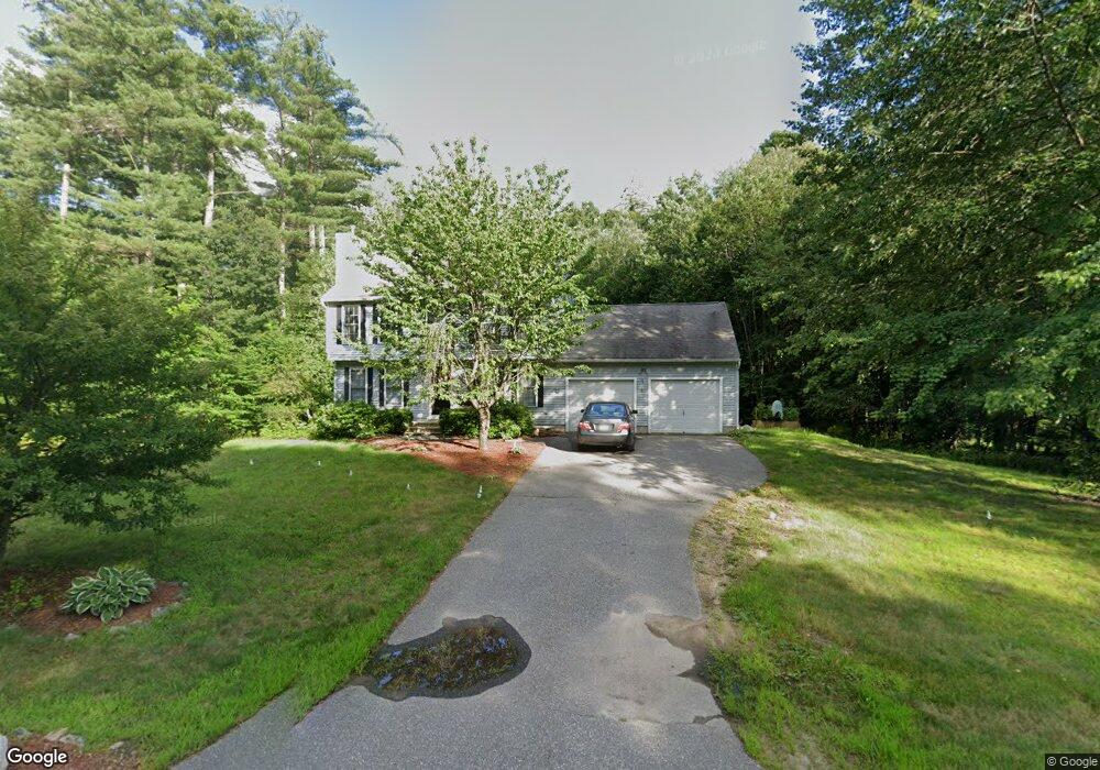
11 Buckthorn St Londonderry, NH 03053
Estimated Value: $606,483 - $729,000
3
Beds
2
Baths
1,600
Sq Ft
$404/Sq Ft
Est. Value
About This Home
This home is located at 11 Buckthorn St, Londonderry, NH 03053 and is currently estimated at $647,121, approximately $404 per square foot. 11 Buckthorn St is a home with nearby schools including North Londonderry Elementary School, Londonderry Middle School, and Londonderry Senior High School.
Ownership History
Date
Name
Owned For
Owner Type
Purchase Details
Closed on
Jul 23, 2001
Sold by
Robert Mark and Robert Cindy
Bought by
Walsh Kathleen and Walsh Michael J
Current Estimated Value
Home Financials for this Owner
Home Financials are based on the most recent Mortgage that was taken out on this home.
Original Mortgage
$199,500
Interest Rate
7.2%
Purchase Details
Closed on
Sep 15, 1999
Sold by
Empire Homes Inc
Bought by
Robert Mark E and Robert Cynthia E
Home Financials for this Owner
Home Financials are based on the most recent Mortgage that was taken out on this home.
Original Mortgage
$147,350
Interest Rate
7.83%
Create a Home Valuation Report for This Property
The Home Valuation Report is an in-depth analysis detailing your home's value as well as a comparison with similar homes in the area
Home Values in the Area
Average Home Value in this Area
Purchase History
| Date | Buyer | Sale Price | Title Company |
|---|---|---|---|
| Walsh Kathleen | $210,000 | -- | |
| Robert Mark E | $163,800 | -- |
Source: Public Records
Mortgage History
| Date | Status | Borrower | Loan Amount |
|---|---|---|---|
| Open | Walsh Kathleen | $242,000 | |
| Closed | Walsh Michael J | $265,000 | |
| Closed | Robert Mark E | $290,000 | |
| Closed | Robert Mark E | $199,500 | |
| Previous Owner | Robert Mark E | $147,350 |
Source: Public Records
Tax History Compared to Growth
Tax History
| Year | Tax Paid | Tax Assessment Tax Assessment Total Assessment is a certain percentage of the fair market value that is determined by local assessors to be the total taxable value of land and additions on the property. | Land | Improvement |
|---|---|---|---|---|
| 2024 | $8,114 | $502,700 | $203,100 | $299,600 |
| 2023 | $7,867 | $502,700 | $203,100 | $299,600 |
| 2022 | $7,268 | $393,300 | $152,400 | $240,900 |
| 2021 | $7,196 | $391,500 | $152,400 | $239,100 |
| 2020 | $7,117 | $353,900 | $122,700 | $231,200 |
| 2019 | $6,862 | $353,900 | $122,700 | $231,200 |
| 2018 | $6,197 | $286,000 | $101,800 | $184,200 |
| 2017 | $6,180 | $286,000 | $101,800 | $184,200 |
| 2016 | $6,149 | $286,000 | $101,800 | $184,200 |
| 2015 | $6,012 | $286,000 | $101,800 | $184,200 |
| 2014 | $6,032 | $286,000 | $101,800 | $184,200 |
| 2011 | -- | $288,300 | $101,800 | $186,500 |
Source: Public Records
Map
Nearby Homes
- 8 Barksdale Ave
- 28 Barksdale Ave
- 5 Webster Rd
- 27 Buckingham Dr
- 15 Harvey Rd
- 10100 S Willow St Unit 214
- 10100 S Willow St Unit 101
- 10100 S Willow St Unit 109
- 10100 S Willow St Unit 207
- 10100 S Willow St Unit 110
- 10100 S Willow St Unit 204
- 1035 S Mammoth Rd Unit 6
- 4 Crestview Cir Unit 119
- 17 Welch Rd
- lot 719-1 & 2 Sheffield Rd
- 32 Noyes Rd
- 90 Forest Hill Way Unit 52
- 12 Forest Hill Way Unit 57
- 133 Corning Rd
- 30 Bryant Rd