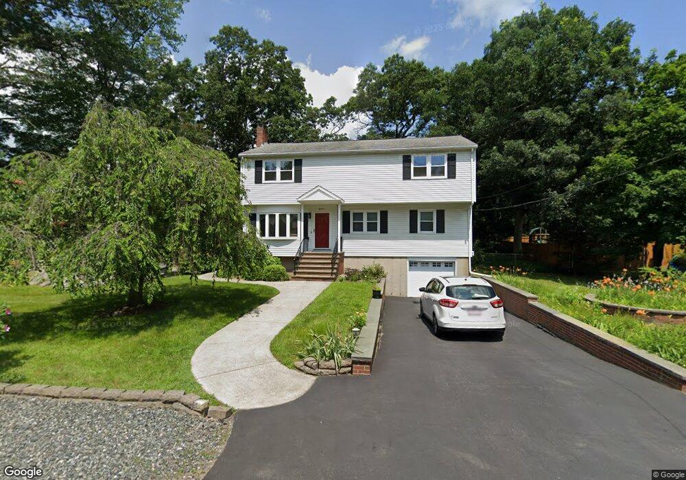
11 Burt Rd Wilmington, MA 01887
Estimated Value: $719,000 - $879,000
4
Beds
2
Baths
2,264
Sq Ft
$350/Sq Ft
Est. Value
About This Home
This home is located at 11 Burt Rd, Wilmington, MA 01887 and is currently estimated at $793,375, approximately $350 per square foot. 11 Burt Rd is a home located in Middlesex County with nearby schools including Wilmington Middle School, Wilmington High School, and Abundant Life Christian School and Childcare.
Ownership History
Date
Name
Owned For
Owner Type
Purchase Details
Closed on
Oct 29, 2019
Sold by
Carlson Tomasino
Bought by
Thomasina Carlson Irt
Current Estimated Value
Purchase Details
Closed on
Apr 16, 1965
Bought by
Carlson Peter C and Carlson Tomasino
Create a Home Valuation Report for This Property
The Home Valuation Report is an in-depth analysis detailing your home's value as well as a comparison with similar homes in the area
Home Values in the Area
Average Home Value in this Area
Purchase History
| Date | Buyer | Sale Price | Title Company |
|---|---|---|---|
| Thomasina Carlson Irt | -- | None Available | |
| Carlson Peter C | -- | -- |
Source: Public Records
Mortgage History
| Date | Status | Borrower | Loan Amount |
|---|---|---|---|
| Previous Owner | Carlson Peter C | $115,000 | |
| Previous Owner | Carlson Peter C | $125,000 |
Source: Public Records
Tax History Compared to Growth
Tax History
| Year | Tax Paid | Tax Assessment Tax Assessment Total Assessment is a certain percentage of the fair market value that is determined by local assessors to be the total taxable value of land and additions on the property. | Land | Improvement |
|---|---|---|---|---|
| 2025 | $7,667 | $669,600 | $275,900 | $393,700 |
| 2024 | $7,519 | $657,800 | $275,900 | $381,900 |
| 2023 | $7,029 | $588,700 | $250,900 | $337,800 |
| 2022 | $6,617 | $507,800 | $209,000 | $298,800 |
| 2021 | $6,588 | $476,000 | $190,000 | $286,000 |
| 2020 | $6,358 | $468,200 | $190,000 | $278,200 |
| 2019 | $6,193 | $450,400 | $180,900 | $269,500 |
| 2018 | $5,974 | $421,800 | $172,300 | $249,500 |
| 2017 | $5,974 | $413,400 | $169,300 | $244,100 |
| 2016 | $5,796 | $396,200 | $161,300 | $234,900 |
| 2015 | $5,583 | $388,500 | $161,300 | $227,200 |
| 2014 | $5,200 | $365,200 | $153,600 | $211,600 |
Source: Public Records
Map
Nearby Homes
- 142 Burlington Ave
- 11 Patchs Pond Ln
- 14 Roberts Rd
- 27 Fairview Ave
- 9 Parker St
- 48 Brand Ave
- 7 Cross St Unit 306
- 7 Cross St Unit 304
- 7 Cross St Unit 205
- 7 Cross St (Units 201 & 202)
- 61 Lowell St
- 17 Molloy Rd
- 3 Cochrane Rd
- 15 Forest St
- 8 Cushing Dr
- 56 Grove Ave
- 2 Winston Ave
- 1 March Rd
- 151 Grove Ave
- 5 Flynn Way