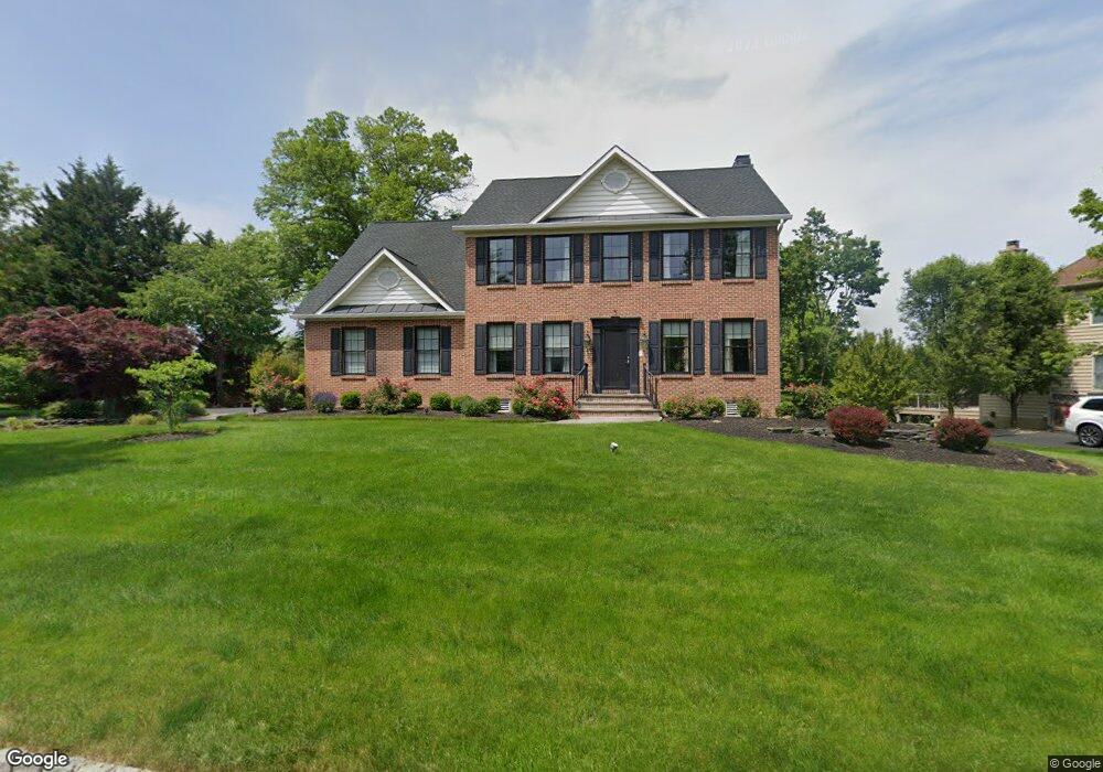
11 Cedar Crest Ct Doylestown, PA 18901
Estimated Value: $854,511 - $961,000
4
Beds
3
Baths
2,928
Sq Ft
$306/Sq Ft
Est. Value
About This Home
This home is located at 11 Cedar Crest Ct, Doylestown, PA 18901 and is currently estimated at $896,378, approximately $306 per square foot. 11 Cedar Crest Ct is a home located in Bucks County with nearby schools including Mill Creek Elementary School, Unami Middle School, and Central Bucks High School - South.
Ownership History
Date
Name
Owned For
Owner Type
Purchase Details
Closed on
May 23, 2023
Sold by
Tripodi Peter Anthony and Thomai Christine
Bought by
Revocable Living Trust and Tripodi
Current Estimated Value
Purchase Details
Closed on
Jul 2, 1998
Sold by
Cedarcrest Farm Ltd Partnership
Bought by
Tripodi Peter A and Tripodi Christine
Home Financials for this Owner
Home Financials are based on the most recent Mortgage that was taken out on this home.
Original Mortgage
$227,150
Interest Rate
6.99%
Create a Home Valuation Report for This Property
The Home Valuation Report is an in-depth analysis detailing your home's value as well as a comparison with similar homes in the area
Home Values in the Area
Average Home Value in this Area
Purchase History
| Date | Buyer | Sale Price | Title Company |
|---|---|---|---|
| Revocable Living Trust | -- | None Listed On Document | |
| Tripodi Peter A | $287,402 | -- |
Source: Public Records
Mortgage History
| Date | Status | Borrower | Loan Amount |
|---|---|---|---|
| Previous Owner | Tripodi Peter A | $227,150 |
Source: Public Records
Tax History Compared to Growth
Tax History
| Year | Tax Paid | Tax Assessment Tax Assessment Total Assessment is a certain percentage of the fair market value that is determined by local assessors to be the total taxable value of land and additions on the property. | Land | Improvement |
|---|---|---|---|---|
| 2025 | $9,676 | $54,680 | $6,760 | $47,920 |
| 2024 | $9,676 | $54,680 | $6,760 | $47,920 |
| 2023 | $9,227 | $54,680 | $6,760 | $47,920 |
| 2022 | $9,124 | $54,680 | $6,760 | $47,920 |
| 2021 | $8,936 | $54,680 | $6,760 | $47,920 |
| 2020 | $8,895 | $54,680 | $6,760 | $47,920 |
| 2019 | $8,799 | $54,680 | $6,760 | $47,920 |
| 2018 | $8,772 | $54,680 | $6,760 | $47,920 |
| 2017 | $8,704 | $54,680 | $6,760 | $47,920 |
| 2016 | -- | $54,680 | $6,760 | $47,920 |
| 2015 | -- | $54,680 | $6,760 | $47,920 |
| 2014 | -- | $54,680 | $6,760 | $47,920 |
Source: Public Records
Map
Nearby Homes
- 13 Cedar Crest Ct
- 1 Elizabeth Ln
- 8 Elizabeth Ln
- 3633 Meadow Ln
- 977 Hickory Ridge Dr
- 12 Warren Dr
- 179 Almshouse Rd
- 34 Warren Dr Unit 16
- 32 Warren Dr Unit 15
- 30 Warren Dr Unit 14
- 158 W Butler Ave
- 79 Becker Dr
- 60 Becker Dr Unit 27
- 62 Becker Dr Unit 28
- 58 Becker Dr Unit 26
- 64 Becker Dr Unit 29
- 117 S Limekiln Pike
- Lots 123 Pickertown Rd
- 25 Mill Creek Dr
- 25 Mill Creek Dr Unit 13
- 9 Cedar Crest Ct
- 28 Leapson Ln
- 7 Cedar Crest Ct
- 14 Cedar Crest Ct
- 16 Cedar Crest Ct
- 12 Cedar Crest Ct
- 18 Cedar Crest Ct
- 10 Cedar Crest Ct
- 5 Cedar Crest Ct
- 26 Leapson Ln
- 8 Cedar Crest Ct
- 20 Cedar Crest Ct
- 27 Leapson Ln
- 25 Leapson Ln
- 6 Cedar Crest Ct
- 3 Cedar Crest Ct
- 24 Leapson Ln
- 22 Cedar Crest Ct
- 3775 Bristol Rd
- 4 Cedar Crest Ct