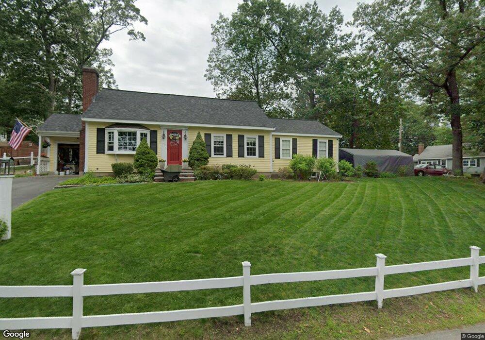
11 Cedar St North Chelmsford, MA 01863
North Chelmsford NeighborhoodEstimated Value: $606,000 - $726,000
3
Beds
2
Baths
1,776
Sq Ft
$372/Sq Ft
Est. Value
About This Home
This home is located at 11 Cedar St, North Chelmsford, MA 01863 and is currently estimated at $660,952, approximately $372 per square foot. 11 Cedar St is a home located in Middlesex County with nearby schools including Charles D. Harrington Elementary School, McCarthy Middle School, and Chelmsford High School.
Create a Home Valuation Report for This Property
The Home Valuation Report is an in-depth analysis detailing your home's value as well as a comparison with similar homes in the area
Home Values in the Area
Average Home Value in this Area
Tax History Compared to Growth
Tax History
| Year | Tax Paid | Tax Assessment Tax Assessment Total Assessment is a certain percentage of the fair market value that is determined by local assessors to be the total taxable value of land and additions on the property. | Land | Improvement |
|---|---|---|---|---|
| 2025 | $7,895 | $568,000 | $257,600 | $310,400 |
| 2024 | $7,505 | $551,000 | $257,600 | $293,400 |
| 2023 | $7,139 | $496,800 | $276,900 | $219,900 |
| 2022 | $6,773 | $429,500 | $240,800 | $188,700 |
| 2021 | $6,556 | $416,500 | $223,100 | $193,400 |
| 2020 | $6,570 | $399,400 | $200,900 | $198,500 |
| 2019 | $6,247 | $382,100 | $198,900 | $183,200 |
| 2018 | $6,507 | $362,300 | $179,100 | $183,200 |
| 2017 | $6,302 | $351,700 | $167,700 | $184,000 |
| 2016 | $5,757 | $319,300 | $159,700 | $159,600 |
| 2015 | $5,369 | $287,100 | $138,000 | $149,100 |
| 2014 | $5,301 | $279,300 | $136,200 | $143,100 |
Source: Public Records
Map
Nearby Homes
- 2 Walter G Wiede St Unit 7
- 24 Brouilette St Unit A
- 1975 Middlesex St Unit 51
- 1975 Middlesex St Unit 2
- 90 Corey St
- 94 Princeton St Unit 1
- 96 Princeton St Unit 2
- 770 Princeton Blvd
- 71 Princeton St Unit 303
- 1821 Middlesex St Unit 10
- 16 Washington St
- 33 Kennedy Dr Unit 33
- 20 Sandy Ln
- 620 Princeton Blvd Unit 13
- 96 Richardson Rd Unit A22
- 6 Louis Farm Rd Unit 6
- 3 Louis Farm Rd Unit 3
- 8 Grace St
- 4 Tamarack St
- 527 Pawtucket Blvd Unit 304