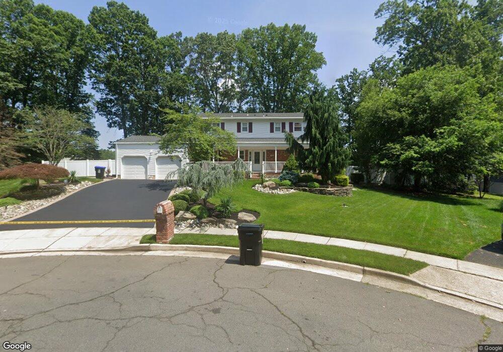
11 Colt Ct East Brunswick, NJ 08816
Estimated Value: $603,871 - $831,000
--
Bed
--
Bath
2,355
Sq Ft
$314/Sq Ft
Est. Value
About This Home
This home is located at 11 Colt Ct, East Brunswick, NJ 08816 and is currently estimated at $740,468, approximately $314 per square foot. 11 Colt Ct is a home located in Middlesex County with nearby schools including Robert Frost Elementary School, Hammarskjold Upper Elementary School, and Churchill Junior High School.
Ownership History
Date
Name
Owned For
Owner Type
Purchase Details
Closed on
Oct 30, 2000
Sold by
Clarke Timothy
Bought by
Silver Samuel and Silver Cathy
Current Estimated Value
Home Financials for this Owner
Home Financials are based on the most recent Mortgage that was taken out on this home.
Original Mortgage
$300,000
Outstanding Balance
$109,755
Interest Rate
7.78%
Estimated Equity
$630,713
Create a Home Valuation Report for This Property
The Home Valuation Report is an in-depth analysis detailing your home's value as well as a comparison with similar homes in the area
Home Values in the Area
Average Home Value in this Area
Purchase History
| Date | Buyer | Sale Price | Title Company |
|---|---|---|---|
| Silver Samuel | $375,000 | -- |
Source: Public Records
Mortgage History
| Date | Status | Borrower | Loan Amount |
|---|---|---|---|
| Open | Silver Samuel | $300,000 |
Source: Public Records
Tax History Compared to Growth
Tax History
| Year | Tax Paid | Tax Assessment Tax Assessment Total Assessment is a certain percentage of the fair market value that is determined by local assessors to be the total taxable value of land and additions on the property. | Land | Improvement |
|---|---|---|---|---|
| 2025 | $14,474 | $118,700 | $36,600 | $82,100 |
| 2024 | $14,042 | $118,700 | $36,600 | $82,100 |
| 2023 | $14,042 | $118,700 | $36,600 | $82,100 |
| 2022 | $13,986 | $118,700 | $36,600 | $82,100 |
| 2021 | $13,588 | $118,700 | $36,600 | $82,100 |
| 2020 | $13,569 | $118,700 | $36,600 | $82,100 |
| 2019 | $13,424 | $118,700 | $36,600 | $82,100 |
| 2018 | $13,196 | $118,700 | $36,600 | $82,100 |
| 2017 | $12,983 | $118,700 | $36,600 | $82,100 |
| 2016 | $12,721 | $118,700 | $36,600 | $82,100 |
| 2015 | $12,422 | $118,700 | $36,600 | $82,100 |
| 2014 | $12,154 | $118,700 | $36,600 | $82,100 |
Source: Public Records
Map
Nearby Homes
- 12 Francis Rd
- 154 Kane Ave
- 13 Francis Rd
- 417 Adirondack Ave
- 46 Appleby Ave
- 266 Madie Ave
- 266 Wyoming Ave
- 254 Wyoming Ave
- 38 Madie Ave
- 147 Szymanski Dr
- 5 Queens Rd
- 257 Summerhill Rd
- 5 Sandalwood Dr
- 364 Mcdowell Dr
- 17 Stephens Dr
- 396 Mcdowell Dr Unit C2
- 376 New Brunswick Ave
- Lot19 Brooklyn Ave
- LOT18 Brooklyn Ave
- 33 Oakcrest Dr