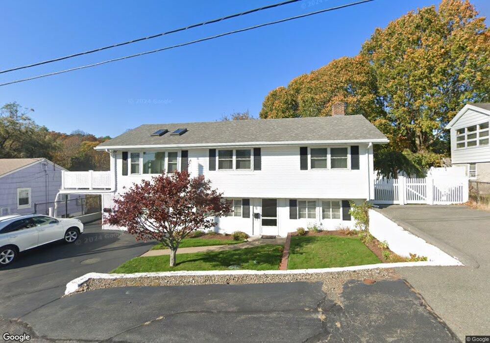
11 Cunningham Rd Gloucester, MA 01930
Riverview NeighborhoodEstimated Value: $641,261 - $708,000
3
Beds
3
Baths
1,232
Sq Ft
$537/Sq Ft
Est. Value
About This Home
This home is located at 11 Cunningham Rd, Gloucester, MA 01930 and is currently estimated at $661,065, approximately $536 per square foot. 11 Cunningham Rd is a home located in Essex County with nearby schools including Plum Cove School, Ralph B O'maley Middle School, and Gloucester High School.
Ownership History
Date
Name
Owned For
Owner Type
Purchase Details
Closed on
Aug 12, 2004
Sold by
Randazzo Amy E and Randazzo John G
Bought by
Abell Rosemarie
Current Estimated Value
Home Financials for this Owner
Home Financials are based on the most recent Mortgage that was taken out on this home.
Original Mortgage
$300,000
Outstanding Balance
$150,344
Interest Rate
6.16%
Mortgage Type
Purchase Money Mortgage
Estimated Equity
$510,721
Purchase Details
Closed on
Mar 31, 1998
Sold by
Moceri Carlo A and Moceri Mary A
Bought by
Randazzo John G and Randazzo Amy E
Home Financials for this Owner
Home Financials are based on the most recent Mortgage that was taken out on this home.
Original Mortgage
$100,000
Interest Rate
6.96%
Mortgage Type
Purchase Money Mortgage
Create a Home Valuation Report for This Property
The Home Valuation Report is an in-depth analysis detailing your home's value as well as a comparison with similar homes in the area
Home Values in the Area
Average Home Value in this Area
Purchase History
| Date | Buyer | Sale Price | Title Company |
|---|---|---|---|
| Abell Rosemarie | $400,000 | -- | |
| Randazzo John G | $146,000 | -- |
Source: Public Records
Mortgage History
| Date | Status | Borrower | Loan Amount |
|---|---|---|---|
| Open | Randazzo John G | $300,000 | |
| Previous Owner | Randazzo John G | $100,000 | |
| Closed | Randazzo John G | $50,000 |
Source: Public Records
Tax History
| Year | Tax Paid | Tax Assessment Tax Assessment Total Assessment is a certain percentage of the fair market value that is determined by local assessors to be the total taxable value of land and additions on the property. | Land | Improvement |
|---|---|---|---|---|
| 2025 | $4,999 | $514,300 | $150,200 | $364,100 |
| 2024 | $4,901 | $503,700 | $143,000 | $360,700 |
| 2023 | $5,188 | $489,900 | $127,700 | $362,200 |
| 2022 | $4,589 | $391,200 | $111,100 | $280,100 |
| 2021 | $4,444 | $357,200 | $101,000 | $256,200 |
| 2020 | $4,228 | $342,900 | $101,000 | $241,900 |
| 2019 | $3,967 | $312,600 | $101,000 | $211,600 |
| 2018 | $3,733 | $288,700 | $101,000 | $187,700 |
| 2017 | $3,577 | $271,200 | $96,200 | $175,000 |
| 2016 | $3,563 | $261,800 | $100,300 | $161,500 |
| 2015 | $3,507 | $256,900 | $100,300 | $156,600 |
Source: Public Records
Map
Nearby Homes
- 6 Monroe Ct
- 13 Mystic Ave
- 98 Maplewood Ave
- 15 Harvard St
- 31 Echo Ave
- 20 Beacon St
- 20 Beacon St Unit 2
- 20 Beacon St Unit 1
- 13 Honeysuckle Rd
- 40 Sargent St
- 33 Maplewood Ave Unit 310
- 33 Maplewood Ave Unit 16
- 5 Lepage Ln
- 113 Pleasant St
- 19 Trask St Unit 2
- 5 Samoset Rd Unit B
- 55 Mansfield St Unit A
- 55 Mansfield St Unit B
- 55 Mansfield St
- 2 Finch Ln
- 9 Cunningham Rd
- 13 Cunningham Rd
- 12 Cunningham Rd
- 14 Cunningham Rd
- 7 Cunningham Rd
- 10 Cunningham Rd
- 18 Marsh St
- 8 Cunningham Rd
- 16 Marsh St
- 9 Ashland Place
- 5 Cunningham Rd
- 11 Ashland Place
- 6 Cunningham Rd
- 7 Ashland Place
- 3 Cunningham Rd
- 26 Marsh St
- 264 Washington St
- 264 Washington St Unit 1
- 4 Cunningham Rd
- 5 Ashland Place
Your Personal Tour Guide
Ask me questions while you tour the home.