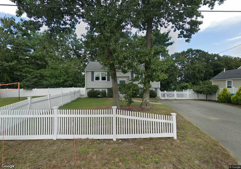
11 Cypress Rd Wrentham, MA 02093
Estimated Value: $480,000 - $557,000
2
Beds
2
Baths
1,363
Sq Ft
$378/Sq Ft
Est. Value
About This Home
This home is located at 11 Cypress Rd, Wrentham, MA 02093 and is currently estimated at $514,546, approximately $377 per square foot. 11 Cypress Rd is a home located in Norfolk County with nearby schools including Delaney Elementary School, Charles E Roderick, and The Sage School.
Ownership History
Date
Name
Owned For
Owner Type
Purchase Details
Closed on
Jul 11, 2024
Sold by
Kane Brendan T and Kane Donna M
Bought by
Kane Ft and Kane
Current Estimated Value
Purchase Details
Closed on
Sep 26, 2007
Sold by
Harootunian Michael D and Harootunian Gina E
Bought by
Kane Brendan T and Kane Donna M
Home Financials for this Owner
Home Financials are based on the most recent Mortgage that was taken out on this home.
Original Mortgage
$309,000
Interest Rate
6.65%
Mortgage Type
Purchase Money Mortgage
Purchase Details
Closed on
Jun 30, 2003
Sold by
Garrett Karen S
Bought by
Harootunian Michael D and Harootunian Gina E
Home Financials for this Owner
Home Financials are based on the most recent Mortgage that was taken out on this home.
Original Mortgage
$195,000
Interest Rate
5.53%
Mortgage Type
Purchase Money Mortgage
Purchase Details
Closed on
Jan 5, 1988
Sold by
Mcternan James M
Bought by
Garrett David B
Home Financials for this Owner
Home Financials are based on the most recent Mortgage that was taken out on this home.
Original Mortgage
$122,800
Interest Rate
10.59%
Mortgage Type
Purchase Money Mortgage
Create a Home Valuation Report for This Property
The Home Valuation Report is an in-depth analysis detailing your home's value as well as a comparison with similar homes in the area
Home Values in the Area
Average Home Value in this Area
Purchase History
| Date | Buyer | Sale Price | Title Company |
|---|---|---|---|
| Kane Ft | -- | None Available | |
| Kane Ft | -- | None Available | |
| Kane Brendan T | $309,000 | -- | |
| Harootunian Michael D | $245,000 | -- | |
| Kane Brendan T | $309,000 | -- | |
| Harootunian Michael D | $245,000 | -- | |
| Garrett David B | $136,500 | -- |
Source: Public Records
Mortgage History
| Date | Status | Borrower | Loan Amount |
|---|---|---|---|
| Previous Owner | Kane Brendan T | $309,000 | |
| Previous Owner | Harootunian Michael D | $195,000 | |
| Previous Owner | Garrett David B | $122,800 |
Source: Public Records
Tax History Compared to Growth
Tax History
| Year | Tax Paid | Tax Assessment Tax Assessment Total Assessment is a certain percentage of the fair market value that is determined by local assessors to be the total taxable value of land and additions on the property. | Land | Improvement |
|---|---|---|---|---|
| 2025 | $5,173 | $446,300 | $242,400 | $203,900 |
| 2024 | $4,805 | $400,400 | $242,400 | $158,000 |
| 2023 | $4,481 | $355,100 | $220,400 | $134,700 |
| 2022 | $4,284 | $313,400 | $198,400 | $115,000 |
| 2021 | $3,699 | $262,900 | $177,300 | $85,600 |
| 2020 | $4,177 | $293,100 | $161,700 | $131,400 |
| 2019 | $3,812 | $270,000 | $147,000 | $123,000 |
| 2018 | $3,663 | $257,200 | $147,200 | $110,000 |
| 2017 | $3,461 | $242,900 | $144,300 | $98,600 |
| 2016 | $3,382 | $236,800 | $140,100 | $96,700 |
| 2015 | $3,308 | $220,800 | $134,700 | $86,100 |
| 2014 | $3,253 | $212,500 | $129,600 | $82,900 |
Source: Public Records
Map
Nearby Homes
- 246 Forest Grove Ave
- 3 Oak Rd
- 0 W Birch Rd
- 10 W Birch Rd
- 270 Dedham St
- 45 King St
- 45 Joshua Rd
- 1 Lorraine Metcalf Dr
- 3 Sparrow Rd
- 50 Reed Fulton Ave Unit Lot 61
- 10 Nature View Dr
- 15 Nature View Dr
- 38 Robin Rd
- 11 Quail Run Rd
- 570 Franklin St
- 2 Diamond St
- 3 Pheasanthill Rd
- 71 Pond St
- 362 East St
- 14 Essex St