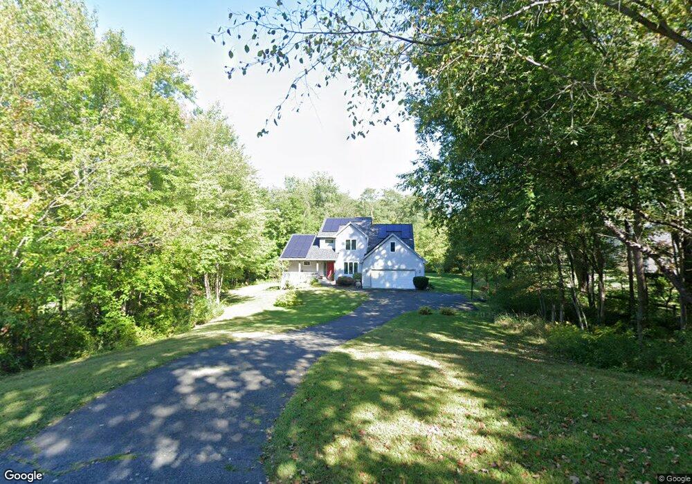
11 Dennis Dr Amherst, MA 01002
Estimated Value: $655,000 - $714,000
4
Beds
3
Baths
2,341
Sq Ft
$289/Sq Ft
Est. Value
About This Home
This home is located at 11 Dennis Dr, Amherst, MA 01002 and is currently estimated at $676,684, approximately $289 per square foot. 11 Dennis Dr is a home located in Hampshire County with nearby schools including Crocker Farm Elementary School, Amherst Regional Middle School, and Amherst Regional High School.
Ownership History
Date
Name
Owned For
Owner Type
Purchase Details
Closed on
Mar 1, 2023
Sold by
Meccouri Linda L
Bought by
Linda L Meccouri Ret
Current Estimated Value
Purchase Details
Closed on
Jun 11, 2010
Sold by
Haynes Terrence D
Bought by
Meccouri Linda L
Purchase Details
Closed on
Mar 30, 2001
Sold by
Gnatek Ronald A
Bought by
Haynes Terrence D and Meccouri Linda L
Purchase Details
Closed on
Apr 24, 2000
Sold by
Greene Ann F and Greene Roderic R
Bought by
R A Gnatek Bldrs Inc
Purchase Details
Closed on
May 15, 1992
Sold by
Magner Jeffrey S and Magner Terilyn
Bought by
Vexler Norman S
Purchase Details
Closed on
Jul 11, 1991
Sold by
Kei May Lau and Ng Ka Ming
Bought by
Malki Omaima Charif and Malki Abed A Usama
Purchase Details
Closed on
Feb 2, 1987
Sold by
Levitan Steven P
Bought by
Kassels Louise R
Create a Home Valuation Report for This Property
The Home Valuation Report is an in-depth analysis detailing your home's value as well as a comparison with similar homes in the area
Home Values in the Area
Average Home Value in this Area
Purchase History
| Date | Buyer | Sale Price | Title Company |
|---|---|---|---|
| Linda L Meccouri Ret | -- | None Available | |
| Meccouri Linda L | -- | -- | |
| Haynes Terrence D | $260,000 | -- | |
| R A Gnatek Bldrs Inc | $45,000 | -- | |
| Vexler Norman S | $36,000 | -- | |
| Malki Omaima Charif | $155,000 | -- | |
| Kassels Louise R | $165,000 | -- |
Source: Public Records
Mortgage History
| Date | Status | Borrower | Loan Amount |
|---|---|---|---|
| Previous Owner | Kassels Louise R | $260,000 | |
| Previous Owner | Kassels Louise R | $54,000 | |
| Previous Owner | Kassels Louise R | $250,700 |
Source: Public Records
Tax History
| Year | Tax Paid | Tax Assessment Tax Assessment Total Assessment is a certain percentage of the fair market value that is determined by local assessors to be the total taxable value of land and additions on the property. | Land | Improvement |
|---|---|---|---|---|
| 2025 | $104 | $581,400 | $188,800 | $392,600 |
| 2024 | $10,188 | $550,400 | $178,200 | $372,200 |
| 2023 | $9,499 | $472,600 | $162,200 | $310,400 |
| 2022 | $9,314 | $437,900 | $147,400 | $290,500 |
| 2021 | $8,863 | $406,200 | $136,600 | $269,600 |
| 2020 | $8,660 | $406,200 | $136,600 | $269,600 |
| 2019 | $8,334 | $382,300 | $136,600 | $245,700 |
| 2018 | $8,082 | $382,300 | $136,600 | $245,700 |
| 2017 | $7,868 | $360,400 | $130,200 | $230,200 |
| 2016 | $7,921 | $373,300 | $143,100 | $230,200 |
| 2015 | $7,668 | $373,300 | $143,100 | $230,200 |
Source: Public Records
Map
Nearby Homes
- 170 E Hadley Rd Unit 87
- 26 Greenleaves Dr Unit 635
- 26 Greenleaves Dr Unit 624
- 24 Greenleaves Dr Unit 418
- 27 Greenleaves Dr Unit 726
- 23 Greenleaves Dr Unit 107
- 6 Eveningstar Dr
- 105 Pomeroy Ln
- 178 W Pomeroy Ln
- 30 Greenleaves Dr
- 132 Pondview Dr
- 1114 S East St
- 89 Potwine Ln
- 0 Main St
- 53 Pine Grove Unit 53
- 67 Pine Grove Unit 67
- 63 Amity Place Unit 63
- 60 Amity Place
- 75 Amity Place Unit 75
- 174 Lincoln Ave
Your Personal Tour Guide
Ask me questions while you tour the home.