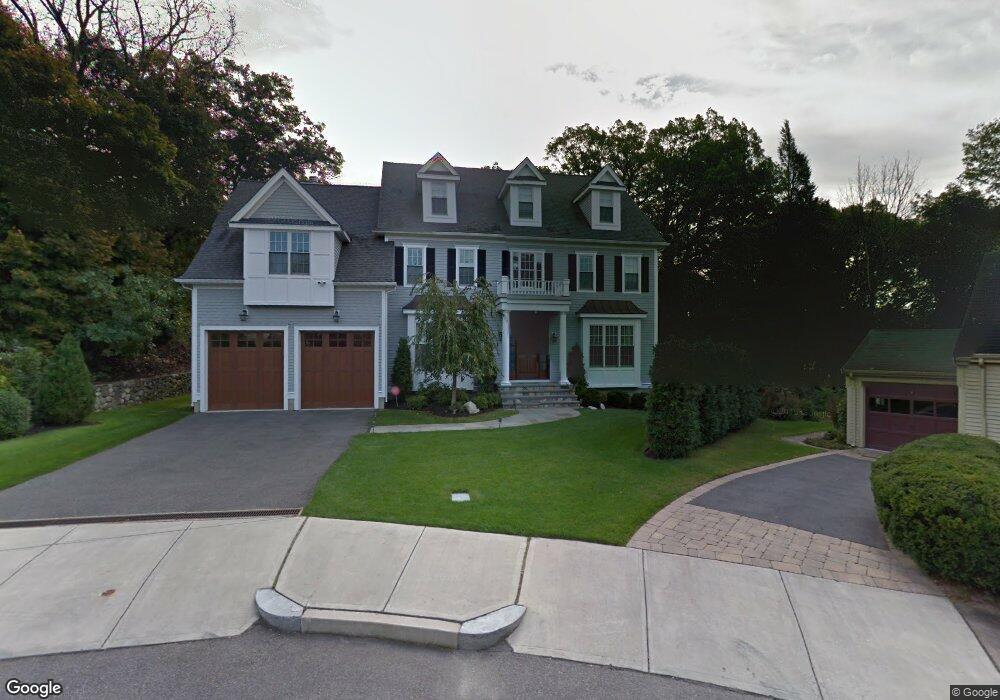
11 Doris Cir Newton, MA 02458
Newton Corner NeighborhoodEstimated Value: $3,075,381 - $3,676,000
6
Beds
6
Baths
4,100
Sq Ft
$816/Sq Ft
Est. Value
About This Home
This home is located at 11 Doris Cir, Newton, MA 02458 and is currently estimated at $3,343,595, approximately $815 per square foot. 11 Doris Cir is a home located in Middlesex County with nearby schools including Cabot Elementary School, F.A. Day Middle School, and Newton North High School.
Ownership History
Date
Name
Owned For
Owner Type
Purchase Details
Closed on
Dec 31, 2020
Sold by
Gabbay Solomon A
Bought by
S A Gabbay 1996 T
Current Estimated Value
Purchase Details
Closed on
Apr 2, 2007
Sold by
11 Doris Circle Dev T and Romm Lev
Bought by
Gabbay Solomon A
Purchase Details
Closed on
Jun 15, 2006
Sold by
Steinman Ft and Simkin Peter H
Bought by
11 Doris Circle Dev T and Romm Lev
Create a Home Valuation Report for This Property
The Home Valuation Report is an in-depth analysis detailing your home's value as well as a comparison with similar homes in the area
Home Values in the Area
Average Home Value in this Area
Purchase History
| Date | Buyer | Sale Price | Title Company |
|---|---|---|---|
| S A Gabbay 1996 T | -- | None Available | |
| Gabbay Solomon A | $1,800,000 | -- | |
| 11 Doris Circle Dev T | $600,000 | -- |
Source: Public Records
Tax History Compared to Growth
Tax History
| Year | Tax Paid | Tax Assessment Tax Assessment Total Assessment is a certain percentage of the fair market value that is determined by local assessors to be the total taxable value of land and additions on the property. | Land | Improvement |
|---|---|---|---|---|
| 2025 | $31,159 | $3,179,500 | $1,089,500 | $2,090,000 |
| 2024 | $30,128 | $3,086,900 | $1,057,800 | $2,029,100 |
| 2023 | $29,155 | $2,863,900 | $816,800 | $2,047,100 |
| 2022 | $27,897 | $2,651,800 | $756,300 | $1,895,500 |
| 2021 | $26,918 | $2,501,700 | $713,500 | $1,788,200 |
| 2020 | $26,118 | $2,501,700 | $713,500 | $1,788,200 |
| 2019 | $25,381 | $2,428,800 | $692,700 | $1,736,100 |
| 2018 | $24,505 | $2,264,800 | $624,100 | $1,640,700 |
| 2017 | $23,759 | $2,136,600 | $588,800 | $1,547,800 |
| 2016 | $22,724 | $1,996,800 | $550,300 | $1,446,500 |
| 2015 | $21,667 | $1,866,200 | $514,300 | $1,351,900 |
Source: Public Records
Map
Nearby Homes
- 14 Summit St
- 642 Centre St
- 686 Centre St
- 35 George St Unit 35
- 37 George St Unit 37
- 324 Adams St Unit 2
- 548 Centre St Unit 5
- 59 Hyde Ave
- 44 Blake St Unit 2
- 12 Richardson St Unit 14
- 48 Harvard St Unit 1
- 110 Harvard St Unit A
- 127-129 Withington Rd Unit 1
- 10 Washington Park
- 10 Washington Park Unit 2
- 10 Washington Park Unit 1
- 90 Waban Park Unit 2
- 12-14 Middle St
- 34 Channing St Unit 1
- 34 Channing St Unit 2