
Seller's Agent in 2025
Sharon Havens
Coldwell Banker Realty Nashua
(603) 769-1774
2 in this area
24 Total Sales
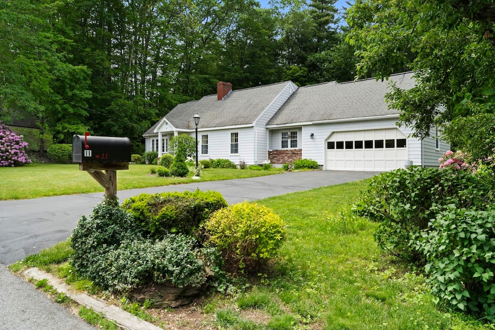
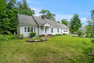
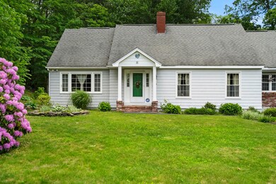
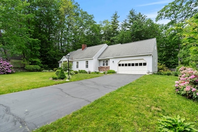
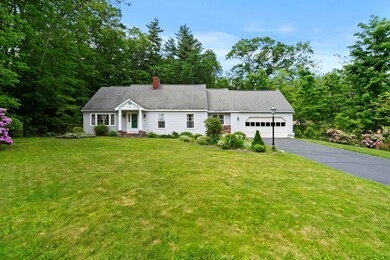
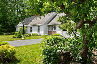
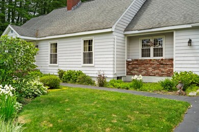
This bright and sunny cape style home in an established and sought after Nashua neighborhood, has a generous lot size and outstanding landscaping. Convenient to Route 3, shopping, multiple businesses, medical services and a variety of restaurants/entertainment. Spacious enough to use rooms as two bedrooms down and two bedrooms up; one being an ensuite on the 2nd floor. The large 1-car garage can manage your extra toys. Private septic exists with an option to connect to town sewer at the street. Nestled amongst other pristine properties with equally maintained gardens and lawns, this property has a great over-sized screened porch overlooking a private backyard with garden space, patio and dog/child fence. The kitchen and three bathrooms have had an update. Some features include quality hardwood floors on both levels, tile in the kitchen and bathrooms, maple cabinets, solid 6 panel doors, 2 fireplaces, large Nashua wood stove, a mini split on the 1st floor, industrially sealed epoxy basement floor and perimeter drain. Convenient generator hookup located outside. You will be amazed at how much storage space is available throughout; including a cedar closet on the second floor and expansive storage closets above the garage with electric heat. You will find the floor plan very flexible with 2 staircases to meet your needs for home office, nursery, guests, studio, space, etc. Sold "AS IS"
Last Agent to Sell the Property
Coldwell Banker Realty Nashua Brokerage Phone: 603-769-1774 License #034477 Listed on: 06/06/2025
| Date | Type | Sale Price | Title Company |
|---|---|---|---|
| Warranty Deed | $660,000 | -- | |
| Warranty Deed | $660,000 | -- | |
| Warranty Deed | $182,600 | -- | |
| Warranty Deed | $182,600 | -- | |
| Warranty Deed | $176,000 | -- | |
| Warranty Deed | $176,000 | -- |
| Date | Status | Loan Amount | Loan Type |
|---|---|---|---|
| Open | $528,000 | New Conventional | |
| Closed | $528,000 | New Conventional | |
| Previous Owner | $180,000 | Unknown | |
| Previous Owner | $173,350 | Purchase Money Mortgage |
| Date | Event | Price | List to Sale | Price per Sq Ft |
|---|---|---|---|---|
| 08/14/2025 08/14/25 | Sold | $660,000 | -5.6% | $260 / Sq Ft |
| 06/06/2025 06/06/25 | For Sale | $699,000 | -- | $276 / Sq Ft |
| Year | Tax Paid | Tax Assessment Tax Assessment Total Assessment is a certain percentage of the fair market value that is determined by local assessors to be the total taxable value of land and additions on the property. | Land | Improvement |
|---|---|---|---|---|
| 2024 | $9,470 | $595,600 | $181,100 | $414,500 |
| 2023 | $8,918 | $489,200 | $144,900 | $344,300 |
| 2022 | $8,840 | $489,200 | $144,900 | $344,300 |
| 2021 | $8,043 | $346,400 | $106,200 | $240,200 |
| 2020 | $7,832 | $346,400 | $106,200 | $240,200 |
| 2019 | $7,538 | $346,400 | $106,200 | $240,200 |
| 2018 | $7,347 | $346,400 | $106,200 | $240,200 |
| 2017 | $7,056 | $273,600 | $87,700 | $185,900 |
| 2016 | $6,859 | $273,600 | $87,700 | $185,900 |
| 2015 | $6,672 | $272,000 | $87,700 | $184,300 |
| 2014 | $6,542 | $272,000 | $87,700 | $184,300 |
Seller's Agent in 2025
Sharon Havens
Coldwell Banker Realty Nashua
(603) 769-1774
2 in this area
24 Total Sales
Buyer's Agent in 2025
James Williamson
J. Borstell Real Estate
(978) 501-2594
1 in this area
32 Total Sales
Source: PrimeMLS
MLS Number: 5045246
APN: NASH-000053B-000000-000081
Disclaimer: Certain information contained herein is derived from information provided by parties other than Homes.com. All information provided is deemed reliable, but is not guaranteed to be accurate and should be independently verified.
![]() Copyright 2025 PrimeMLS, Inc. All rights reserved. This information is deemed reliable, but not guaranteed. The data relating to real estate displayed on this display comes in part from the IDX Program of PrimeMLS. The information being provided is for consumers’ personal, non-commercial use and may not be used for any purpose other than to identify prospective properties consumers may be interested in purchasing.
Copyright 2025 PrimeMLS, Inc. All rights reserved. This information is deemed reliable, but not guaranteed. The data relating to real estate displayed on this display comes in part from the IDX Program of PrimeMLS. The information being provided is for consumers’ personal, non-commercial use and may not be used for any purpose other than to identify prospective properties consumers may be interested in purchasing.