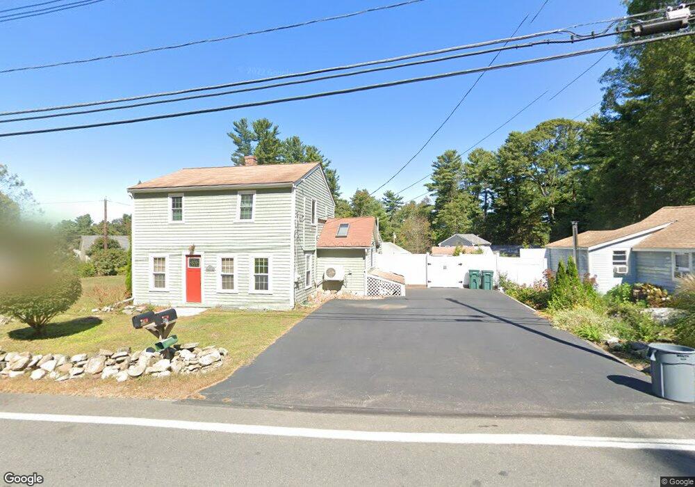
11 Dunstable Rd Westford, MA 01886
Estimated Value: $743,582 - $958,000
3
Beds
4
Baths
2,432
Sq Ft
$356/Sq Ft
Est. Value
About This Home
This home is located at 11 Dunstable Rd, Westford, MA 01886 and is currently estimated at $864,896, approximately $355 per square foot. 11 Dunstable Rd is a home located in Middlesex County with nearby schools including Rita E. Miller Elementary School, Day Elementary School, and Stony Brook School.
Ownership History
Date
Name
Owned For
Owner Type
Purchase Details
Closed on
Dec 21, 2016
Sold by
Peatfield Charles R and Ross Peatfield C
Bought by
Peatfield 2016 T
Current Estimated Value
Create a Home Valuation Report for This Property
The Home Valuation Report is an in-depth analysis detailing your home's value as well as a comparison with similar homes in the area
Home Values in the Area
Average Home Value in this Area
Purchase History
| Date | Buyer | Sale Price | Title Company |
|---|---|---|---|
| Peatfield 2016 T | -- | -- |
Source: Public Records
Tax History
| Year | Tax Paid | Tax Assessment Tax Assessment Total Assessment is a certain percentage of the fair market value that is determined by local assessors to be the total taxable value of land and additions on the property. | Land | Improvement |
|---|---|---|---|---|
| 2025 | $7,852 | $582,900 | $320,500 | $262,400 |
| 2024 | $7,644 | $555,100 | $305,200 | $249,900 |
| 2023 | $7,554 | $511,800 | $290,800 | $221,000 |
| 2022 | $7,491 | $464,700 | $256,200 | $208,500 |
| 2021 | $7,283 | $437,700 | $256,200 | $181,500 |
| 2020 | $7,148 | $437,700 | $256,200 | $181,500 |
| 2019 | $6,970 | $420,900 | $256,200 | $164,700 |
| 2018 | $5,884 | $409,800 | $245,100 | $164,700 |
| 2017 | $6,341 | $386,400 | $245,100 | $141,300 |
| 2016 | $6,086 | $373,400 | $231,200 | $142,200 |
| 2015 | $5,932 | $365,300 | $231,200 | $134,100 |
| 2014 | $5,920 | $356,600 | $221,700 | $134,900 |
Source: Public Records
Map
Nearby Homes
- 4 Lady Constance Way Unit 20
- 6 Lady Constance Way Unit 21
- 2 Wendell Place Unit 1
- 2 Lady Constance Way Unit 19
- 13 Long Rd
- 12 Keyes Rd
- 8 Loon Way
- 1 Appian Way
- 7 Loon Way
- 3 Colonel Rolls Dr
- 55 Lawson Rd
- 18 B Pilgrim Dr Unit 18b
- 427 Groton Rd
- 7 Dempsey Way
- 11 River St
- 8 Wilson Ln
- 7 3rd St
- 4 Heywood Rd
- 22 Highland Rd
- 3 Hillside Ave
Your Personal Tour Guide
Ask me questions while you tour the home.