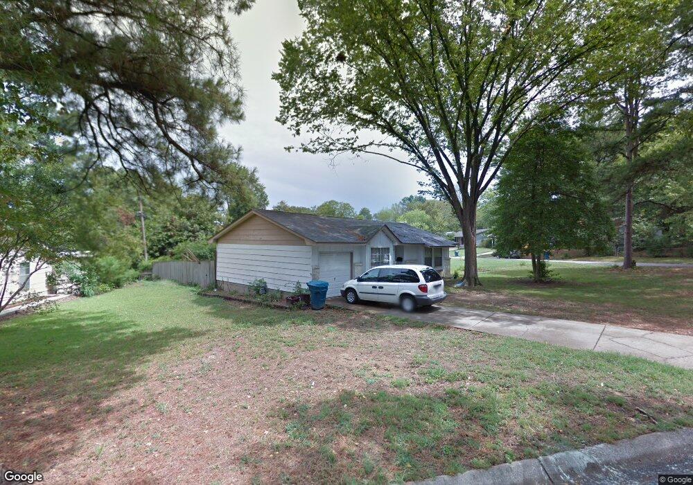
11 Elmhurst Dr Little Rock, AR 72209
Wakefield NeighborhoodEstimated Value: $74,493 - $108,000
--
Bed
3
Baths
996
Sq Ft
$86/Sq Ft
Est. Value
About This Home
This home is located at 11 Elmhurst Dr, Little Rock, AR 72209 and is currently estimated at $85,873, approximately $86 per square foot. 11 Elmhurst Dr is a home located in Pulaski County with nearby schools including Bale Elementary School, Cloverdale Middle School, and Little Rock Southwest High School.
Ownership History
Date
Name
Owned For
Owner Type
Purchase Details
Closed on
Sep 8, 2025
Sold by
Thornton Donna A
Bought by
Hall Abe and Hall Jennifer
Current Estimated Value
Purchase Details
Closed on
Jan 28, 2021
Sold by
Thornton Donna A and Rasool Donna A
Bought by
Rasool Donna A and Thornton Donna A
Purchase Details
Closed on
Oct 7, 2015
Sold by
Thornton Chester Lee
Bought by
Hall Danny
Purchase Details
Closed on
Dec 1, 1997
Sold by
Seitz George
Bought by
Rasool Donna A
Create a Home Valuation Report for This Property
The Home Valuation Report is an in-depth analysis detailing your home's value as well as a comparison with similar homes in the area
Home Values in the Area
Average Home Value in this Area
Purchase History
| Date | Buyer | Sale Price | Title Company |
|---|---|---|---|
| Hall Abe | $10,000 | None Listed On Document | |
| Rasool Donna A | -- | None Listed On Document | |
| Hall Danny | -- | None Available | |
| Rasool Donna A | -- | -- |
Source: Public Records
Tax History Compared to Growth
Tax History
| Year | Tax Paid | Tax Assessment Tax Assessment Total Assessment is a certain percentage of the fair market value that is determined by local assessors to be the total taxable value of land and additions on the property. | Land | Improvement |
|---|---|---|---|---|
| 2025 | $724 | $12,063 | $1,200 | $10,863 |
| 2024 | $664 | $12,063 | $1,200 | $10,863 |
| 2023 | $664 | $12,063 | $1,200 | $10,863 |
| 2022 | $634 | $12,063 | $1,200 | $10,863 |
| 2021 | $608 | $8,620 | $1,200 | $7,420 |
| 2020 | $228 | $8,620 | $1,200 | $7,420 |
| 2019 | $228 | $8,620 | $1,200 | $7,420 |
| 2018 | $253 | $8,620 | $1,200 | $7,420 |
| 2017 | $253 | $8,620 | $1,200 | $7,420 |
| 2016 | $325 | $9,640 | $1,920 | $7,720 |
| 2015 | $676 | $9,640 | $1,920 | $7,720 |
| 2014 | $676 | $9,586 | $1,920 | $7,666 |
Source: Public Records
Map
Nearby Homes
- 4905 Gum Springs Rd Unit 4907 Gum Springs Rd
- 24 Rosemoor Dr
- 51 Hill Ln
- 5215 Gum Springs Rd
- 48 Rosemoor Dr
- 105 Lancaster Rd
- 5419 Western Ln
- 5424 W 51st St
- 5303 W 57th St
- 5223 Mabelvale Pike
- 31 Allyson Cir
- 5900-5908 Geyer Springs
- 22 Daven Ct
- 40 Wellford Dr
- 19 Daven Ct
- 00 S University Ave
- 17 Belmar Dr
- 5 Delrose Dr
- 29 Rugby Dr
- 11 Lamont Dr
- 5018 Greenfield Dr
- 15 Elmhurst Dr
- 5012 Greenfield Dr
- 5 Elmhurst Dr
- 17 Elmhurst Dr
- 0 Elmhurst Dr Unit 16028827
- 12 Elmhurst Dr
- 10 Elmhurst Dr
- 14 Elmhurst Dr
- 8 Elmhurst Dr
- 5017 Greenfield Dr
- 5006 Greenfield Dr
- 19 Elmhurst Dr
- 16 Elmhurst Dr
- 5011 Greenfield Dr
- 6 Elmhurst Dr
- 3 Elmhurst Dr
- 4 Rosemoor Dr
- 5005 Greenfield Dr
- 21 Elmhurst Dr