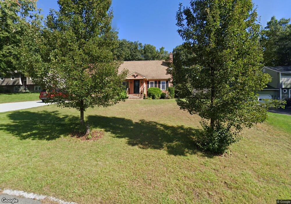
11 Hazel Ave Nashua, NH 03062
West Hollis NeighborhoodEstimated Value: $656,353 - $798,000
4
Beds
2
Baths
2,728
Sq Ft
$261/Sq Ft
Est. Value
About This Home
This home is located at 11 Hazel Ave, Nashua, NH 03062 and is currently estimated at $713,088, approximately $261 per square foot. 11 Hazel Ave is a home located in Hillsborough County with nearby schools including Main Dunstable School, Elm Street Middle School, and Nashua High School South.
Ownership History
Date
Name
Owned For
Owner Type
Purchase Details
Closed on
Jan 18, 2000
Sold by
Delosa Patricia
Bought by
Ceci Joseph A and Ceci Colleen A
Current Estimated Value
Home Financials for this Owner
Home Financials are based on the most recent Mortgage that was taken out on this home.
Original Mortgage
$142,405
Interest Rate
7.79%
Create a Home Valuation Report for This Property
The Home Valuation Report is an in-depth analysis detailing your home's value as well as a comparison with similar homes in the area
Home Values in the Area
Average Home Value in this Area
Purchase History
| Date | Buyer | Sale Price | Title Company |
|---|---|---|---|
| Ceci Joseph A | $149,900 | -- |
Source: Public Records
Mortgage History
| Date | Status | Borrower | Loan Amount |
|---|---|---|---|
| Open | Ceci Joseph A | $106,300 | |
| Open | Ceci Joseph A | $264,000 | |
| Closed | Ceci Joseph A | $142,405 |
Source: Public Records
Tax History
| Year | Tax Paid | Tax Assessment Tax Assessment Total Assessment is a certain percentage of the fair market value that is determined by local assessors to be the total taxable value of land and additions on the property. | Land | Improvement |
|---|---|---|---|---|
| 2025 | $9,940 | $590,600 | $174,100 | $416,500 |
| 2024 | $9,391 | $590,600 | $174,100 | $416,500 |
| 2023 | $8,973 | $492,200 | $139,300 | $352,900 |
| 2022 | $8,894 | $492,200 | $139,300 | $352,900 |
| 2021 | $8,364 | $360,200 | $97,400 | $262,800 |
| 2020 | $8,144 | $360,200 | $97,400 | $262,800 |
| 2019 | $7,838 | $360,200 | $97,400 | $262,800 |
| 2018 | $7,640 | $360,200 | $97,400 | $262,800 |
| 2017 | $7,912 | $306,800 | $78,300 | $228,500 |
| 2016 | $7,691 | $306,800 | $78,300 | $228,500 |
| 2015 | $7,526 | $306,800 | $78,300 | $228,500 |
| 2014 | $7,379 | $306,800 | $78,300 | $228,500 |
Source: Public Records
Map
Nearby Homes
- 36 Silverton Dr Unit U85
- 17 Twilight Dr
- 4 Burlington Rd
- 103 Saranac Dr
- 23 Spring Cove Rd Unit U152
- 30 Spring Cove Rd Unit U112
- 47 Dogwood Dr Unit U202
- 45 Dogwood Dr Unit U208
- 4 Kittery Dr
- 9 Leslie Ln
- 668 W Hollis St
- 16 Champagne Dr Unit U31
- 14 Millbrook Dr
- 5 Lowther Place Unit U6
- 27 Hyacinth Dr
- 12 Pioneer Dr
- 8 Althea Ln Unit U26
- 21 Parkhurst Dr
- 4 Lee Ann St
- 2 Henry David Dr Unit 207
- 9 Hazel Ave
- 15 Hazel Ave
- 17 Hazel Ave
- 7 Hazel Ave
- 18 Cortez Dr Unit U50
- 19 Cortez Dr Unit U51
- 20 Cortez Dr Unit U52
- 21 Cortez Dr Unit U53
- 14 Hazel Ave
- 12 Hazel Ave
- 22 Cortez Dr Unit U54
- 22 Cortez Dr Unit 22
- 23 Cortez Dr Unit U55
- 10 Hazel Ave
- 24 Cortez Dr Unit U56
- 19 Hazel Ave
- 5 Hazel Ave
- 41 Silverton Dr Unit U81
- 37 Silverton Dr Unit U79
- 25 Cortez Dr Unit 25 157
Your Personal Tour Guide
Ask me questions while you tour the home.