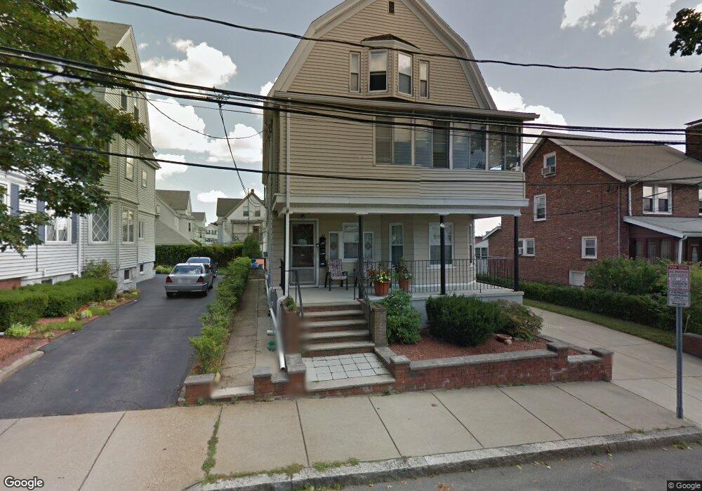
11 Hill St Unit 1 Somerville, MA 02144
Teele Square NeighborhoodEstimated Value: $1,498,000 - $1,822,000
3
Beds
1
Bath
1,200
Sq Ft
$1,367/Sq Ft
Est. Value
About This Home
This home is located at 11 Hill St Unit 1, Somerville, MA 02144 and is currently estimated at $1,640,333, approximately $1,366 per square foot. 11 Hill St Unit 1 is a home located in Middlesex County with nearby schools including Somerville High School, International School of Boston, and St. Clement Elementary School.
Ownership History
Date
Name
Owned For
Owner Type
Purchase Details
Closed on
Feb 28, 2005
Sold by
Ferrone Frances
Bought by
Ferrone Alan E and Ferrone Gaetano
Current Estimated Value
Purchase Details
Closed on
Feb 11, 2005
Sold by
Ferrone Gaetano V and Ferrone Joseph A
Bought by
Ferrone Alan E and Ferrone Gaetano
Create a Home Valuation Report for This Property
The Home Valuation Report is an in-depth analysis detailing your home's value as well as a comparison with similar homes in the area
Home Values in the Area
Average Home Value in this Area
Purchase History
| Date | Buyer | Sale Price | Title Company |
|---|---|---|---|
| Ferrone Alan E | -- | -- | |
| Ferrone Alan E | -- | -- |
Source: Public Records
Tax History Compared to Growth
Tax History
| Year | Tax Paid | Tax Assessment Tax Assessment Total Assessment is a certain percentage of the fair market value that is determined by local assessors to be the total taxable value of land and additions on the property. | Land | Improvement |
|---|---|---|---|---|
| 2025 | $15,753 | $1,443,900 | $756,100 | $687,800 |
| 2024 | $14,877 | $1,414,200 | $756,100 | $658,100 |
| 2023 | $14,943 | $1,445,200 | $756,100 | $689,100 |
| 2022 | $14,216 | $1,396,500 | $720,000 | $676,500 |
| 2021 | $13,507 | $1,325,500 | $714,800 | $610,700 |
| 2020 | $12,967 | $1,285,100 | $715,200 | $569,900 |
| 2019 | $12,294 | $1,142,600 | $651,100 | $491,500 |
| 2018 | $11,368 | $1,005,100 | $592,000 | $413,100 |
| 2017 | $11,193 | $959,100 | $558,500 | $400,600 |
| 2016 | $10,986 | $876,800 | $498,700 | $378,100 |
Source: Public Records
Map
Nearby Homes
- 11 Watson St Unit 1
- 11 Watson St Unit 2
- 202 Powder House Blvd Unit 2
- 34 Belknap St
- 6 Hamilton Rd Unit 6
- 235 Powder House Blvd
- 69 Clarendon Ave Unit A
- 57 Garrison Ave
- 29 Packard Ave
- 55 Packard Ave Unit 1
- 33 Conwell Ave
- 22 Ossipee Rd Unit 2
- 23 Ossipee Rd
- 20 Electric Ave Unit 2
- 24 Washburn Ave Unit 1
- 39 Seven Pines Ave
- 16 High St Unit 2
- 67-69 Cameron Ave
- 21 High St
- 32 Cameron Ave
- 11 Hill St
- 15 Hill St Unit 1
- 15 Hill St
- 1169 Broadway
- 106-108 10 Hills Unit 2
- 52-54 10 Hills Rd Unit 54
- 12 Curtis St
- 12 Curtis St Unit 1
- 12 Curtis St Unit 2
- 1165 Broadway
- 16 Fairmount Ave
- 10 Hill St
- 10 Hill St
- 10 Hill St
- 8 Hill St
- 8 Hill St Unit 1
- 10 Hill St Unit 1
- 10 Hill St Unit 1
- 14 Fairmount Ave
- 14 Fairmount Ave Unit SF