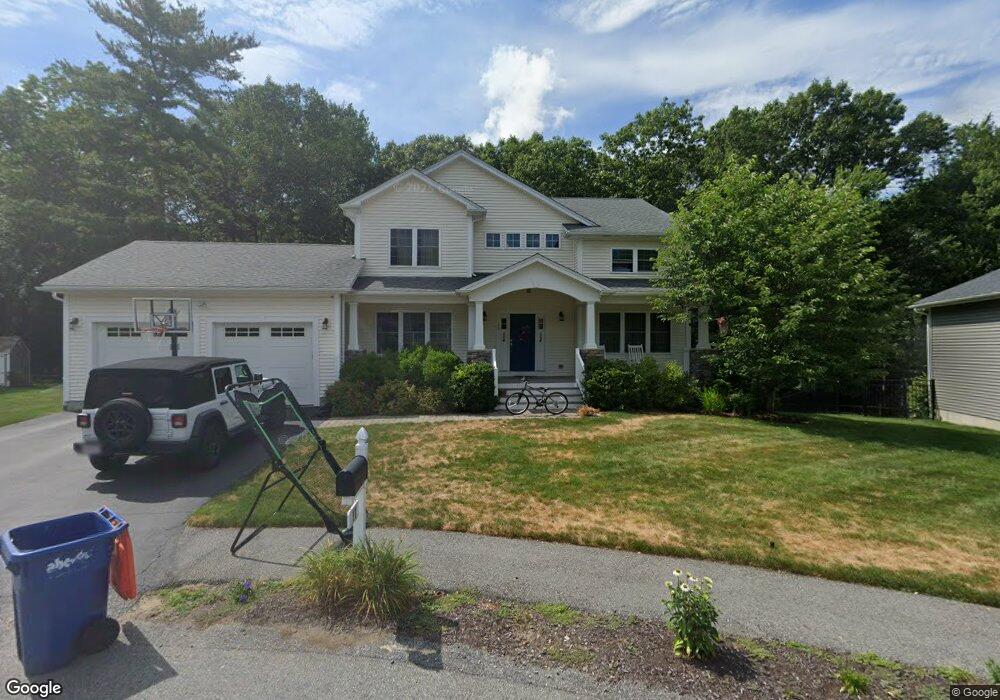
11 Jacoby Way Seekonk, MA 02771
Estimated Value: $772,471 - $920,000
3
Beds
3
Baths
2,524
Sq Ft
$336/Sq Ft
Est. Value
About This Home
This home is located at 11 Jacoby Way, Seekonk, MA 02771 and is currently estimated at $849,118, approximately $336 per square foot. 11 Jacoby Way is a home with nearby schools including Seekonk High School, St Margaret School, and The Wolf School.
Ownership History
Date
Name
Owned For
Owner Type
Purchase Details
Closed on
May 28, 2014
Sold by
Najas Realty Llc
Bought by
Mcbride Jeffrey M and Mcbride Trisha J
Current Estimated Value
Home Financials for this Owner
Home Financials are based on the most recent Mortgage that was taken out on this home.
Original Mortgage
$414,545
Outstanding Balance
$318,547
Interest Rate
4.26%
Mortgage Type
New Conventional
Estimated Equity
$530,571
Create a Home Valuation Report for This Property
The Home Valuation Report is an in-depth analysis detailing your home's value as well as a comparison with similar homes in the area
Home Values in the Area
Average Home Value in this Area
Purchase History
| Date | Buyer | Sale Price | Title Company |
|---|---|---|---|
| Mcbride Jeffrey M | $165,000 | -- |
Source: Public Records
Mortgage History
| Date | Status | Borrower | Loan Amount |
|---|---|---|---|
| Open | Mcbride Jeffrey M | $414,545 |
Source: Public Records
Tax History Compared to Growth
Tax History
| Year | Tax Paid | Tax Assessment Tax Assessment Total Assessment is a certain percentage of the fair market value that is determined by local assessors to be the total taxable value of land and additions on the property. | Land | Improvement |
|---|---|---|---|---|
| 2025 | $8,504 | $688,600 | $169,600 | $519,000 |
| 2024 | $8,010 | $648,600 | $169,600 | $479,000 |
| 2023 | $7,993 | $609,700 | $169,600 | $440,100 |
| 2022 | $7,257 | $544,000 | $169,600 | $374,400 |
| 2021 | $7,115 | $524,300 | $157,900 | $366,400 |
| 2020 | $6,772 | $514,200 | $157,800 | $356,400 |
| 2019 | $6,482 | $496,300 | $157,800 | $338,500 |
| 2018 | $6,383 | $478,100 | $157,800 | $320,300 |
| 2017 | $6,157 | $457,400 | $157,800 | $299,600 |
| 2016 | $5,883 | $438,700 | $157,800 | $280,900 |
| 2015 | $1,995 | $150,800 | $150,800 | $0 |
Source: Public Records
Map
Nearby Homes
- 52 Walker St
- 50 Dexter Ave
- 14 Field St
- 134 Naushon Rd
- 91 Seabiscuit Place
- 181 Sherman Ave
- 245 Manton St
- 245 Manton St Unit 83
- 0 Arcade Ave Unit 73446971
- 38 E Point Dr Unit 5
- 34 E Point Dr Unit 3
- 32 E Point Dr Unit 2
- 60 West Dr
- 242 Manton #41 St
- 242 Manton St
- 46 Lowell Ave
- 90 Ellis St
- 38 Lowell Ave
- 50 Redland Ave
- 331 Newman Ave Unit 333