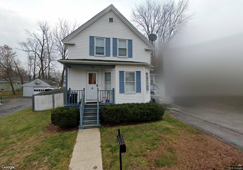
11 Jones St Dracut, MA 01826
Estimated Value: $505,137 - $655,000
3
Beds
3
Baths
1,608
Sq Ft
$354/Sq Ft
Est. Value
About This Home
This home is located at 11 Jones St, Dracut, MA 01826 and is currently estimated at $569,534, approximately $354 per square foot. 11 Jones St is a home located in Middlesex County with nearby schools including Greenmont Avenue School, Richardson Middle School, and Dracut Senior High School.
Ownership History
Date
Name
Owned For
Owner Type
Purchase Details
Closed on
Feb 21, 2023
Sold by
Ridge Thomas P and Ridge Elaine D
Bought by
Ridge Ft
Current Estimated Value
Purchase Details
Closed on
Jun 10, 1993
Sold by
Bergeron Richard E and Bergeron Karon
Bought by
Ridge Thomas P and Ridge Elaine
Create a Home Valuation Report for This Property
The Home Valuation Report is an in-depth analysis detailing your home's value as well as a comparison with similar homes in the area
Home Values in the Area
Average Home Value in this Area
Purchase History
| Date | Buyer | Sale Price | Title Company |
|---|---|---|---|
| Ridge Ft | -- | None Available | |
| Ridge Thomas P | $100,000 | -- |
Source: Public Records
Mortgage History
| Date | Status | Borrower | Loan Amount |
|---|---|---|---|
| Previous Owner | Ridge Thomas P | $189,000 | |
| Previous Owner | Ridge Thomas P | $24,000 | |
| Previous Owner | Ridge Thomas P | $136,000 |
Source: Public Records
Tax History Compared to Growth
Tax History
| Year | Tax Paid | Tax Assessment Tax Assessment Total Assessment is a certain percentage of the fair market value that is determined by local assessors to be the total taxable value of land and additions on the property. | Land | Improvement |
|---|---|---|---|---|
| 2025 | $4,167 | $411,800 | $175,200 | $236,600 |
| 2024 | $4,148 | $396,900 | $166,900 | $230,000 |
| 2023 | $3,972 | $343,000 | $145,100 | $197,900 |
| 2022 | $3,986 | $324,300 | $131,900 | $192,400 |
| 2021 | $21,786 | $294,500 | $119,900 | $174,600 |
| 2020 | $3,841 | $287,700 | $116,400 | $171,300 |
| 2019 | $20,192 | $257,200 | $110,900 | $146,300 |
| 2018 | $19,777 | $246,100 | $110,900 | $135,200 |
| 2017 | $19,402 | $246,100 | $110,900 | $135,200 |
| 2016 | $3,194 | $215,200 | $106,600 | $108,600 |
| 2015 | $3,064 | $205,200 | $106,600 | $98,600 |
| 2014 | $2,875 | $198,400 | $106,600 | $91,800 |
Source: Public Records
Map
Nearby Homes
- 1572 Bridge St
- 81 Spring Park Ave
- 18 Stone St
- 121 Old Marsh Hill Rd
- 26 Frank St
- 35 Thissell Ave
- 700 Robbins Ave Unit 6
- 675 Robbins Ave Unit 1
- 44 19th St
- 345 Hildreth St Unit 14
- 363 Hildreth St Unit 11
- 108 Billings St
- 349 Hildreth St Unit 16
- 167 Betty Ann Ln
- 650 Robbins Ave Unit 33
- 315 Broadway Rd Unit 7
- 575 Beacon St
- 7 Wildwood St Unit A24
- 2 Sutherland St
- 321 Old Marsh Hill Rd