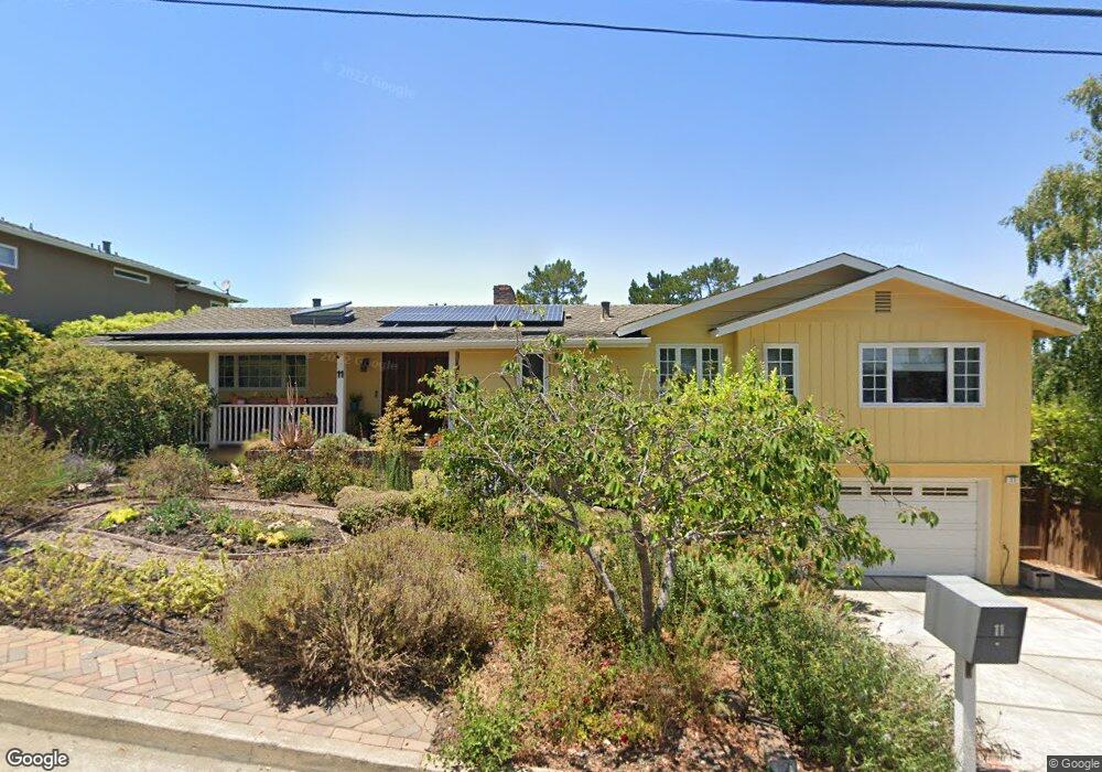
11 Kenmar Way Burlingame, CA 94010
Burlingame Hills NeighborhoodEstimated Value: $2,946,121 - $4,142,000
3
Beds
3
Baths
2,090
Sq Ft
$1,638/Sq Ft
Est. Value
About This Home
This home is located at 11 Kenmar Way, Burlingame, CA 94010 and is currently estimated at $3,423,030, approximately $1,637 per square foot. 11 Kenmar Way is a home located in San Mateo County with nearby schools including Hoover Elementary School, Burlingame Intermediate School, and Burlingame High School.
Ownership History
Date
Name
Owned For
Owner Type
Purchase Details
Closed on
Jul 25, 2022
Sold by
Revocabl John and Revocabl Letitia
Bought by
Gong Family Trust
Current Estimated Value
Purchase Details
Closed on
May 17, 2005
Sold by
Gong John W and Gong Letitia G
Bought by
Gong John and Gong Letitia Gail
Purchase Details
Closed on
Feb 19, 1999
Sold by
Kaplinsky David A and Kaplinsky H A
Bought by
Gong John W and Gong Letitia G
Home Financials for this Owner
Home Financials are based on the most recent Mortgage that was taken out on this home.
Original Mortgage
$380,000
Interest Rate
6.78%
Create a Home Valuation Report for This Property
The Home Valuation Report is an in-depth analysis detailing your home's value as well as a comparison with similar homes in the area
Home Values in the Area
Average Home Value in this Area
Purchase History
| Date | Buyer | Sale Price | Title Company |
|---|---|---|---|
| Gong Family Trust | -- | -- | |
| Gong John | -- | -- | |
| Gong John W | $772,500 | Old Republic Title Ins Compa |
Source: Public Records
Mortgage History
| Date | Status | Borrower | Loan Amount |
|---|---|---|---|
| Previous Owner | Gong John W | $380,000 |
Source: Public Records
Tax History
| Year | Tax Paid | Tax Assessment Tax Assessment Total Assessment is a certain percentage of the fair market value that is determined by local assessors to be the total taxable value of land and additions on the property. | Land | Improvement |
|---|---|---|---|---|
| 2025 | $13,788 | $1,210,264 | $605,132 | $605,132 |
| 2023 | $13,788 | $1,163,270 | $581,635 | $581,635 |
| 2022 | $13,296 | $1,140,462 | $570,231 | $570,231 |
| 2021 | $13,309 | $1,118,100 | $559,050 | $559,050 |
| 2020 | $13,032 | $1,106,636 | $553,318 | $553,318 |
| 2019 | $12,747 | $1,084,938 | $542,469 | $542,469 |
| 2018 | $12,505 | $1,063,666 | $531,833 | $531,833 |
| 2017 | $12,411 | $1,042,810 | $521,405 | $521,405 |
| 2016 | $11,956 | $1,022,364 | $511,182 | $511,182 |
| 2015 | $11,901 | $1,007,008 | $503,504 | $503,504 |
| 2014 | $11,726 | $987,284 | $493,642 | $493,642 |
Source: Public Records
Map
Nearby Homes
- 14 Kenmar Way
- 2620 Summit Dr
- 2734 Summit Dr
- 2900 Hillside Dr
- 2260 Summit Dr
- 1408 Alvarado Ave
- 1425 Benito Ave
- 3035 Canyon Rd
- 2323 Summit Dr
- 1308 Montero Ave
- 70 Tiptoe Ln
- 6 La Strada Ct
- 85 Fagan Dr
- 90 Fagan Dr
- 2930 Privet Dr
- 2950 Churchill Dr
- 1683 Escalante Way
- 1822 Sebastian Dr
- 1208 Bernal Ave
- 1550 Frontera Way Unit 319
- 9 Kenmar Way
- 13 Kenmar Way
- 20 El Quanito Way
- 18 El Quanito Way
- 7 Kenmar Way
- 10 Kenmar Way
- 12 Kenmar Way
- 8 Kenmar Way
- 15 Kenmar Way
- 23 El Quanito Way
- 25 El Quanito Way
- 16 El Quanito Way
- 5 Kenmar Way
- 16 Kenmar Way
- 6 Kenmar Way
- 21 El Quanito Way
- 19 El Quanito Way
- 14 El Quanito Way
- 2891 Canyon Rd
- 3 Kenmar Way
Your Personal Tour Guide
Ask me questions while you tour the home.