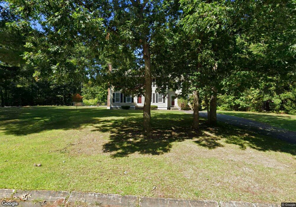
11 Kimberly Ln Dunstable, MA 01827
Estimated Value: $659,343 - $808,000
3
Beds
2
Baths
2,388
Sq Ft
$305/Sq Ft
Est. Value
About This Home
This home is located at 11 Kimberly Ln, Dunstable, MA 01827 and is currently estimated at $728,836, approximately $305 per square foot. 11 Kimberly Ln is a home located in Middlesex County with nearby schools including Groton Dunstable Regional High School, Pepperell Christian Academy, and Maple Dene & Moppet School.
Ownership History
Date
Name
Owned For
Owner Type
Purchase Details
Closed on
Sep 17, 2003
Sold by
Mcevoy Dennis H and Chandonnet Renee M
Bought by
Mcevoy Dennis H and Mcevoy Renee M
Current Estimated Value
Home Financials for this Owner
Home Financials are based on the most recent Mortgage that was taken out on this home.
Original Mortgage
$151,455
Interest Rate
6.31%
Mortgage Type
Purchase Money Mortgage
Purchase Details
Closed on
Jun 28, 1991
Sold by
Bentley Bldg Corp
Bought by
Mcevoy Dennis H and Mcevoy Renee Chandonnet
Home Financials for this Owner
Home Financials are based on the most recent Mortgage that was taken out on this home.
Original Mortgage
$130,000
Interest Rate
9.44%
Mortgage Type
Purchase Money Mortgage
Create a Home Valuation Report for This Property
The Home Valuation Report is an in-depth analysis detailing your home's value as well as a comparison with similar homes in the area
Home Values in the Area
Average Home Value in this Area
Purchase History
| Date | Buyer | Sale Price | Title Company |
|---|---|---|---|
| Mcevoy Dennis H | -- | -- | |
| Mcevoy Dennis H | $144,900 | -- | |
| Bentley Bldg Corp | $60,000 | -- |
Source: Public Records
Mortgage History
| Date | Status | Borrower | Loan Amount |
|---|---|---|---|
| Open | Bentley Bldg Corp | $165,000 | |
| Closed | Mcevoy Dennis H | $151,455 | |
| Previous Owner | Bentley Bldg Corp | $157,500 | |
| Previous Owner | Bentley Bldg Corp | $128,000 | |
| Previous Owner | Bentley Bldg Corp | $130,000 |
Source: Public Records
Tax History Compared to Growth
Tax History
| Year | Tax Paid | Tax Assessment Tax Assessment Total Assessment is a certain percentage of the fair market value that is determined by local assessors to be the total taxable value of land and additions on the property. | Land | Improvement |
|---|---|---|---|---|
| 2025 | $7,532 | $547,800 | $202,500 | $345,300 |
| 2024 | $7,191 | $515,100 | $186,900 | $328,200 |
| 2023 | $7,172 | $479,100 | $186,900 | $292,200 |
| 2022 | $6,684 | $438,300 | $186,900 | $251,400 |
| 2021 | $4,134 | $408,700 | $171,300 | $237,400 |
| 2020 | $13,062 | $391,000 | $163,500 | $227,500 |
| 2019 | $6,411 | $375,800 | $163,500 | $212,300 |
| 2018 | $6,311 | $359,800 | $163,500 | $196,300 |
| 2017 | $6,039 | $354,800 | $163,500 | $191,300 |
| 2016 | $5,877 | $355,100 | $163,500 | $191,600 |
| 2015 | $5,558 | $332,200 | $137,100 | $195,100 |
| 2014 | $5,239 | $332,200 | $137,100 | $195,100 |
Source: Public Records
Map
Nearby Homes
- 8 Jamie Rd
- 208 North St
- 452 River St
- 5 June St
- 46 Lowell Rd
- 23 Shawnee Rd Unit 23
- 319 Pleasant St
- 38 Tarbell St Unit 5B
- 9 Tarbell St
- 80A Nashua Rd
- 153 Off Pond St
- 28-30 Groton St
- 573 Longley Rd
- 139 Nashua Rd
- 31 Prospect St
- 660 Old Dunstable Rd
- 4 Parker Hill Way Unit C
- 147 Nashua Rd
- 8 Tucker Park Unit D
- 170 Nashua Rd
- 7 Kimberly Ln
- 6 Kimberly Ln
- 4 Kimberly Ln
- 9 Adams St
- 12 Kimberly Ln
- 15 Kimberly Ln
- 25 Adams St
- 16 Kimberly Ln
- 157 Lowell Rd
- 153 Lowell Rd
- 19 Kimberly Ln
- 155 Lowell Rd
- 20 Kimberly Ln
- 41 Adams St
- 149 Lowell Rd Unit 1
- 149 Lowell Rd
- 149 Lowell Rd Unit A
- 149 Lowell Rd Unit D
- 149 Lowell Rd Unit C
- 149 Lowell Rd Unit B