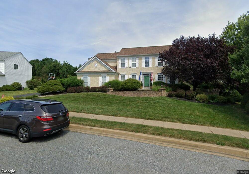
11 Longwood Ln Newark, DE 19711
Estimated Value: $632,101 - $764,000
3
Beds
3
Baths
2,527
Sq Ft
$267/Sq Ft
Est. Value
About This Home
This home is located at 11 Longwood Ln, Newark, DE 19711 and is currently estimated at $675,025, approximately $267 per square foot. 11 Longwood Ln is a home located in New Castle County with nearby schools including Downes (John R.) Elementary School, Shue-Medill Middle School, and Newark High School.
Ownership History
Date
Name
Owned For
Owner Type
Purchase Details
Closed on
Apr 11, 2013
Sold by
Baker Natalie Maria and Bedford Natalie Maria
Bought by
Natalie Maria Bedford Living Trust
Current Estimated Value
Purchase Details
Closed on
Mar 17, 2011
Sold by
Baker Natalie M
Bought by
Baker Natalie Maria and Natalie Maria Baker Living Tru
Purchase Details
Closed on
Aug 24, 2007
Sold by
Baker Michael J and Baker Natalie M
Bought by
Baker Natalie M
Home Financials for this Owner
Home Financials are based on the most recent Mortgage that was taken out on this home.
Original Mortgage
$360,000
Outstanding Balance
$227,817
Interest Rate
6.74%
Mortgage Type
New Conventional
Estimated Equity
$447,208
Purchase Details
Closed on
Dec 27, 2001
Sold by
Pulte Home Corp
Bought by
Baker Michael J and Baker Natalie M
Home Financials for this Owner
Home Financials are based on the most recent Mortgage that was taken out on this home.
Original Mortgage
$258,700
Interest Rate
7.15%
Create a Home Valuation Report for This Property
The Home Valuation Report is an in-depth analysis detailing your home's value as well as a comparison with similar homes in the area
Home Values in the Area
Average Home Value in this Area
Purchase History
| Date | Buyer | Sale Price | Title Company |
|---|---|---|---|
| Natalie Maria Bedford Living Trust | -- | None Available | |
| Baker Natalie Maria | -- | None Available | |
| Baker Natalie M | -- | None Available | |
| Baker Michael J | $287,340 | -- |
Source: Public Records
Mortgage History
| Date | Status | Borrower | Loan Amount |
|---|---|---|---|
| Open | Baker Natalie M | $360,000 | |
| Closed | Baker Michael J | $258,700 |
Source: Public Records
Tax History Compared to Growth
Tax History
| Year | Tax Paid | Tax Assessment Tax Assessment Total Assessment is a certain percentage of the fair market value that is determined by local assessors to be the total taxable value of land and additions on the property. | Land | Improvement |
|---|---|---|---|---|
| 2024 | $1,324 | $125,500 | $18,300 | $107,200 |
| 2023 | $4,538 | $125,500 | $18,300 | $107,200 |
| 2022 | $4,490 | $125,500 | $18,300 | $107,200 |
| 2021 | $4,375 | $125,500 | $18,300 | $107,200 |
| 2020 | $4,249 | $125,500 | $18,300 | $107,200 |
| 2019 | $3,725 | $125,500 | $18,300 | $107,200 |
| 2018 | $3,638 | $125,500 | $18,300 | $107,200 |
| 2017 | $3,530 | $125,500 | $18,300 | $107,200 |
| 2016 | $3,408 | $121,500 | $18,300 | $103,200 |
| 2015 | $3,055 | $121,500 | $18,300 | $103,200 |
| 2014 | $3,054 | $121,500 | $18,300 | $103,200 |
Source: Public Records
Map
Nearby Homes
- 211 Cullen Way
- 230 Aronimink Dr
- 6 Shenandoah Dr
- 335 Old Paper Mill Rd
- 123 Unami Trail
- 132 Osage Ln
- 324 Delaplane Ave
- 41 Fremont Rd
- 300 Capitol Trail
- 7 Warbler Ct
- 305 Poplar Ave
- 8 Peacock Place
- 311 Stamford Dr
- 33 Hummingbird Ln
- 109 Mulberry Rd
- 402 Stafford Ave
- 506 Cambridge Dr
- 47 Covered Bridge Ln
- 25 Brentwood Ln
- 344 Delaware Cir