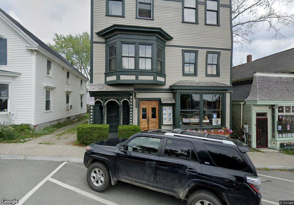
11 Main St Castine, ME 04421
Estimated Value: $577,095 - $862,000
Studio
--
Bath
--
Sq Ft
3,920
Sq Ft Lot
About This Home
This home is located at 11 Main St, Castine, ME 04421 and is currently estimated at $681,524. 11 Main St is a home with nearby schools including Adams School.
Create a Home Valuation Report for This Property
The Home Valuation Report is an in-depth analysis detailing your home's value as well as a comparison with similar homes in the area
Tax History
| Year | Tax Paid | Tax Assessment Tax Assessment Total Assessment is a certain percentage of the fair market value that is determined by local assessors to be the total taxable value of land and additions on the property. | Land | Improvement |
|---|---|---|---|---|
| 2025 | $4,587 | $424,700 | $149,900 | $274,800 |
| 2024 | $4,035 | $424,700 | $149,900 | $274,800 |
| 2023 | $3,801 | $322,100 | $113,500 | $208,600 |
| 2022 | $3,595 | $276,500 | $97,500 | $179,000 |
| 2021 | $3,152 | $276,500 | $97,500 | $179,000 |
| 2020 | $3,142 | $275,600 | $97,500 | $178,100 |
| 2019 | $1,114 | $272,100 | $97,500 | $174,600 |
| 2018 | $2,922 | $248,700 | $74,100 | $174,600 |
| 2017 | $2,914 | $248,000 | $74,100 | $173,900 |
| 2016 | $2,787 | $291,800 | $87,200 | $204,600 |
| 2015 | $2,787 | $291,800 | $87,200 | $204,600 |
| 2013 | $2,714 | $291,800 | $87,200 | $204,600 |
Source: Public Records
Map
Nearby Homes
- 15 Main St
- M17 L15 Battle Ave
- M17 L15 Perkins St
- 27 Windmill Hill Ln
- 21 La Tour St
- 79 Perkins St
- 26 Tidal Creek Rd
- 21 Harborside Rd
- 581 the Shore Rd
- 684 the Shore Rd
- 1552 Turtle Head Rd
- 1026 Castine Rd
- 1588 Turtle Head Rd
- 1446 Meadow Pond Rd
- 113 Wardwell Point Rd
- 11 S Cape Shore Unit C11
- 112 Rocky Point Rd
- 565 Bagaduce Rd
- 8 Clipper Ln
- 182 Dunbar Rd
Your Personal Tour Guide
Ask me questions while you tour the home.