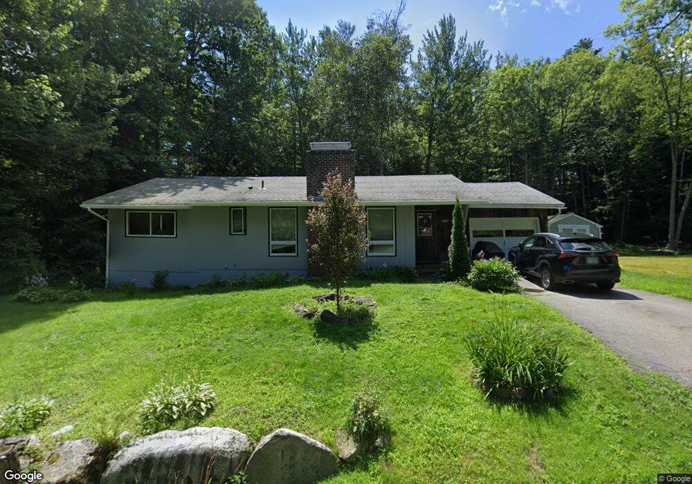
11 Maple St Plymouth, NH 03264
Estimated Value: $385,000 - $405,921
3
Beds
2
Baths
1,150
Sq Ft
$346/Sq Ft
Est. Value
About This Home
This home is located at 11 Maple St, Plymouth, NH 03264 and is currently estimated at $397,480, approximately $345 per square foot. 11 Maple St is a home located in Grafton County with nearby schools including Plymouth Elementary School, Plymouth Regional High School, and Plymouth State University CD & FC.
Ownership History
Date
Name
Owned For
Owner Type
Purchase Details
Closed on
Mar 6, 2025
Sold by
Emery Jeffrey P
Bought by
Kearney William P and Kearney Siobhan S
Current Estimated Value
Home Financials for this Owner
Home Financials are based on the most recent Mortgage that was taken out on this home.
Original Mortgage
$360,000
Outstanding Balance
$358,189
Interest Rate
6.96%
Mortgage Type
Purchase Money Mortgage
Estimated Equity
$39,291
Purchase Details
Closed on
Jul 20, 2009
Sold by
Currie Margaret K
Bought by
Emery 2Nd Jeffrey P
Home Financials for this Owner
Home Financials are based on the most recent Mortgage that was taken out on this home.
Original Mortgage
$148,265
Interest Rate
5.31%
Mortgage Type
Purchase Money Mortgage
Create a Home Valuation Report for This Property
The Home Valuation Report is an in-depth analysis detailing your home's value as well as a comparison with similar homes in the area
Home Values in the Area
Average Home Value in this Area
Purchase History
| Date | Buyer | Sale Price | Title Company |
|---|---|---|---|
| Kearney William P | $385,000 | None Available | |
| Kearney William P | $385,000 | None Available | |
| Emery 2Nd Jeffrey P | $151,000 | -- | |
| Emery 2Nd Jeffrey P | $151,000 | -- |
Source: Public Records
Mortgage History
| Date | Status | Borrower | Loan Amount |
|---|---|---|---|
| Open | Kearney William P | $360,000 | |
| Closed | Kearney William P | $360,000 | |
| Previous Owner | Emery 2Nd Jeffrey P | $148,265 | |
| Previous Owner | Emery 2Nd Jeffrey P | $250,500 |
Source: Public Records
Tax History Compared to Growth
Tax History
| Year | Tax Paid | Tax Assessment Tax Assessment Total Assessment is a certain percentage of the fair market value that is determined by local assessors to be the total taxable value of land and additions on the property. | Land | Improvement |
|---|---|---|---|---|
| 2024 | $6,823 | $271,600 | $92,900 | $178,700 |
| 2023 | $6,622 | $271,600 | $92,900 | $178,700 |
| 2022 | $5,191 | $165,100 | $46,400 | $118,700 |
| 2021 | $5,034 | $165,100 | $46,400 | $118,700 |
| 2020 | $4,704 | $165,100 | $46,400 | $118,700 |
| 2019 | $4,654 | $165,100 | $46,400 | $118,700 |
| 2018 | $4,681 | $165,000 | $46,400 | $118,600 |
| 2017 | $4,357 | $147,400 | $35,900 | $111,500 |
| 2016 | $3,710 | $147,400 | $35,900 | $111,500 |
| 2015 | $3,602 | $147,400 | $35,900 | $111,500 |
| 2014 | $3,527 | $147,400 | $35,900 | $111,500 |
| 2013 | $3,542 | $147,400 | $35,900 | $111,500 |
Source: Public Records
Map
Nearby Homes
- 0 Binks Hill Rd
- 10 Hawthorne St
- 2 Smith St
- 143 Highland St
- 30 Pleasant St
- 25 Wentworth St
- 9 Crawford St
- 28, 29 &42 Railroad & Main Square
- 21 Plaza Village Rd Unit B
- 263 Highland St
- 6 Boe Rd
- M 230 L 21&22 Thurlow St
- 0 Wooley Pasture Rd Unit 36
- 29 Reservoir Heights Rd
- 18 Wildflower Ln Unit 208-97-8-01
- 20 Wildflower Ln Unit 208-97-9-2
- 20 Wildflower Ln Unit 208-97-9-1
- 72 Crescent St
- 11 Clay Brook Dr
- 208 New Hebron Rd