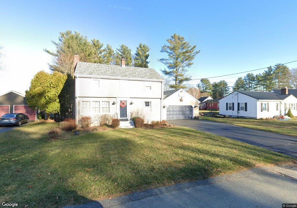
11 Marilyn Ave Westbrook, ME 04092
Estimated Value: $415,000 - $486,000
3
Beds
2
Baths
1,350
Sq Ft
$336/Sq Ft
Est. Value
About This Home
This home is located at 11 Marilyn Ave, Westbrook, ME 04092 and is currently estimated at $453,918, approximately $336 per square foot. 11 Marilyn Ave is a home located in Cumberland County with nearby schools including Westbrook High School, St. Brigid School, and Breakwater School.
Ownership History
Date
Name
Owned For
Owner Type
Purchase Details
Closed on
Mar 16, 2018
Sold by
Perry Philip E and Perry Janice C
Bought by
Pono Lenore C
Current Estimated Value
Home Financials for this Owner
Home Financials are based on the most recent Mortgage that was taken out on this home.
Original Mortgage
$250,000
Outstanding Balance
$213,412
Interest Rate
4.22%
Mortgage Type
New Conventional
Estimated Equity
$240,506
Create a Home Valuation Report for This Property
The Home Valuation Report is an in-depth analysis detailing your home's value as well as a comparison with similar homes in the area
Home Values in the Area
Average Home Value in this Area
Purchase History
| Date | Buyer | Sale Price | Title Company |
|---|---|---|---|
| Pono Lenore C | -- | -- |
Source: Public Records
Mortgage History
| Date | Status | Borrower | Loan Amount |
|---|---|---|---|
| Open | Pono Lenore C | $250,000 |
Source: Public Records
Tax History Compared to Growth
Tax History
| Year | Tax Paid | Tax Assessment Tax Assessment Total Assessment is a certain percentage of the fair market value that is determined by local assessors to be the total taxable value of land and additions on the property. | Land | Improvement |
|---|---|---|---|---|
| 2023 | $4,218 | $252,900 | $87,000 | $165,900 |
| 2022 | $3,821 | $211,100 | $72,500 | $138,600 |
| 2021 | $3,764 | $211,100 | $72,500 | $138,600 |
| 2020 | $2,168 | $210,600 | $72,500 | $138,100 |
| 2019 | $8,931 | $210,600 | $72,500 | $138,100 |
| 2018 | $3,929 | $182,600 | $63,000 | $119,600 |
| 2017 | $1,940 | $182,600 | $63,000 | $119,600 |
| 2016 | $3,360 | $182,600 | $63,000 | $119,600 |
| 2015 | $3,279 | $182,600 | $63,000 | $119,600 |
| 2014 | $3,141 | $182,600 | $63,000 | $119,600 |
| 2013 | $3,141 | $182,600 | $63,000 | $119,600 |
Source: Public Records
Map
Nearby Homes
- 317 Austin St Unit 7
- 11 Mayflower Rd
- 0 Reed St
- 56 Constitution Dr
- 155 Bridgton Rd
- 290 Bridgton Rd Unit 1
- 384 Austin St
- 128 Grandview Dr Unit 8
- 42 Villa Rd
- 7 Collins Place Unit 6
- 84 Hillside Rd
- 375 Bridgton Rd Unit 43
- 145 Brooks Edge Farm Rd Unit 66
- 151 Brooks Edge Farm Rd Unit 68
- 20 Elmwood Ave
- 7 Apex Dr Unit 2
- 5 Apex Dr Unit 1
- 33 Wilkie St
- 21 Castine Ave
- 171 Brook St Unit 41
- 17 Marilyn Ave
- 3 Marilyn Ave
- 37 Pine View Rd
- 23 Marilyn Ave
- 31 Pine View Rd
- 65 Woodland Rd
- 4 Marilyn Ave
- 12 Marilyn Ave
- 16 Marilyn Ave
- 25 Pine View Rd
- 37 Woodland Rd
- 54 Woodland Rd
- 73 Woodland Rd
- 46 Pine View Rd
- 62 Woodland Rd
- 40 Pine View Rd
- 54 Pine View Rd
- 21 Pine View Rd
- 34 Pine View Rd
- 27 Woodland Rd