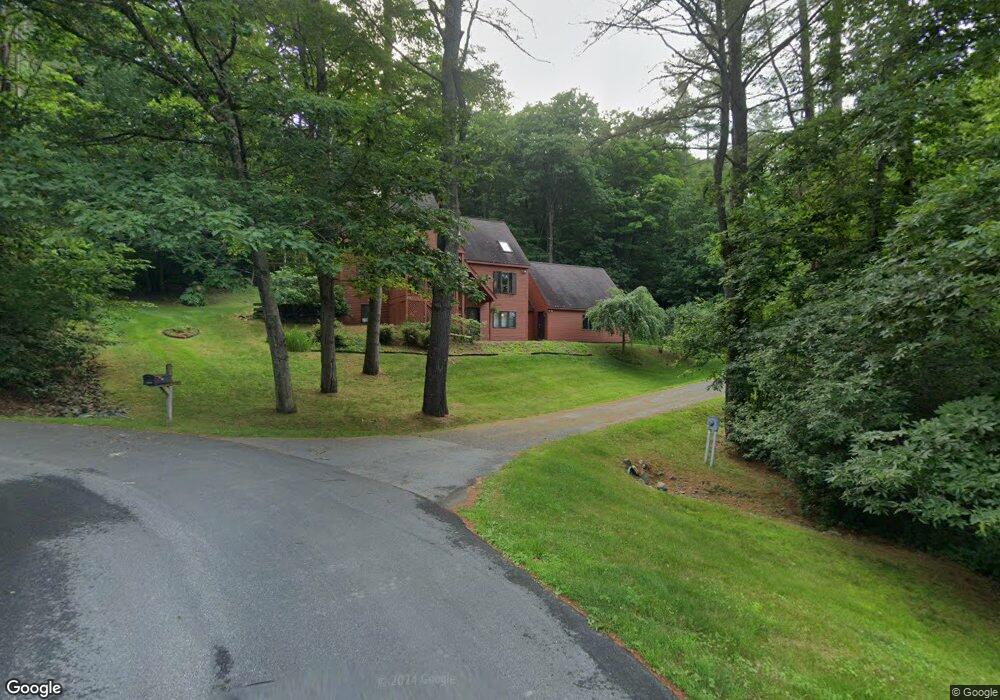
11 Morrison Rd Hanover, NH 03755
Estimated Value: $912,000 - $1,064,000
4
Beds
3
Baths
1,770
Sq Ft
$553/Sq Ft
Est. Value
About This Home
This home is located at 11 Morrison Rd, Hanover, NH 03755 and is currently estimated at $977,928, approximately $552 per square foot. 11 Morrison Rd is a home located in Grafton County with nearby schools including Bernice A. Ray School, Frances C. Richmond School, and Hanover High School.
Ownership History
Date
Name
Owned For
Owner Type
Purchase Details
Closed on
Sep 3, 2013
Sold by
Dartmouth College
Bought by
Wright Kevin C and Wright Dana L
Current Estimated Value
Purchase Details
Closed on
Jul 11, 2013
Sold by
Kavanagh John F and Kavanagh Ellen
Bought by
Dartmouth College
Create a Home Valuation Report for This Property
The Home Valuation Report is an in-depth analysis detailing your home's value as well as a comparison with similar homes in the area
Home Values in the Area
Average Home Value in this Area
Purchase History
| Date | Buyer | Sale Price | Title Company |
|---|---|---|---|
| Wright Kevin C | $389,000 | -- | |
| Wright Kevin C | $389,000 | -- | |
| Dartmouth College | $370,700 | -- | |
| Dartmouth College | $370,700 | -- |
Source: Public Records
Mortgage History
| Date | Status | Borrower | Loan Amount |
|---|---|---|---|
| Previous Owner | Dartmouth College | $393,000 | |
| Previous Owner | Dartmouth College | $393,600 | |
| Closed | Dartmouth College | $0 |
Source: Public Records
Tax History
| Year | Tax Paid | Tax Assessment Tax Assessment Total Assessment is a certain percentage of the fair market value that is determined by local assessors to be the total taxable value of land and additions on the property. | Land | Improvement |
|---|---|---|---|---|
| 2024 | $10,637 | $552,000 | $160,000 | $392,000 |
| 2023 | $10,234 | $552,000 | $160,000 | $392,000 |
| 2022 | $9,820 | $552,000 | $160,000 | $392,000 |
| 2021 | $9,737 | $552,000 | $160,000 | $392,000 |
| 2020 | $8,151 | $403,300 | $85,500 | $317,800 |
| 2019 | $8,038 | $403,300 | $85,500 | $317,800 |
| 2018 | $7,755 | $403,300 | $85,500 | $317,800 |
| 2017 | $8,058 | $371,500 | $97,700 | $273,800 |
| 2016 | $7,909 | $371,500 | $97,700 | $273,800 |
| 2015 | $7,757 | $371,500 | $97,700 | $273,800 |
| 2014 | $7,441 | $371,500 | $97,700 | $273,800 |
| 2013 | $7,174 | $371,500 | $97,700 | $273,800 |
| 2012 | $6,740 | $364,500 | $102,700 | $261,800 |
Source: Public Records
Map
Nearby Homes
- 25 Hemlock Rd
- 4 Haskins Rd
- 53 Lyme Rd Unit 35
- 26 Low Rd
- 126 Brook Hollow
- 37 Low Rd
- 33 E Wheelock St
- 2 Hilton Field Ln
- 0 U S 5
- 51 Loveland Rd
- 32 Melview Ridge
- 85 Lebanon St
- 4 Occom Ridge
- 23 School St
- 7 Birchbrook St
- 195 Willey Hill Rd
- 253 Main St
- 34 Stevens Rd
- 00 Bradley Hill Rd Unit 121
- 16 Olcott Rd
- 9 Morrison Rd
- 7 Morrison Rd
- 14 Morrison Rd
- 6 Morrison Rd
- 10 Macdonald Dr
- 14 Macdonald Dr
- 12 Morrison Rd
- 12 Macdonald Dr
- 18 Grasse Rd
- 4 Morrison Rd
- 12 Grasse Rd
- 16 Macdonald Dr
- 2 Macdonald Dr
- 11 Macdonald Dr
- 15 Macdonald Dr
- 18 Macdonald Dr
- 17 Macdonald Dr
- 1 Macdonald Dr
- 20 Macdonald Dr
- 19 Macdonald Dr
Your Personal Tour Guide
Ask me questions while you tour the home.