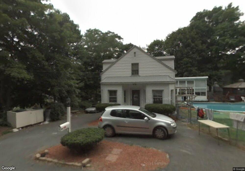
11 Newton St Shrewsbury, MA 01545
Estimated Value: $473,000 - $620,000
4
Beds
1
Bath
2,000
Sq Ft
$278/Sq Ft
Est. Value
About This Home
This home is located at 11 Newton St, Shrewsbury, MA 01545 and is currently estimated at $555,262, approximately $277 per square foot. 11 Newton St is a home located in Worcester County with nearby schools including Sherwood Middle School, Floral Street School, and Oak Middle School.
Ownership History
Date
Name
Owned For
Owner Type
Purchase Details
Closed on
Oct 22, 2024
Sold by
Brownell Lorrie L
Bought by
Lorrie L Brownell Ft and Brownell
Current Estimated Value
Purchase Details
Closed on
Sep 11, 2000
Sold by
Brownell Ronald W
Bought by
Brownell Lorrie
Create a Home Valuation Report for This Property
The Home Valuation Report is an in-depth analysis detailing your home's value as well as a comparison with similar homes in the area
Home Values in the Area
Average Home Value in this Area
Purchase History
| Date | Buyer | Sale Price | Title Company |
|---|---|---|---|
| Lorrie L Brownell Ft | -- | None Available | |
| Lorrie L Brownell Ft | -- | None Available | |
| Lorrie L Brownell Ft | -- | None Available | |
| Brownell Lorrie | $145,000 | -- | |
| Brownell Lorrie | $145,000 | -- |
Source: Public Records
Mortgage History
| Date | Status | Borrower | Loan Amount |
|---|---|---|---|
| Previous Owner | Brownell Lorrie | $228,000 | |
| Previous Owner | Brownell Lorrie | $37,400 | |
| Previous Owner | Brownell Lorrie | $135,000 |
Source: Public Records
Tax History Compared to Growth
Tax History
| Year | Tax Paid | Tax Assessment Tax Assessment Total Assessment is a certain percentage of the fair market value that is determined by local assessors to be the total taxable value of land and additions on the property. | Land | Improvement |
|---|---|---|---|---|
| 2025 | $52 | $433,700 | $233,800 | $199,900 |
| 2024 | $4,815 | $388,900 | $222,600 | $166,300 |
| 2023 | $4,639 | $353,600 | $222,600 | $131,000 |
| 2022 | $4,713 | $334,000 | $193,600 | $140,400 |
| 2021 | $3,907 | $296,200 | $180,000 | $116,200 |
| 2020 | $3,863 | $309,800 | $193,600 | $116,200 |
| 2019 | $3,535 | $281,200 | $166,100 | $115,100 |
| 2018 | $3,446 | $272,200 | $151,000 | $121,200 |
| 2017 | $3,172 | $247,200 | $136,800 | $110,400 |
| 2016 | $2,688 | $206,800 | $127,800 | $79,000 |
| 2015 | $2,507 | $189,900 | $109,100 | $80,800 |
Source: Public Records
Map
Nearby Homes
- 31 Oak St
- 15 Conifer Cir Unit 31
- 5 Conifer Cir Unit 28
- 3 Conifer Cir Unit 29
- 315 Maple Ave
- 129 A-B Maple Ave
- 43 Harriet Ave
- 25 Harriet Ave
- 26 Williamsburg Ct Unit 22
- 20 Williamsburg Ct Unit 21
- 21 Fiske St
- 9 Heritage St
- 33 Shady Lane Ave
- 129 Maple Ave
- 6 Selina St
- 175 Oak St
- 10 Gleason Rd
- 307 Main St
- 7 Tern Dr
- 102 Harrington Farms Way