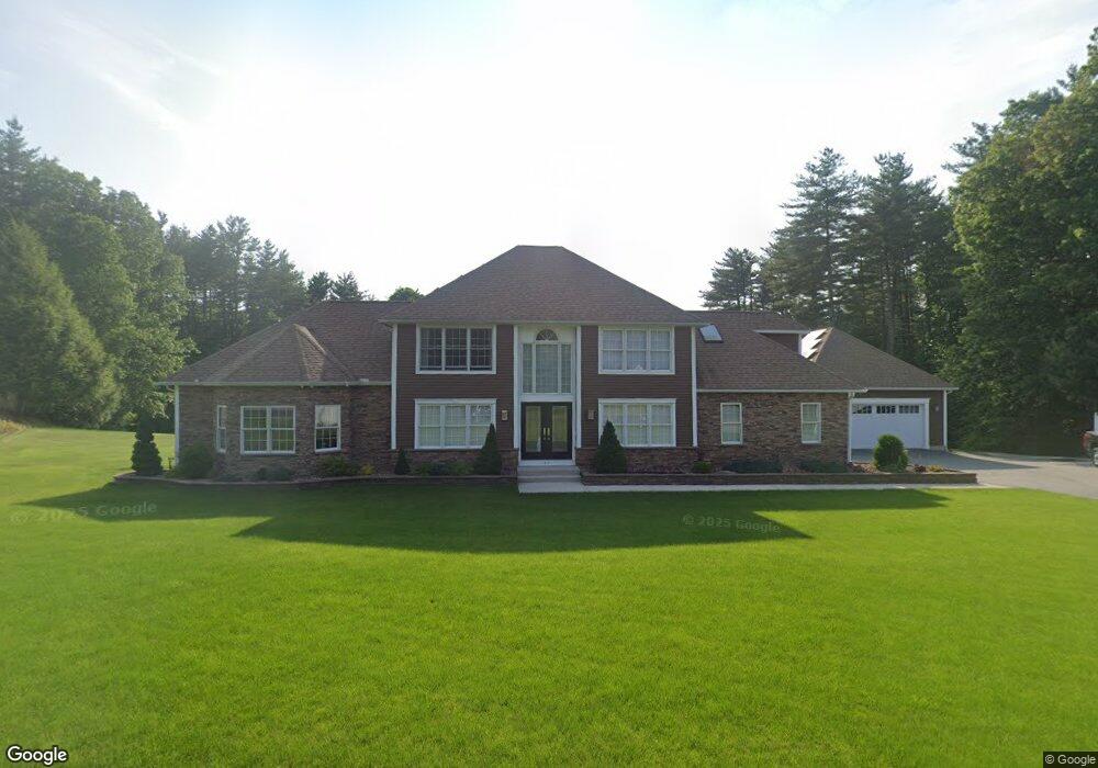
11 Nicole Cir Southampton, MA 01073
Estimated Value: $672,000 - $756,434
4
Beds
3
Baths
2,892
Sq Ft
$247/Sq Ft
Est. Value
About This Home
This home is located at 11 Nicole Cir, Southampton, MA 01073 and is currently estimated at $713,359, approximately $246 per square foot. 11 Nicole Cir is a home located in Hampshire County with nearby schools including William E Norris School, White Oak School, and Westfield Christian Academy.
Ownership History
Date
Name
Owned For
Owner Type
Purchase Details
Closed on
Dec 6, 2017
Sold by
Kasa Kazimierz J and Kasa Susan M
Bought by
Kazimierz J Kasa Ret
Current Estimated Value
Purchase Details
Closed on
Jan 23, 1998
Sold by
Gwinner Edward H
Bought by
Kasa Kazimierz J and Kasa Susan M
Home Financials for this Owner
Home Financials are based on the most recent Mortgage that was taken out on this home.
Original Mortgage
$170,000
Interest Rate
7.11%
Mortgage Type
Purchase Money Mortgage
Create a Home Valuation Report for This Property
The Home Valuation Report is an in-depth analysis detailing your home's value as well as a comparison with similar homes in the area
Home Values in the Area
Average Home Value in this Area
Purchase History
| Date | Buyer | Sale Price | Title Company |
|---|---|---|---|
| Kazimierz J Kasa Ret | -- | -- | |
| Kasa Kazimierz J | $205,000 | -- |
Source: Public Records
Mortgage History
| Date | Status | Borrower | Loan Amount |
|---|---|---|---|
| Previous Owner | Kasa Kazimierz J | $180,000 | |
| Previous Owner | Kasa Kazimierz J | $30,000 | |
| Previous Owner | Kasa Kazimierz J | $170,000 |
Source: Public Records
Tax History Compared to Growth
Tax History
| Year | Tax Paid | Tax Assessment Tax Assessment Total Assessment is a certain percentage of the fair market value that is determined by local assessors to be the total taxable value of land and additions on the property. | Land | Improvement |
|---|---|---|---|---|
| 2025 | $9,756 | $688,500 | $131,700 | $556,800 |
| 2024 | $9,492 | $666,100 | $131,700 | $534,400 |
| 2023 | $8,862 | $618,400 | $131,700 | $486,700 |
| 2022 | $8,402 | $557,500 | $127,100 | $430,400 |
| 2021 | $4,192 | $505,000 | $119,700 | $385,300 |
| 2020 | $4,161 | $505,000 | $119,700 | $385,300 |
| 2019 | $5,638 | $450,500 | $119,700 | $330,800 |
| 2018 | $7,171 | $419,300 | $108,400 | $310,900 |
| 2017 | $6,843 | $419,300 | $108,400 | $310,900 |
| 2015 | $5,659 | $360,200 | $104,800 | $255,400 |
Source: Public Records
Map
Nearby Homes
- 369 College Hwy
- Lot 57 White Loaf Rd
- Lot 5 Brickyard Rd
- 119 Brickyard Rd
- 150 Middle Rd
- 94 Pequot Rd (Rear)
- 4 Fitch Farm Way
- 64 Old Stage Rd
- 36 County Rd
- Lot 5 Gil Farm Rd
- Lot 6 Gil Farm Rd
- 216 College Hwy
- 405 Rock Valley Rd
- 103 Dupuis Rd
- 0 Char Dr
- 117 Russellville Rd
- 14 Eastwood Dr
- 868 Southampton Rd Unit 18
- 22 Eastwood Ln
- 336 Russellville Rd