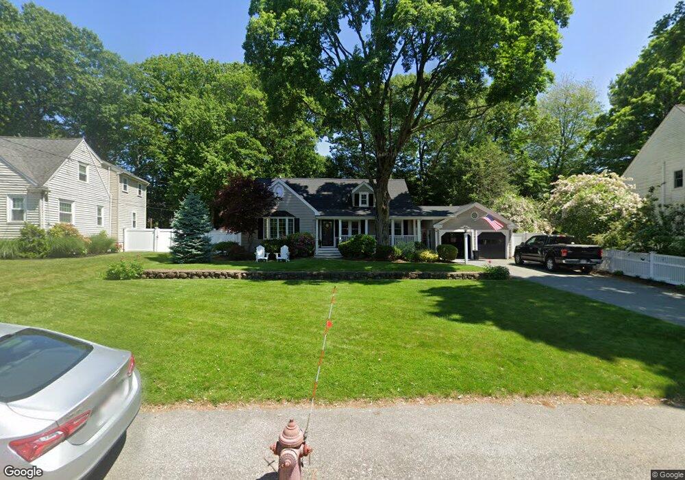
11 Reynolds St Canton, MA 02021
Estimated Value: $724,000 - $980,000
4
Beds
2
Baths
2,316
Sq Ft
$366/Sq Ft
Est. Value
About This Home
This home is located at 11 Reynolds St, Canton, MA 02021 and is currently estimated at $846,530, approximately $365 per square foot. 11 Reynolds St is a home located in Norfolk County with nearby schools including St. John the Evangelist School and Chabad Day School of School.
Ownership History
Date
Name
Owned For
Owner Type
Purchase Details
Closed on
Oct 9, 2025
Sold by
Ragusa Douglas P and Ragusa Deborah A
Bought by
11 Reynolds St Rt and Ragusa
Current Estimated Value
Purchase Details
Closed on
Aug 31, 1999
Sold by
Giampietro Ann M
Bought by
Ragusa Douglas P and Ragusa Deborah A
Create a Home Valuation Report for This Property
The Home Valuation Report is an in-depth analysis detailing your home's value as well as a comparison with similar homes in the area
Home Values in the Area
Average Home Value in this Area
Purchase History
| Date | Buyer | Sale Price | Title Company |
|---|---|---|---|
| 11 Reynolds St Rt | -- | -- | |
| Ragusa Douglas P | $280,000 | -- |
Source: Public Records
Mortgage History
| Date | Status | Borrower | Loan Amount |
|---|---|---|---|
| Previous Owner | Ragusa Douglas P | $227,000 | |
| Previous Owner | Ragusa Douglas P | $219,000 |
Source: Public Records
Tax History Compared to Growth
Tax History
| Year | Tax Paid | Tax Assessment Tax Assessment Total Assessment is a certain percentage of the fair market value that is determined by local assessors to be the total taxable value of land and additions on the property. | Land | Improvement |
|---|---|---|---|---|
| 2025 | $7,889 | $797,700 | $326,300 | $471,400 |
| 2024 | $7,933 | $795,700 | $342,300 | $453,400 |
| 2023 | $7,809 | $738,800 | $342,300 | $396,500 |
| 2022 | $7,490 | $659,900 | $326,000 | $333,900 |
| 2021 | $6,989 | $572,900 | $271,700 | $301,200 |
| 2020 | $6,725 | $549,900 | $258,700 | $291,200 |
| 2019 | $6,672 | $538,100 | $235,200 | $302,900 |
| 2018 | $6,480 | $521,700 | $226,100 | $295,600 |
| 2017 | $6,598 | $515,900 | $221,700 | $294,200 |
| 2016 | $6,299 | $492,500 | $216,300 | $276,200 |
| 2015 | $6,009 | $468,700 | $210,000 | $258,700 |
Source: Public Records
Map
Nearby Homes
- 919 Washington St
- 780 Washington St Unit 780
- 50 Coppersmith Way Unit 211
- 30 Coppersmith Way Unit 409
- 30 Coppersmith Way Unit 301
- 30 Coppersmith Way Unit 112
- 30 Coppersmith Way Unit 206
- 30 Coppersmith Way Unit 110
- 30 Coppersmith Way Unit 113
- 30 Coppersmith Way Unit 104
- 30 Coppersmith Way Unit 213
- 30 Coppersmith Way Unit 407
- 30 Coppersmith Way Unit 311
- 30 Coppersmith Way Unit 201
- 30 Coppersmith Way Unit 107
- 30 Coppersmith Way Unit 204
- 30 Coppersmith Way Unit 111
- 30 Coppersmith Way Unit 505
- 30 Coppersmith Way Unit 510
- 16 Danforth St