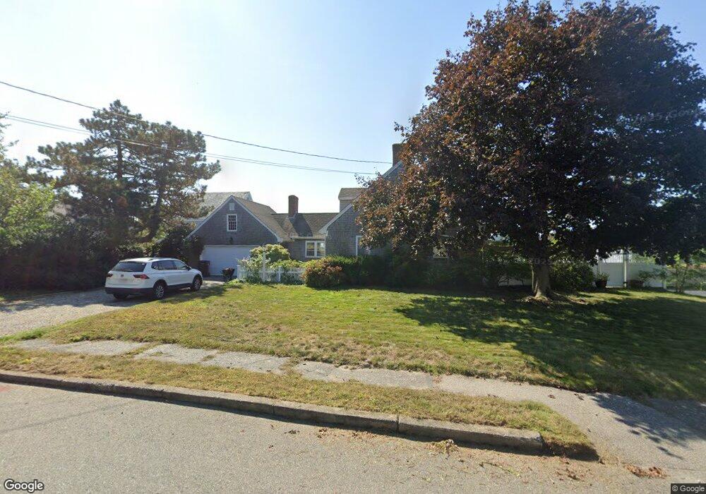
11 Roberts Dr Scituate, MA 02066
Estimated Value: $1,370,899 - $1,957,000
4
Beds
3
Baths
1,764
Sq Ft
$947/Sq Ft
Est. Value
About This Home
This home is located at 11 Roberts Dr, Scituate, MA 02066 and is currently estimated at $1,670,975, approximately $947 per square foot. 11 Roberts Dr is a home located in Plymouth County with nearby schools including Jenkins Elementary School, Lester J. Gates Middle School, and Scituate High School.
Ownership History
Date
Name
Owned For
Owner Type
Purchase Details
Closed on
Nov 5, 2014
Sold by
Detore Katharine B and Detore John A
Bought by
Detore Katharine B
Current Estimated Value
Purchase Details
Closed on
Sep 16, 2013
Sold by
Cheverie William R and Cheverie Jane E
Bought by
Detore Katharine B and Detore John A
Home Financials for this Owner
Home Financials are based on the most recent Mortgage that was taken out on this home.
Original Mortgage
$588,750
Interest Rate
4%
Mortgage Type
Adjustable Rate Mortgage/ARM
Purchase Details
Closed on
Oct 30, 1987
Sold by
Cheverie William R
Bought by
Cheverie William R
Create a Home Valuation Report for This Property
The Home Valuation Report is an in-depth analysis detailing your home's value as well as a comparison with similar homes in the area
Home Values in the Area
Average Home Value in this Area
Purchase History
| Date | Buyer | Sale Price | Title Company |
|---|---|---|---|
| Detore Katharine B | -- | -- | |
| Detore Katharine B | $785,000 | -- | |
| Cheverie William R | $422,000 | -- |
Source: Public Records
Mortgage History
| Date | Status | Borrower | Loan Amount |
|---|---|---|---|
| Previous Owner | Detore Katharine B | $588,750 | |
| Previous Owner | Cheverie William R | $260,000 | |
| Previous Owner | Cheverie William R | $207,000 | |
| Previous Owner | Cheverie William R | $261,000 |
Source: Public Records
Tax History
| Year | Tax Paid | Tax Assessment Tax Assessment Total Assessment is a certain percentage of the fair market value that is determined by local assessors to be the total taxable value of land and additions on the property. | Land | Improvement |
|---|---|---|---|---|
| 2025 | $13,582 | $1,359,600 | $858,100 | $501,500 |
| 2024 | $13,250 | $1,279,000 | $816,300 | $462,700 |
| 2023 | $12,485 | $1,175,800 | $758,600 | $417,200 |
| 2022 | $12,485 | $989,300 | $637,600 | $351,700 |
| 2021 | $12,072 | $905,600 | $607,200 | $298,400 |
| 2020 | $11,775 | $872,200 | $583,800 | $288,400 |
| 2019 | $10,584 | $770,300 | $497,700 | $272,600 |
| 2018 | $10,421 | $747,000 | $493,000 | $254,000 |
| 2017 | $10,229 | $726,000 | $472,000 | $254,000 |
| 2016 | $10,112 | $715,100 | $461,100 | $254,000 |
| 2015 | $9,094 | $694,200 | $440,200 | $254,000 |
Source: Public Records
Map
Nearby Homes
- 23 Sunset Rd
- 91 Front St Unit 106
- 25 Morton Place
- 32 Barker Rd Unit 3
- 50 First Parish Rd
- 12 Richfield Rd
- 76 A Brook St
- 76 A Brook St Unit 1
- 46 Tilden Rd
- 86 Hatherly Rd
- 105 Turner Rd
- 23 Oceanside Dr
- 33 Oceanside Dr
- 92 Marion Rd
- 59 Greenfield Ln
- 40 Driftway Unit 27
- 40 Driftway Unit 13
- 2 Collier Rd
- 111 Elm St
- 115 Elm St
- 7 Roberts Dr
- 14 Conroy Terrace
- 10 Roberts Dr
- 6 Roberts Dr
- 3 Roberts Dr
- 16 Roberts Dr
- 19 Roberts Dr
- 155 Edward Foster Rd
- 165 Edward Foster Rd
- 7 Sunset Rd
- 15 Sunset Rd
- 143 Edward Foster Rd
- 11 Conroy Terrace
- 19 Sunset Rd
- 169 Edward Foster Rd
- 149 Edward Foster Rd
- 160 Edward Foster Rd
- 139 Edward Foster Rd
- 10 Sunset Rd
- 10 Sunset Rd