
11 Sanford Loop Lumpkin, GA 31815
Estimated payment $1,521/month
Highlights
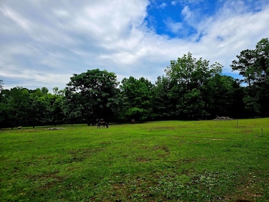
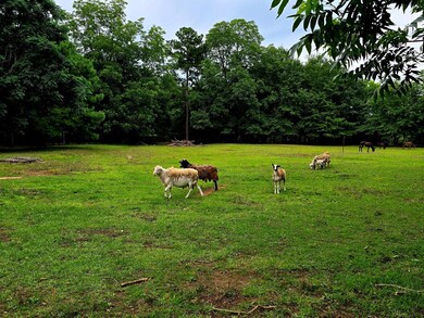
- Horses Allowed On Property
- Wooded Lot
- Pasture
- 2,491,632 Sq Ft lot
- No HOA
- Timber
About This Lot
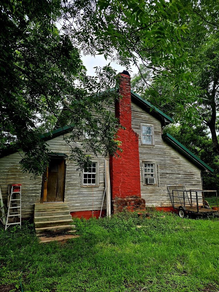
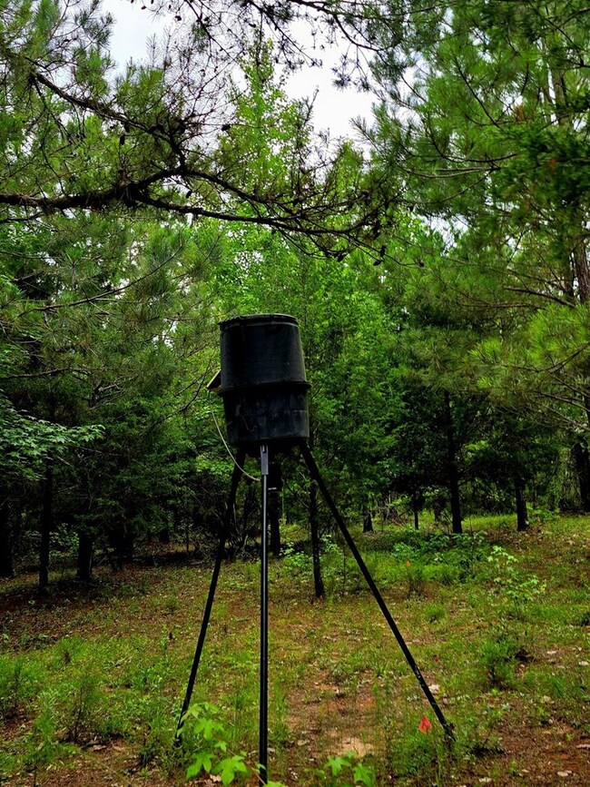
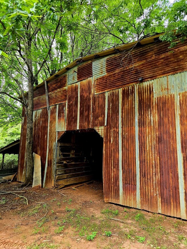
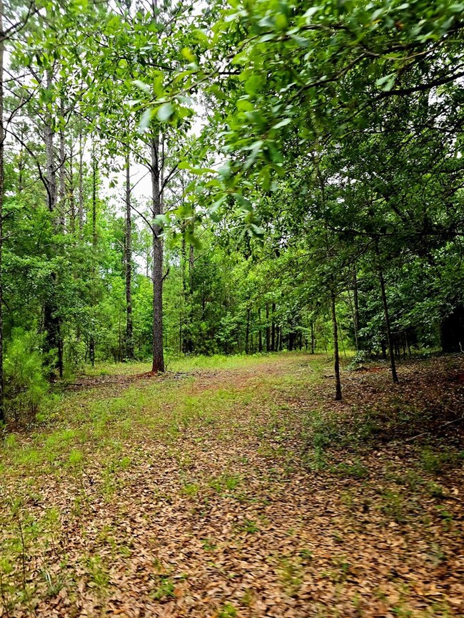
Endless Possibilities on 57.2 Acres – A Hunter's Paradise with Historic Charm. Beautiful, fenced-in land offering potential for recreational or agricultural use. Ideal for hunting deer, hogs, and turkey, this property features a mix of open pasture and mature hardwoods, including 200-year-old pecan trees, chestnut, and black walnut trees. The historic home on site is equipped with power, water, a septic tank, and a 200-ft well. Solar panels were added in 2023. Additional structures include an old barn and a chicken coop—perfect for farming or homesteading. The open pastures are suitable for horses or livestock. Located just 30 minutes from Harmony Church Road and Fort Benning and 15 min from Eufaula.
Listing Agent
RE/MAX Champions Brokerage Phone: 7065961339 License #72531 Listed on: 06/27/2025

Property Details
Property Type
- Land
Est. Annual Taxes
- $694
Lot Details
- 57.2 Acre Lot
- Property fronts a state road
- Dirt Road
- Fenced
- Cleared Lot
- Wooded Lot
Farming
- Timber
- Pasture
Horse Facilities and Amenities
- Horses Allowed On Property
Utilities
- Well
- Septic Tank
Listing and Financial Details
- Assessor Parcel Number 021 007
Community Details
Overview
- No Home Owners Association
Recreation
- Outbuilding
Map
Home Values in the Area
Average Home Value in this Area
Tax History
| Year | Tax Paid | Tax Assessment Tax Assessment Total Assessment is a certain percentage of the fair market value that is determined by local assessors to be the total taxable value of land and additions on the property. | Land | Improvement |
|---|---|---|---|---|
| 2024 | $694 | $55,200 | $43,920 | $11,280 |
| 2023 | $688 | $55,200 | $43,920 | $11,280 |
| 2022 | $618 | $37,760 | $28,800 | $8,960 |
| 2021 | $605 | $37,760 | $28,800 | $8,960 |
| 2020 | $595 | $37,760 | $28,800 | $8,960 |
| 2019 | $1,006 | $37,760 | $28,800 | $8,960 |
| 2018 | $575 | $37,760 | $28,800 | $8,960 |
| 2017 | $566 | $37,760 | $28,800 | $8,960 |
| 2016 | $556 | $37,760 | $28,800 | $8,960 |
| 2015 | -- | $37,760 | $28,800 | $8,960 |
| 2013 | -- | $37,760 | $28,800 | $8,960 |
Property History
| Date | Event | Price | List to Sale | Price per Sq Ft |
|---|---|---|---|---|
| 07/21/2025 07/21/25 | Pending | -- | -- | -- |
| 06/27/2025 06/27/25 | For Sale | $275,000 | -- | -- |
Purchase History
| Date | Type | Sale Price | Title Company |
|---|---|---|---|
| Warranty Deed | -- | -- | |
| Warranty Deed | $110,000 | -- | |
| Deed | $125,000 | -- |
Mortgage History
| Date | Status | Loan Amount | Loan Type |
|---|---|---|---|
| Open | $34,570 | New Conventional |
Source: Columbus Board of REALTORS® (GA)
MLS Number: 221896
APN: 021-007
Disclaimer: Certain information contained herein is derived from information provided by parties other than Homes.com. All information provided is deemed reliable, but is not guaranteed to be accurate and should be independently verified.
![]() IDX information is provided exclusively for personal, non-commercial use, and may not be used for any purpose other than to identify prospective properties consumers may be interested in purchasing. Information is deemed reliable but not guaranteed.
IDX information is provided exclusively for personal, non-commercial use, and may not be used for any purpose other than to identify prospective properties consumers may be interested in purchasing. Information is deemed reliable but not guaranteed.
- 0 California Woods Rd
- 513 Bo Cannington Rd
- 0 Hwy 27 Highway 27
- 0 Canyon Rd
- 2160 Herndon Rd
- 0 County Line Rd
- 37 Hillcrest Rd
- 683 Union Church Rd Unit LotWP001
- 683 Union Church Rd
- 0 Thomas Rd
- 367 Broad St
- 247 Alabama 165
- 247 Highway 165
- 235 Alabama 165
- XX1 US 27
- 0 Us Highway 27
- Lumpkin Bypass Us Highway 27
- 0 Humber Ave
- 0 Watson Spur Rd Unit 189883
- 0 Watson Spur Rd Unit 20115025