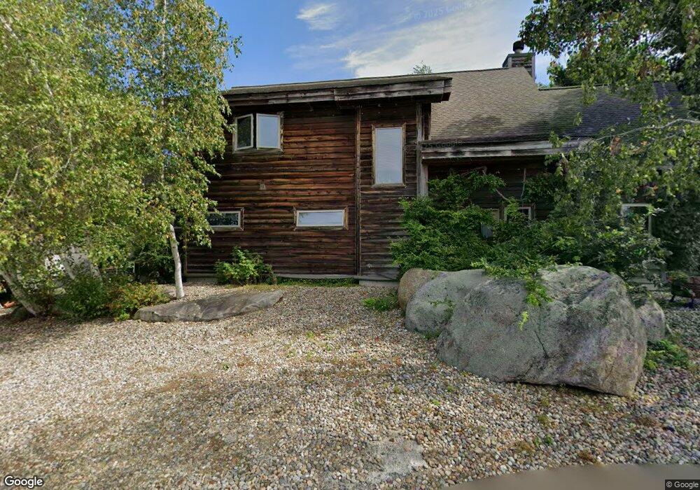
11 Squam Ln Gloucester, MA 01930
Riverview NeighborhoodEstimated Value: $854,000 - $1,207,000
3
Beds
3
Baths
2,271
Sq Ft
$454/Sq Ft
Est. Value
About This Home
This home is located at 11 Squam Ln, Gloucester, MA 01930 and is currently estimated at $1,031,859, approximately $454 per square foot. 11 Squam Ln is a home located in Essex County with nearby schools including Plum Cove School, Ralph B O'maley Middle School, and Gloucester High School.
Ownership History
Date
Name
Owned For
Owner Type
Purchase Details
Closed on
May 25, 2012
Sold by
Keefe Joan E and Keefe Robert J
Bought by
Keefe Ft
Current Estimated Value
Home Financials for this Owner
Home Financials are based on the most recent Mortgage that was taken out on this home.
Original Mortgage
$266,000
Interest Rate
3.89%
Purchase Details
Closed on
Jan 31, 2000
Sold by
Boston Skyline Lp
Bought by
Keefe Robert J and Keefe Joan E
Create a Home Valuation Report for This Property
The Home Valuation Report is an in-depth analysis detailing your home's value as well as a comparison with similar homes in the area
Home Values in the Area
Average Home Value in this Area
Purchase History
| Date | Buyer | Sale Price | Title Company |
|---|---|---|---|
| Keefe Ft | -- | -- | |
| Keefe Robert J | $115,000 | -- |
Source: Public Records
Mortgage History
| Date | Status | Borrower | Loan Amount |
|---|---|---|---|
| Open | Keefe Robert J | $268,000 | |
| Closed | Keefe Robert J | $266,000 | |
| Previous Owner | Keefe Robert J | $270,000 |
Source: Public Records
Tax History
| Year | Tax Paid | Tax Assessment Tax Assessment Total Assessment is a certain percentage of the fair market value that is determined by local assessors to be the total taxable value of land and additions on the property. | Land | Improvement |
|---|---|---|---|---|
| 2025 | $9,752 | $1,003,300 | $345,900 | $657,400 |
| 2024 | $9,172 | $942,700 | $329,200 | $613,500 |
| 2023 | $8,561 | $808,400 | $293,800 | $514,600 |
| 2022 | $8,141 | $694,000 | $249,600 | $444,400 |
| 2021 | $7,863 | $632,100 | $227,500 | $404,600 |
| 2020 | $7,980 | $647,200 | $227,500 | $419,700 |
| 2019 | $8,292 | $653,400 | $227,500 | $425,900 |
| 2018 | $7,776 | $601,400 | $227,500 | $373,900 |
| 2017 | $7,787 | $590,400 | $216,500 | $373,900 |
| 2016 | $7,586 | $557,400 | $217,000 | $340,400 |
| 2015 | $7,299 | $534,700 | $217,000 | $317,700 |
Source: Public Records
Map
Nearby Homes
- 13 Honeysuckle Rd
- 31 Echo Ave
- 3 Rockland St
- 3 Deacon Farm Ln
- 6 Monroe Ct
- 145 Essex Ave Unit 402
- 5 Samoset Rd Unit B
- 24 Cobblestone Ln Unit 603
- 13 Mystic Ave
- 8 Mystic Ave
- 5 Lepage Ln
- 98 Maplewood Ave
- 15 Harvard St
- 2 Breezy Point Rd
- 9 Cleveland Place
- 12 Arthur St
- 120 Washington St
- 13 Leslie o Johnson Rd
- 20 Beacon St
- 20 Beacon St Unit 2
- 12 Squam Lane: Winter Unit 1
- 10 Squam Ln
- 12 Squam Ln Unit 2
- 12 Squam Ln Unit 1
- 8 Squam Ln
- 36 Riverview Rd Unit 36R
- 36 Riverview Rd
- 6 Squam Ln
- 15 Perrywinkle Ln
- 107 Riverview Rd Unit 2
- 107 Riverview Rd Unit 1
- 107a Riverview Rd Unit A
- 107 Riverview Rd Unit B
- 107 Riverview Rd Unit A
- 107 Riverview Rd
- 4 Squam Ln
- 13 Perrywinkle Ln
- 1 Squam Ln
- 11 Perrywinkle Ln
- 7 Perrywinkle Ln
Your Personal Tour Guide
Ask me questions while you tour the home.