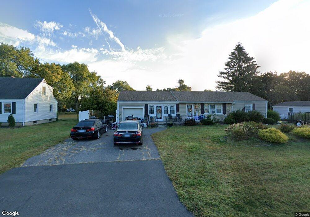
11 Stark Dr East Granby, CT 06026
Estimated Value: $446,000 - $499,730
4
Beds
3
Baths
2,064
Sq Ft
$231/Sq Ft
Est. Value
About This Home
This home is located at 11 Stark Dr, East Granby, CT 06026 and is currently estimated at $477,433, approximately $231 per square foot. 11 Stark Dr is a home located in Hartford County with nearby schools including Carl Allgrove Elementary School, R. Dudley Seymour Elementary School, and East Granby Middle School.
Ownership History
Date
Name
Owned For
Owner Type
Purchase Details
Closed on
Dec 28, 1993
Sold by
Olszewski Laura
Bought by
Olszewski Charles and Olszewski Roberta
Current Estimated Value
Home Financials for this Owner
Home Financials are based on the most recent Mortgage that was taken out on this home.
Original Mortgage
$80,000
Interest Rate
7%
Mortgage Type
Purchase Money Mortgage
Create a Home Valuation Report for This Property
The Home Valuation Report is an in-depth analysis detailing your home's value as well as a comparison with similar homes in the area
Home Values in the Area
Average Home Value in this Area
Purchase History
| Date | Buyer | Sale Price | Title Company |
|---|---|---|---|
| Olszewski Charles | $100,000 | -- |
Source: Public Records
Mortgage History
| Date | Status | Borrower | Loan Amount |
|---|---|---|---|
| Closed | Olszewski Charles | $53,800 | |
| Closed | Olszewski Charles | $45,000 | |
| Closed | Olszewski Charles | $170,000 | |
| Closed | Olszewski Charles | $80,000 |
Source: Public Records
Tax History Compared to Growth
Tax History
| Year | Tax Paid | Tax Assessment Tax Assessment Total Assessment is a certain percentage of the fair market value that is determined by local assessors to be the total taxable value of land and additions on the property. | Land | Improvement |
|---|---|---|---|---|
| 2025 | $8,110 | $265,900 | $51,900 | $214,000 |
| 2024 | $7,924 | $265,900 | $51,900 | $214,000 |
| 2023 | $7,529 | $207,400 | $49,500 | $157,900 |
| 2022 | $7,072 | $207,400 | $49,500 | $157,900 |
| 2021 | $6,969 | $207,400 | $49,500 | $157,900 |
| 2020 | $6,886 | $207,400 | $49,500 | $157,900 |
| 2019 | $6,803 | $207,400 | $49,500 | $157,900 |
| 2018 | $6,521 | $197,600 | $53,900 | $143,700 |
| 2017 | $6,402 | $197,600 | $53,900 | $143,700 |
| 2016 | $6,145 | $197,600 | $53,900 | $143,700 |
| 2015 | $6,007 | $197,600 | $53,900 | $143,700 |
| 2014 | $5,888 | $197,600 | $53,900 | $143,700 |
Source: Public Records
Map
Nearby Homes
- 7 Peppercorn Ln
- 4 Sage Ln
- 14 Loren Cir
- 16 Hilltop Rd
- 39 Loren Cir
- 6 Spoonville Rd
- 552 Stone Rd
- 49 Seymour Rd
- 999 Stone Rd
- 68 Tariffville Rd
- 220 Castlewood
- 9 Tunxis Place
- 5 Tunxis Place Unit C
- 46 Hatchet Hill Rd
- 23 Maple St
- 14 Main Street Extension
- 14 Teal Cir Unit 14
- 158 Tariffville Rd
- 2 Quail Dr Unit 2
- 11 Mallard Cir